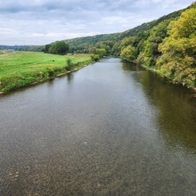
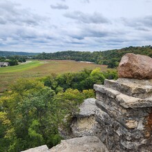
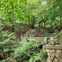
Decorah, Iowa, is a small, rural town of nearly 8,000 people nestled in the beautiful Driftless Region of the Midwest United States. The Driftless is a geographical region that was never covered by ice during the last Ice Age. Therefore, the landscape includes unique features like jagged bluffs, cliffs, caves, natural springs, ice cold streams, and steep hills. The Driftless Round - Decorah incorporates all of these unique features. It is also centrally located between major Midwestern cities providing a perfect FKT getaway vacation for those in Minneapolis-St. Paul (2.5 hrs), Madison (2.5 hrs), Des Moines (3.5 hrs), and Chicago (5 hrs) as well as Iowa City (2 hrs), Cedar Rapids (2 hrs), Rochester (1.5 hrs), and La Crosse (1+ hrs).
This route connects numerous parks and special natural features of Decorah in one large ~ 26-mile loop meant to provide the Midwestern equivalent of a "long day in the hills/mountains" traversing a landscape. Although we don't have summits in Iowa, this route includes the steepest and longest climbs on the local trails and several fun descents too. It also visits lookout points from every direction of town. In several places, you can see the spot you last were. In the spirit of the pint at the end of a Bob Graham Round, this route starts and ends at Pulpit Rock Brewing Co (corner of 5th Ave and College Dr) for a post-run celebratory beverage (and bathroom!) upon finishing. A free pint for finishing the route is still TBD.
Here are the highlights of this fun, beautiful round:
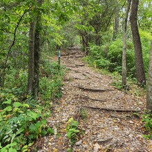
- Run on a mix of dirt singletrack (11), mowed grass (4), and paved trail (11) in a flowy yet challenging route intended to show you all of the sights of Decorah while also providing spots you can hammer the pace or make up time. Note: Almost every bit of pavement has grass or gravel next to it if you prefer not to run on asphalt.
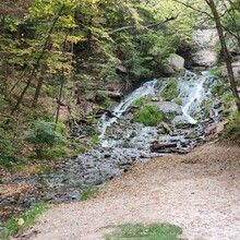
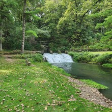
- Visit Iowa's tallest waterfall, Dunning's Spring Waterfall, as well as the staircase waterfall at Siewers Springs
- Peer out over Decorah from overlooks above Dunning's Spring, Palisades Park, Carlson Park, Trout Run Trail, The Cut, Phelps Park, and Pulpit Rock
- Dip your hat (or yourself) in the ice cold water of beautiful Twin Springs Park
- Pass several small ice cave openings along Dug Road that blast ice cold air year round
- Check out the numerous sculptures along the route and an antique car being reclaimed by nature. There may even be painted rocks or a gnome sighting.
- Visit Dunning's Spring Park, Ice Cave Park, Van Peenen Park, Palisades Park, Trout Run Park, Decorah Fish Hatchery and Siewers Springs, Carlson Park, Miller Park, Trout Run Trail, Phelps Park, Twin Springs Park, Pulpit Rock Campground, Pulpit Rock lookout, and run past the Community Prairie and Butterfly Garden all in a single loop.
- Two public bathrooms/water fountains for unsupported attempts are directly on the route (open seasonally Apr-Nov, Decorah Fish Hatchery - clockwise mile 14, Pulpit Rock Campground - clockwise mile 24). Other seasonally available bathrooms are at Phelps Park which would require a small detour into the park (clockwise mile 21) and there may be porta-potties along the route at Dunning's Spring Park (clockwise mile .7) and below the grass dike (clockwise mile 10.5)
The route has been intentionally designed to connect all of the sights of Decorah in a flowing manner. Further, it requires the runner to take in the sights during the attempt. The GPX route is to be followed precisely, including very short out and backs to each waterfall and overlook and not only peering at them from afar.
The .gpx file provides the exact route including a couple new trails that have not been mapped by Decorah Parks and Recreation yet. The following files provide descriptions about the parks included in the route. The route designer is also available to help answer any questions - erinshawrocks@gmail.com.

