A famous alpine crossing in central Europe. Traversing three countries it connects Oberstdorf in the southernmost region of Germany with Meran, a beautiful city in south tyrol with mediterranean flair.
The first few kilometers from Oberstdorf are pretty smooth with very little elevation. As the valley narrows down the first climb to the "Kemptner Hütte" begins. With increasing elevation, the valley narrows down even more into a canyon that can hold lots of snow, even in the summer months. But it should not be an issue, since the route is well traveled and there is a clear path for you to follow.
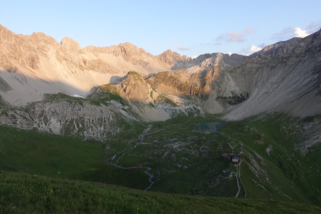
Once you reached the "Kemptner Hütte", there is only a few hundred meters until you cross the austrian border at the "Mädelejoch". Pay close attention to the GPS here, because this route leaves the official E5 signs shortly after the notch and continues to the left. Long grassy mountain slopes follow for the next few kilometers, before you start to climb down through a thick pine forest and into the "Lechtal".
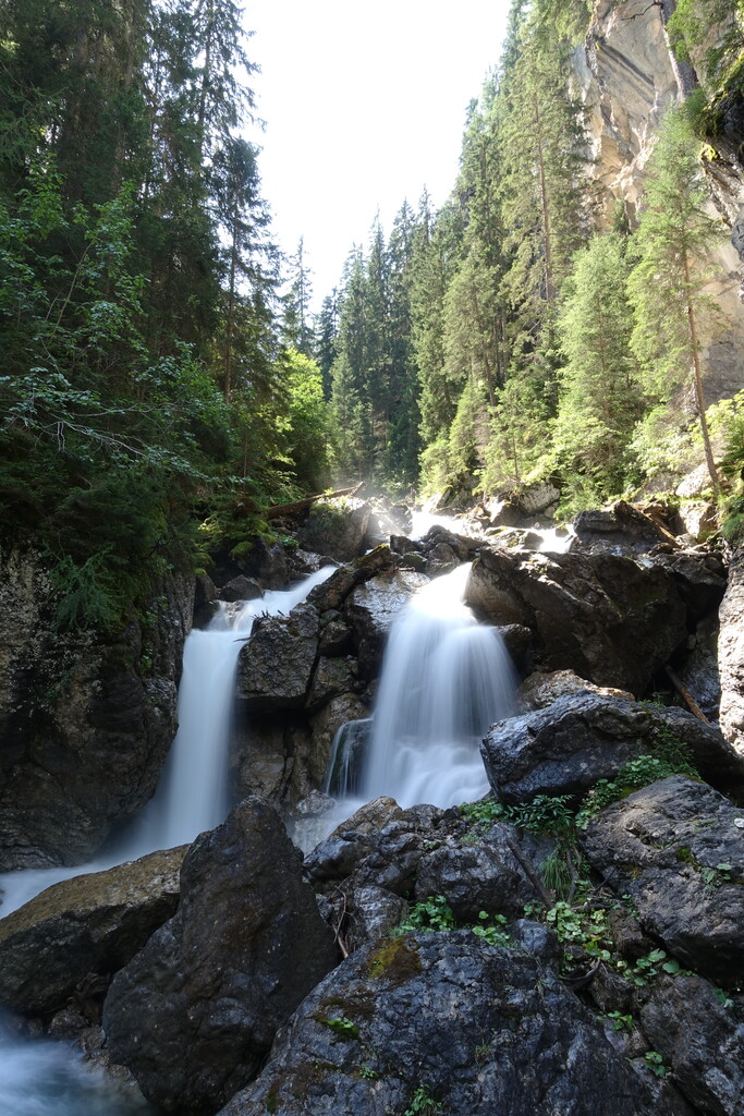
You'll then make your way up a side valley and pass the town of Madau on an easy gravel road, as you make your way to the next hut on the route. A sharp left turn crossing a set of wooden bridges throws you in the next steep incline. Climbing almost a thousand meters to the "Memminger Hütte" and taking a short side trip to the "Seekogel" peak nearby the hut, you'll ascent to well over 2000m in altitude once again. On the climb you will follow a mountain stream and find a beautiful waterfall, but trust me: Don't drink this water! Most people ignore the signs and drink it anyway, but this will propably make you sick, because it's straight out of the sewage from the hut on top of the climb.
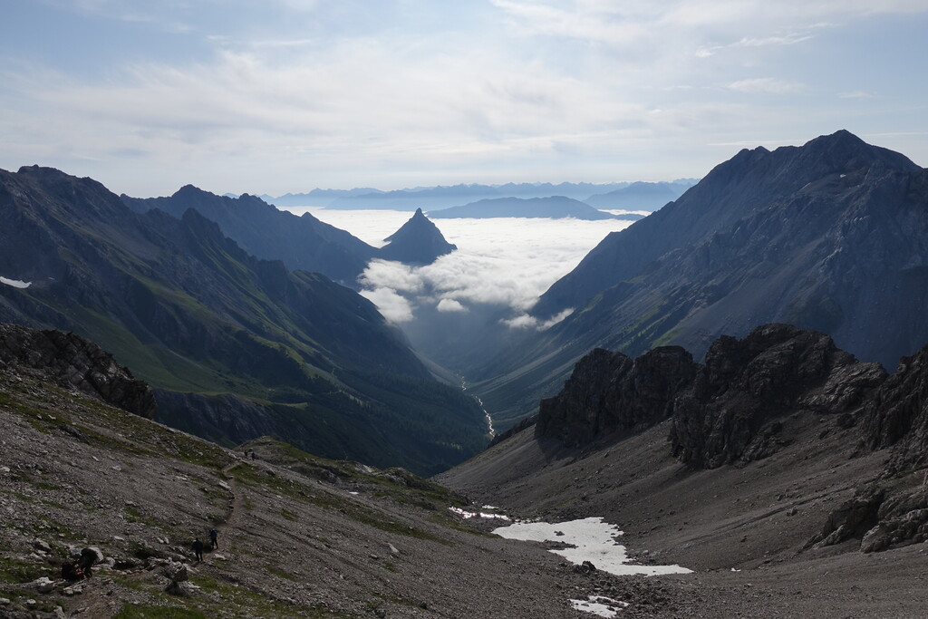
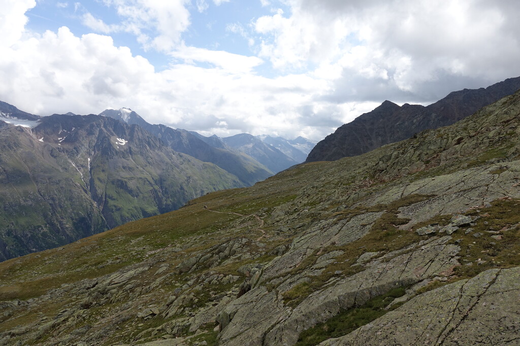
After passing the hut, you'll have a steep climb up to the first high point on the route, the "Seescharte". Crossing this notch will gift you with an outstanding view over the valley unfolding in front of you. The following descent is quite long with 12 km along a beautiful stream that is cutting deeper and deeper into the rock as you make your way through the lush pine forests. Eventually you'll traverse an ever narrowing canyon with the stream far below before the canyon opens and you finally reach the city of Zams. Since this is the biggest city on the route (apart from the start and finish point), it's a good location to resupply.
The following climb is steep as you gain around 1300m of elevation. Once you reach the top of "Venet", you are spoiled with a beautiful panorama as you cross several peaks following the ridgeline, before taking a turn to the right and descending into a thick pine forest. On the bottom of the valley, you join the "Pitztal" to the southeast. This valley is about 28km long and pretty uneventful.
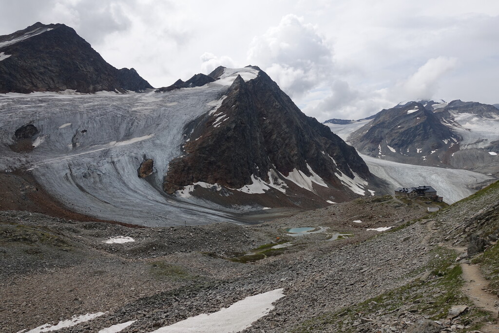
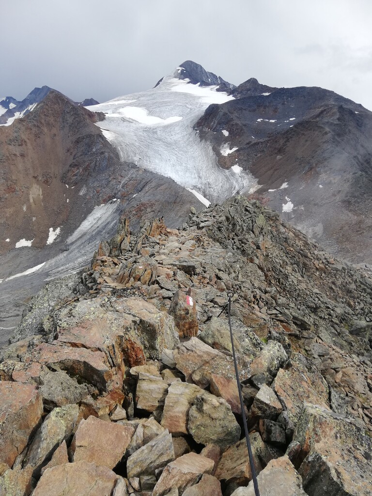
The climb up to "Braunschweiger Hütte" is demanding but beautiful. You'll leave the main gravel road to follow the "Jägersteig", a small and exposed shortcut on your way up the mountain. Pay attention here, you can easily miss the junction and find yourself on the wrong way up the hill. The "Jägersteig" begins right after the small hut called "Gletscher Stüberl". After the shortcut and a never ending set of stairs you'll pass the "Braunschweiger Hütte" and have a stunning view over the massive glaciers to your right. Crossing the notch "Pitztaler Jochköpfle" you climb down to the heart of the Sölden ski resort. Here you are required to take a bus, because you need to get to the other side of the mountain and the only way is through a several kilometer long tunnel, that you are not allowed to walk. So the bus trip from the "Glacier Express" to the "Tiefenbachbahn" is part of the route and not considered cheating.
The following 10 km you can enjoy an amazing panorama on the "Venter Höhenweg" - an easy to walk path that slowly drops down to the small town of "Vent". The next valley takes you up to the highest point of the route at 3200m. The landscape is marked with debris and boulders and is well above tree line. You leave the main path that is leading to the "Similaun Hütte" and make your way up to the infamous "Ötzi Fundstelle", where a 5300 year old mummy that has been conserved by a glacier was discovered in 1991. From there it's a rugged trail to the next hut "Similaun Hütte" with a great view of the town of Vernagt. Entering Italy, you'll descent to Vernagt and the big water reservior the town is located at.
Walking over the dam to the other side of the valley, you are welcomed by a wonderful forest. The following 10km you'll perambulate small italian villages, meadows and small forests, before you cross the main road and hike along a winding road with little traffic. The small town of "Monte Santa Caterina" is soon in sight and passed. The last big part of the route is the "Meraner Höhenweg", a scenic hiking trail with many small climbs and descents. The trail leads through tiny settlings and farms as well as shade giving pine trees and small canyons. With a great panorama along the entire way, this is a worthy ending to your trip. But you're not really done yet. A tedious descent into the town of "Parcines" leads you to the final section of the hike. Through some beautiful apple farms and small towns with typical italian architecture, you'll join the main road for a few hundred meters, before turning right onto a hiking and cycling track along the Etsch river. The track runs parallel to a highway and after a few kilometers you'll get through a tunnel to the other side of the highway. You enter the home stretch as you make you way into the center of Meran. Leaving a handful of bridges stretching over the Passirio stream to your right, you'll eventually cross the "Ponte Teatro" or "Theater Bridge" which is also the finish line of this route.
The best season for this route is between June and September, you won't see a lot of snow in this period. A key factor for this route is your sleeping plan. Typically you stay in the huts along the route, but they may not fit your pace and schedule. Please check where you are allowed to camp, because there can be local restrictions on wild camping for the different countries and states along the route.
The first 4 stages between Oberstdorf and Pitztaler Gletscherbahn cover about 100 km.
Comments
Mein Plan ist am Mittwoch die Tour zu starten 🤞
All! Full E5 Route Obersdorf - Meran was updated due to updated Roads/Trails. Please use only this gpx!