Starting in the center of Exford, Somerset, UK this circular route tours the highlights of East Exmoor National Park. The Exmoor national Park is a protected part of the South West spanning parts of Somerset and Devon. Known for its dramatic moorland landscapes, wooded valleys, rolling hills and rugged coastlines. Exmoor is home to iconic wildlife such as red dear and Exmoor ponies. It features ancient hill forts, charming villages including Dunster. The park is also designated and international Dark Sky Reserve.
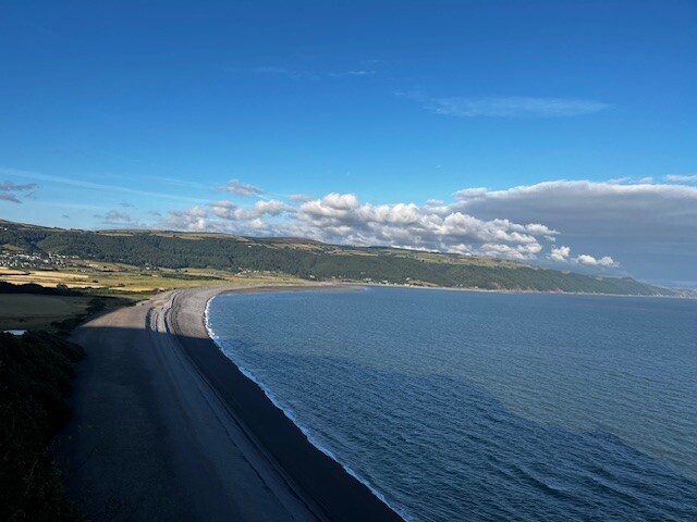
Too begin it's straight up to Dunkery beacon, before heading west and down through Horner woods and onto Bossington. Here you can make use of the National Trust toilets and water tap if needed. Then you follow the South west Coastal path approx 4 miles east before looping back over high ground to Selworthy Beacon. Dropping down into Selworthy (there's a super tearoom here) picking up some road before finding the trails again to head towards Dunster. Dunster is a jewel in the crown of the route, being picturesque with the Castle dominating the view. Here you can stock up on food, drink etc before a few climbs over Batts castle and over to the most easterly point on the route in Roadwater. A cracking post office with cafe can be used as an impromptu check point before heading West towards Luxborough.
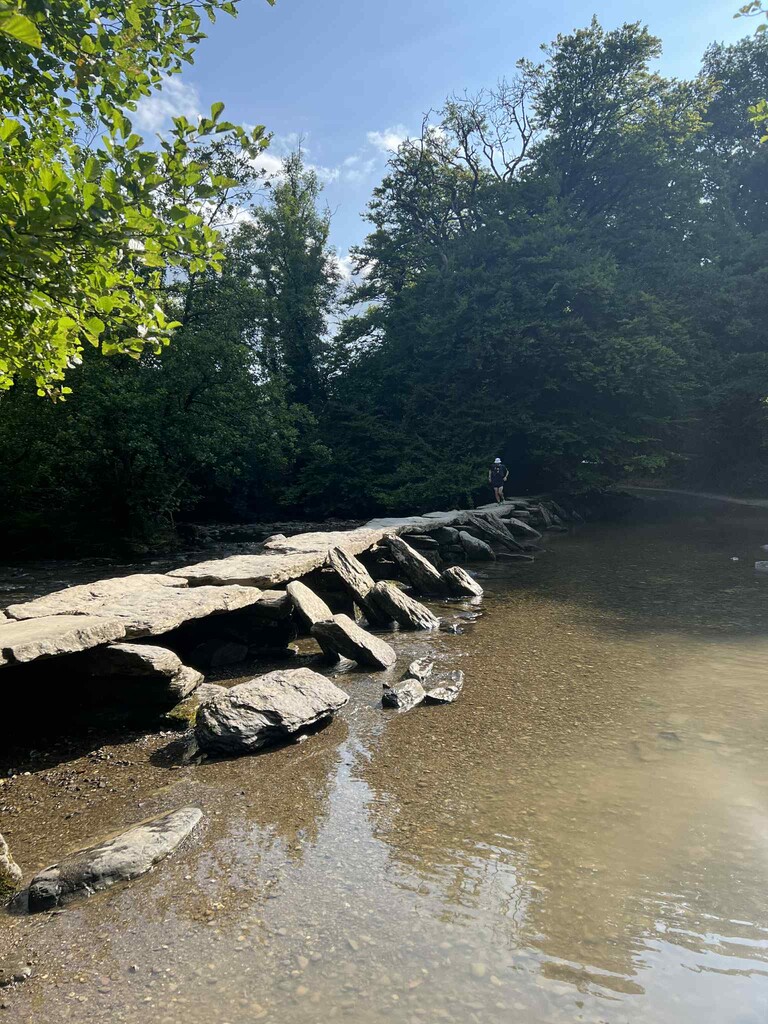
Climbing out of Luxborough there's a little tarmac to navigate on the way down towards Wimbleball lake. Take the lakeside path over the dam and find the route up to the trig point on Haddon Hill. From here it's back down hill via a technical drove into the village of Bury, which has the most picturesque bridge you could wish to see. Over the hill lays the market town of Dulverton, where you can make one final pit stop if you wish before heading along the river, picking up part of the two moors way into the Tarr Steps,This historic “clapper bridge” is the longest and oldest of its kind in Britain, possibly dating back thousands of years. Taking the river North you soon take a sharp right turn uphill towards the final trig point of the route on Winsford hill. A few miles later the route winds it's way back to Exford where you complete the round.
To find out more about Exmoor National Park please use this link
https://www.exmoor-nationalpark.gov.uk/

Comments
stunning day on the trails with perfect weather, fully supported
Hi Martyn. Just to let you know that I plan to run the East Exmoor Round that you posted on FKT. I'm just looking to complete 100k and may change the route to suit me so I don't think your time is in danger! It's a good route, thanks for sharing.