The Trinity Alps Wilderness, located in northwestern California, is home to more than 600 miles of trails and encompasses more than 500 acres of land. It is the second largest wilderness area in California after having doubled in size when the 1984 California Wilderness Act was passed. That same year it was added to the Wilderness Preservation System.
The landscape of the Trinity Alps is quite diverse. Creek drainages drop as low as 2,000 ft and surrounding summits top 9,000 ft. Dotted throughout are immaculate alpine lakes and rugged granite peaks. The trail network is intricate and well established.
The Trinity Alps have long been a well kept secret. Locals in surrounding towns, such as Weaverville and Trinity Center, have enjoyed the tranquility and remote feeling while out in their backyard terrain. More and more, visitation from population centers like the Bay Area, Sacramento and Portland has increased. It’s common to have a hard time finding parking at the many trailheads including those a little further in and off the main highways.
You can learn more about the Trinity Alps Wilderness on the Shasta-Trinity National Forest Website HERE.
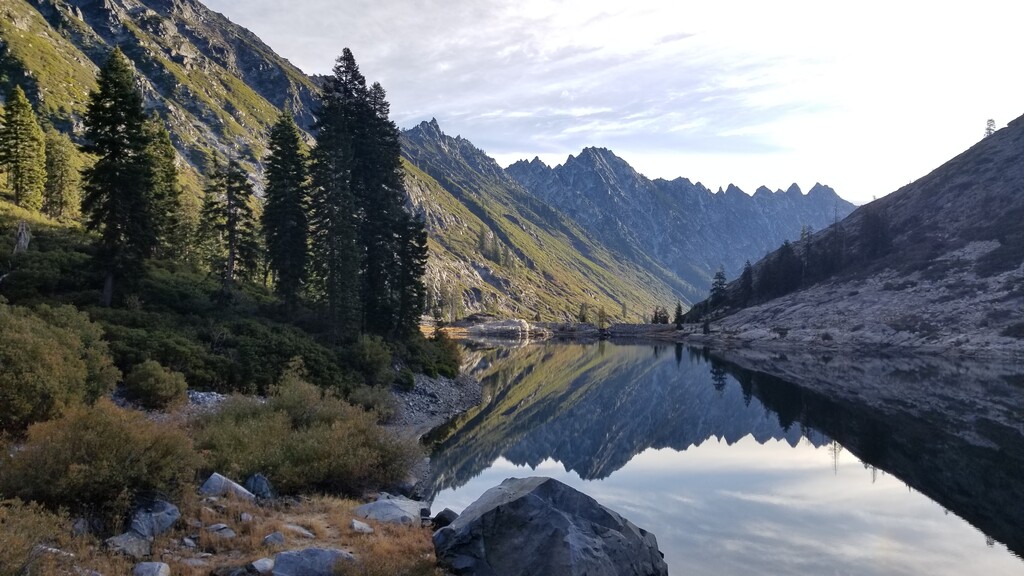
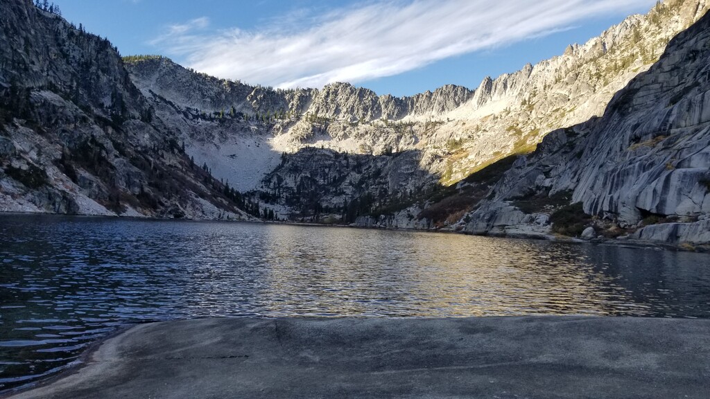
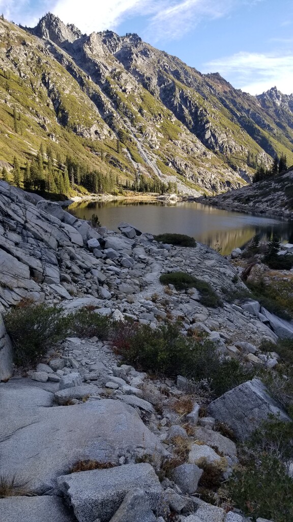
This route, the Emerald and Sapphire Lakes Out & Back, is likely the most popular hike in the Trinity Alps (AllTrails LINK with over 200 reviews). The trailhead is simple to get to (see notes below) and the trail is well established. At the trail's highpoint, you’ll find yourself at two alpine lakes surrounded by massive granite walls and high peaks including Thompson Peak, the high point of the Trinity Alps Wilderness. The combination of creeks, hardwood trees, massive evergreens, meadows, alpine lakes, and towering craggy peaks makes this trail well worth the adventure.
To access the trailhead, travel approximately 13 miles north of Weaverville on Highway 3. You will drive along the shoreline of Trinity Lake past Tan Bark picnic area and a Forest Service information center, then cross a bridge over the Stuart Fork arm of the lake. At the north side of the bridge turn west on Trinity Alps Resort road. You will drive through the resort so be sure to go slow and stop by the store if it is open for goodies. Beyond the cabins lining the river banks, the road turns to gravel. Low clearance vehicles will need to take their time at one spot as of this writing (Nov. 2020) but beyond that, road is good. About 3.5 miles from Highway 3, the road ends at a campground and trailhead parking with a locked gate.
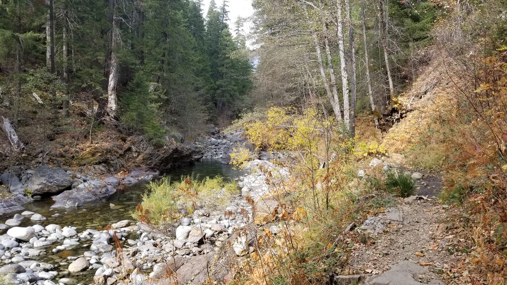
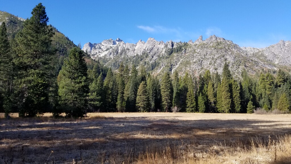
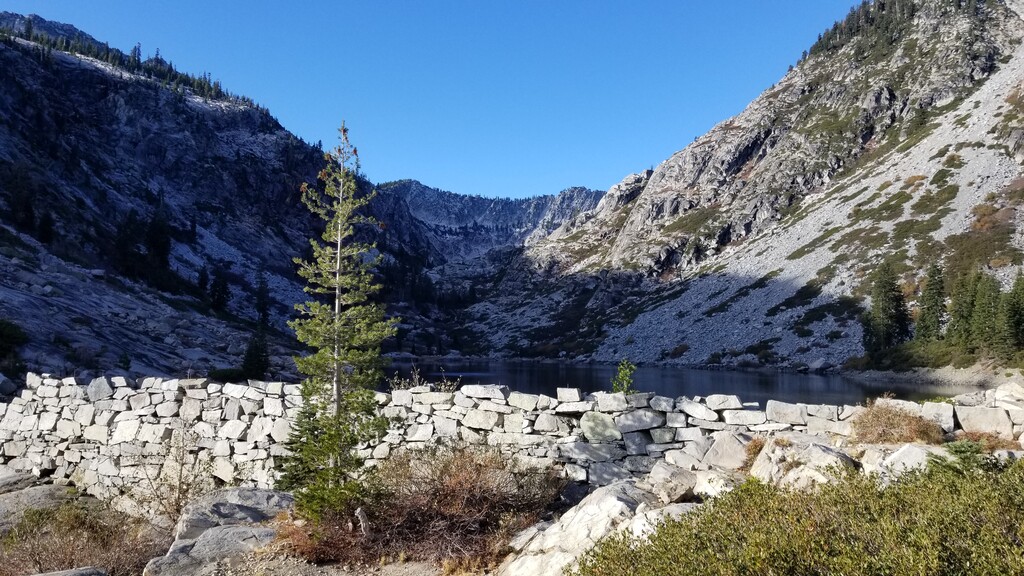
This route starts from the trailhead by following an old road past private property to the Trinity Alps Wilderness boundary at Cherry Flat. Climb gradually along the Stuart Fork of the Trinity River. After four miles, the trail crosses Deep Creek over a bridge and then crosses Oak Flat. At five miles, pass the turnoff for the Alpine Lake Trail, choosing instead to continue straight. The trail continues to climb gently, crossing Deer Creek over a bridge at around seven miles. Pass the junction with the Deer Creek Trail at eight miles and reach Morris Meadow at nine miles. Morris Meadow has awesome wildflower displays all summer and views of craggy peaks. Beyond the meadow, the trail turns west into more mountainous territory. At 12 miles, you'll reach Portuguese Camp. The trail becomes steep and open as it climbs to the west toward Emerald Lake. Emerald Lake is actually man-made, created for mining operations a century ago. There's still a lot of old mining equipment lying around, and this is a good place to take in the relics of the area's mining history. Follow the trail through brush north of the lake and up a rock field using cairns around Emerald Lake's northwest shore, climbing 400 feet to Sapphire Lake. At the deep, clear lake, enjoy the views of Thompson Peak and the Sawtooth Ridge. Return the way you came. (Route description adapted from HikingProject.)