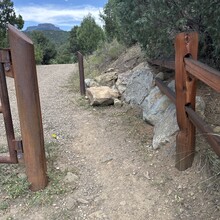
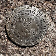
Fishers Peak State Park - Parking lot to summit geodetic survey marker
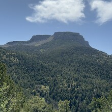
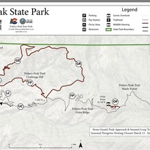
This route is in the Fishers Peak State Park and is the most direct route to the summit of Fishers Peak. For the FKT the route starts at the gate at the parking lot and ends at the Geo marker at the summit. The peak is visible for most of the distance.
From the parking lot start at the gate on the Challenge Trail (gravel road) for 1.3 miles and ~700 feet of elevation gain to the "hub" a central point where three single track trails come together. Head straight towards the Peak on the Fishers Peak Trail, Osita Ridge Section, to an intersection with the Osita Point Trail. (~3.8 miles from start) At the intersection, there is a sign noting the final distance and what to expect.
Continue on to the Fishers Peak Trail, - Shady Forest Section. At the end of the Shady Forest Section (~5.5 miles from start) there is green gate. Note: This gate is locked from March 31 to July 31 for wildlife closures falcon nesting. The next section is called the Stone Guard Section.
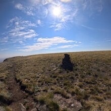
The next section is the Summit Approach Section. This is the most technical and steep section of the route. There are several areas where the trail is narrow and close to steep drop-offs. To get to the summit, there is a narrow chute to scramble through to get to the Summit Loop. Proceed on the Summit Loop to the left until you see two large stone stacks. At the second stone stack, is the Geo Marker for the summit.
Note: There are restrictions on accessing the summit. Wildlife closures to summit access from March 31 - July 31.
There is a $10 daily parking fee unless you have one of the various Colored State park passes. There are NO Water Sources on this trail. Bring plenty of fluids! Mountain bikes are allowed on the trail to the gate at Stone Guard section only.
Link to the park website
https://cpw.state.co.us/placestogo/parks/FishersPeak
Local trail maintainers: Trinidad Trails Alliance. https://www.facebook.com/trinidadtrailsalliance/

