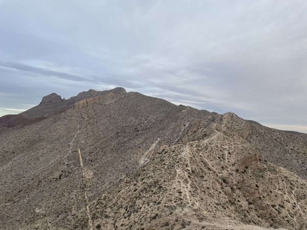
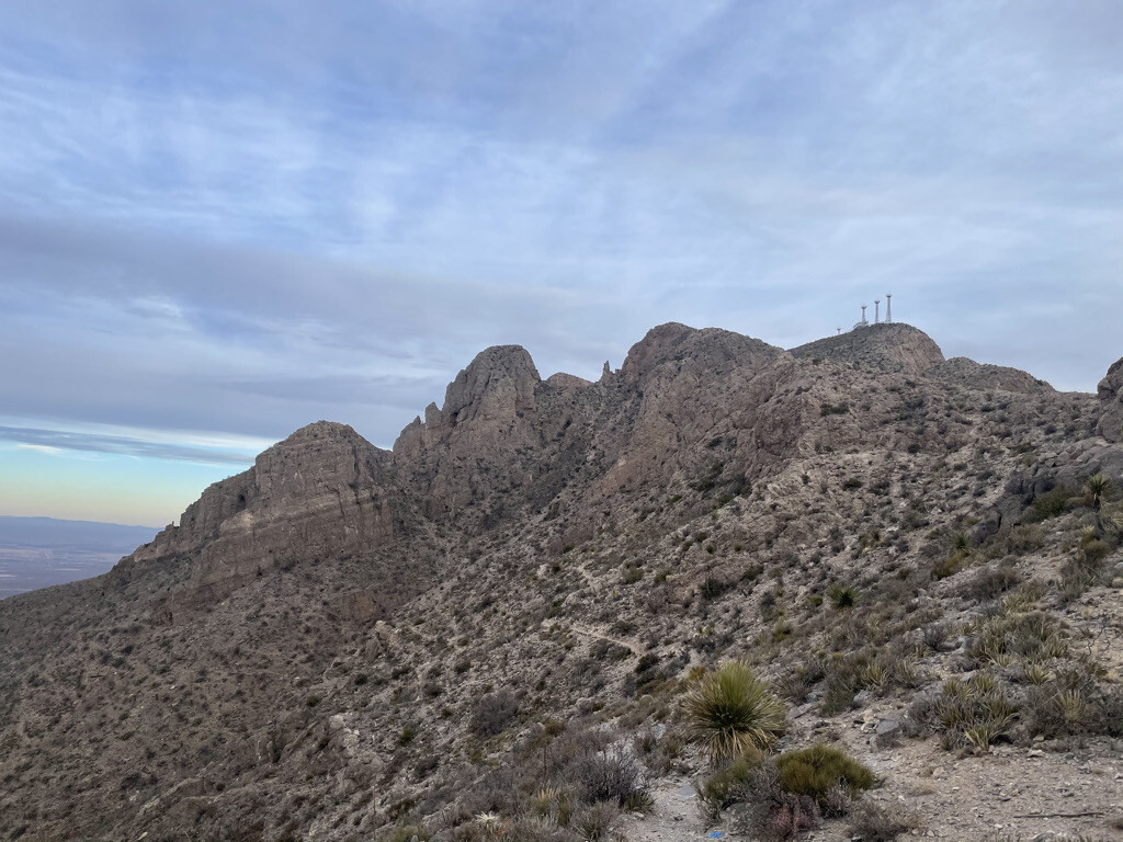
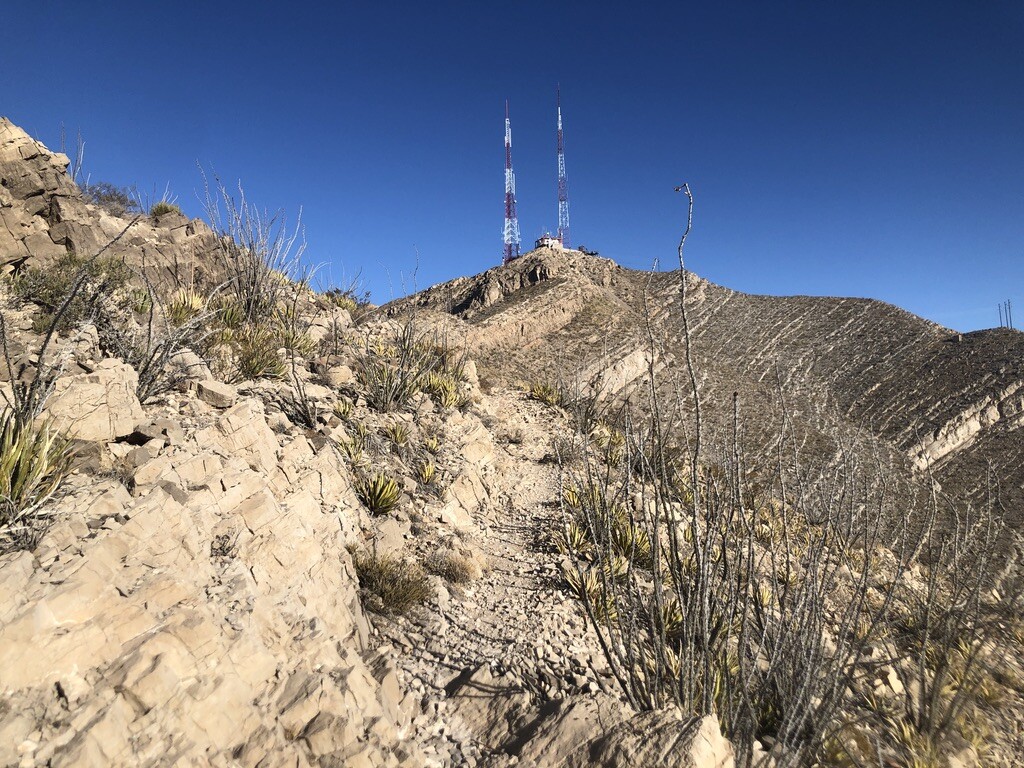
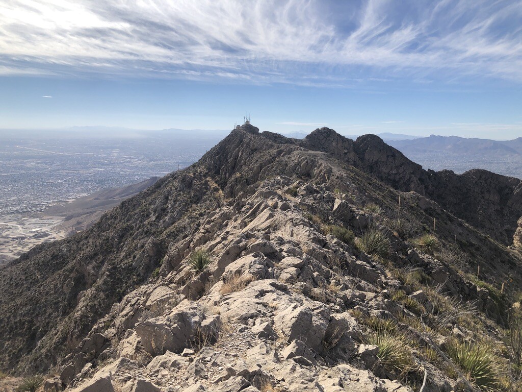
A truly epic route across the panoramic Franklin Mountains which span across the entirety of El Paso, Texas. Described south to north (note however that it might make more sense to go the other was, since you would have a net elevation loss going north to south): Starting from the Scenic Drive Overlook which offers a great view of both Ciudad Juarez, Mexico and El Paso, this route climbs off the road directly into the sky towards radio towers which power local television stations. There is no official trail here, but the lines are quite easy to follow all the way up towards the now defunct Wyler Aerial Tramway, a relic of the past which would allow passengers to ride up to Ranger Peak rather than going by foot. Cutting through the complex and onto rugged footing, the trail continues forward into a very narrow and almost imperceptible line that slithers around massive stones and back up onto the ridgeline where another (gated) radio tower complex stands. Move through the complex and it becomes a "choose your own adventure" sort of affair, where there is no indication of a beaten path, so a lot of prudence and intuition is required to proceed onto the treacherous "Devil's Edge," a tiny sliver of stone that connects one part of the ridge to the other (this can either be straddled upright or circumvented to the left). Once the "Devil's Edge" and more intuitive scrambling is conquered, a now forgotten antenna lays flat on the ground which offers a grand view of Mount Franklin, the next peak to be tapped upon this route. On the descent from this peak, a trail comes into being which makes the next section a sigh of relief compared of what has been thus far, although some down-climbing must commence as the trail drops to a cliffside below. This connects to the Ron Coleman system of trails which leads all the way up to some more vertical climbing to "The Window," a novel cutout from a rock-face that exposes the northeast side of El Paso, to both South Franklin Mountain and the Mammoth, a formation of stone which resembles the long extinct creature. The path then dives towards the Mammoth and down towards the ground that meets with the surprisingly busy Transmountain highway, formerly known as Smuggler's Pass.
Comments
Planning to attempt Saturday November 19, 2022!
Missed the mark! 2:55:59. Trip report here: https://www.strava.com/activities/8141793422
The Strava heat for some sections of this route are pretty weak, so I had my doubts regarding whether it was actually doable anymore. I passed by the start point today and confirmed there are multiple No Trespassing signs posted by the city. I love a good challenge, but not that kind.