Location
France
Distance
2,104 km
Vertical Gain
25,000 m
Description
GPS Track
FKTs
Male
| Olivier Mevel | 41d 8h 3m 0s |


Comments
Tested a small section on the GR34 on Saturday around the peninsula of Plevenon. The route is well marked and stunning in this section, it was also beautiful weather, sunny, light breeze and 20 C. In the weekends there is a lot of hikers and tourist around the light tower and castle and on the track between them. Great run, 20 km out and 20 back, with 900 m elevation.
/Torben
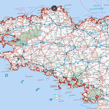
GR34 Northbound : " On GR34 trail along the coast of Brittany, 1305 miles long, hikers and runners usually choose the southbound way, by local tradition. From the iconic Mont Saint-Michel in the north to Saint-Nazaire town in the south, 2100 km further. Instead of taking this standard route, it is possible to hike or run the northbound (NOBO) way. Sometimes used by only few hikers, seldom run by trailers on a long part or the total distance. This northbound way crosses five departments : Loire-Atlantique, Morbihan, Finistère (900 km by itself - 560 miles), the Côtes d'Armor and Ille-et-Vilaine with at the end 8 km of Manche department to the Mont-Saint-Michel. The NOBO way is rather flat during the first 660 km (410 miles), along the first two departments with only 3000 m of elevation gain (approx.) and then proposes the main wearing and tiring elevation gain along the last 1500 km, especially on the demanding Côtes d'Armor department (430 km - 270 miles) hiked or run ... after one thousand miles (1600 km) ! "