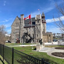
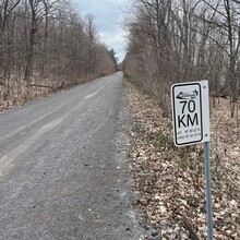
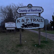
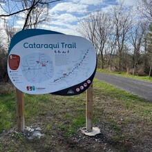
This is a massive loop which uses part of but not all of 3 different Rail Trail systems. These were at one point all railways. The 3 trail systems are the Ottawa Valley Recreation Trail, the K & P Trail, and the Cataraqui Trail.
https://www.ottawavalleytrail.com/
https://www.frontenaccounty.ca/en/things-to-do/kp-trail.aspx
https://cataraquitrail.ca/
Simply start anywhere on the loop, and finish where you started. Please check the above links for any reroutes or closures. I would estimate this route is at least 98% Rail Trail. There are a couple of parts where you take a road section which brings you back to the trail. Also, the Cataraqui Trail ends just before Smith Falls and the Ottawa Valley Recreation Trail starts on the other side of Smith Falls. So you will have to venture on roads to connect. The 3 trail systems do have a lot of signage. You will pass through many towns including Smith Falls, Carleton Place, Almonte, Pakenham, Arnprior, Renfrew, Calabogie, Sharbot Lake, Verona, Harrowsmith and Sydenham. So there are many resupply and lodging options along the way if needed. Water sources are abundant, but some of these may dry up certain times of the year. So please do your research.
Cell service is available on a lot of the trail, but not on the upper section of the K & P Trail. This is the most desolate section by far, but also the most beautiful. It's neat to think that this route was once all a functioning railway system. I can't say for certain, but I don't think there are many other Rail Trail loops that are this big and beautiful. In the world for that matter. It is also the easiest terrain you could ever imagine. Enjoy!!!


