Gunung Raya is the highest mountain in Langkawi with an altitude of 881 meters. It is located in central Langkawi and has the sprawling Gunung Raya Golf Course at the base. The mountain is covered with dense rainforest which is full of amazing flora & fauna.
There are two ways you can approach the peak of Gunung Raya. You can either by road or stairs.
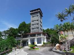
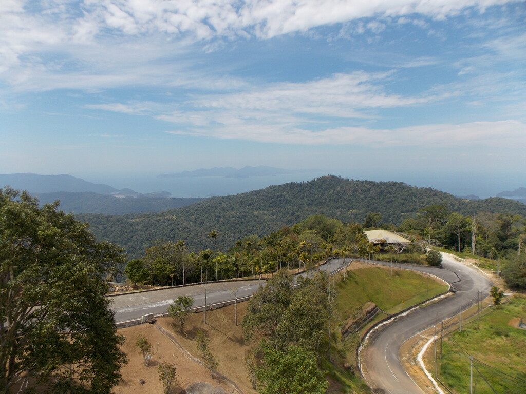
By Road, You will need to take the narrow winding road Jalan Gunung Raya that starts from a junction with Jalan Ulu Melaka. The road to the peak goes through a dense forest,The mountain peak is a massive granite formation that offers view of Langkawi’s verdant surroundings, neighbouring islets, and the Andaman Sea. There’s also a small park, museum, a satellite control tower, and D’Coconut Hill Resort Langkawi.
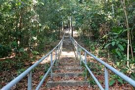
By Stairs, a steep and occasionally overgrown cement staircase leads up from the southwest about 1 kilometre north of Mardi Agro Technology Park (an area sometimes known as Lubuk Semilang). Known as Tangga Helang Seribu Kenangan (‘thousand memories eagle steps’), this 3 kilometre trek that was constructed in 2000-2001 takes you directly up the hillside and allegedly consists of 4,287 steps!
You can either start from Road or Stairs go up to the Gunung Raya, if take road which about 13km to the peak and if take the stairs go to the peak about 3.6km, The connection between Road and Stairs is another 3.7km. Run the loop in the direction that is faster for you!
Enjoy the Spectacular view of Langkawi when you reach the peak of Gunung Raya,