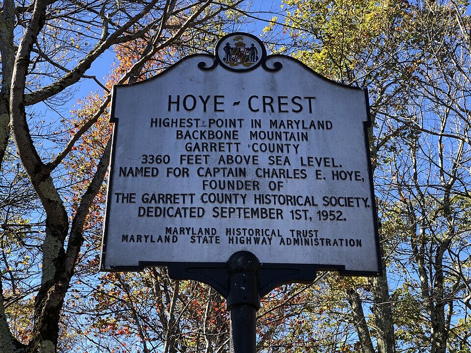
Route: Harbor to Hoye-Crest (MD)

Submitted by aaron_iles on Mon, 04/13/2026 - 04:21pm
Location
Maryland, US
Distance
200 mi
Vertical Gain
20,000 ft
Description

Introduction

This open route traverses the state of Maryland from its lowest natural point (sea level) to its highest point atop Backbone Mountain: Hoye-Crest. Covering seven counties, this point-to-point effort links urban waterfront, suburban communities, rolling piedmont, vast farmland, and rugged Appalachian mountains.

The Route

This is an open route. The exact path is not prescribed, but the following rules must be met for an effort to be considered:

  1. Efforts must begin at Baltimore Inner Harbor at sea level.
  2. Efforts must end at Hoye-Crest.
  3. To stay within the spirit of a state low-to-high route, efforts must not leave the state of Maryland, though to reach Hoye-Crest a short passage on route 219 in West Virginia just before getting on Maryland High Point Trail is allowed.
GPS Track
Images