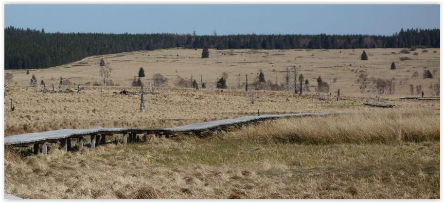
The path leads through the 'Ardennen' along some major rivers like: 'Amblève, Ourthe, Lesse, Semois'. It is meant as a multi-day hike with a lot of bivac places and has a low water and a packraft variant as it follows those major rivers. One on the strong points of the route is the variety of landscapes you cross. The paths can be difficult to find single tracks, but also sections of straight dirt roads and endless roots and rocks covered tracks along the rivers. There is also a very large section of peat land with large stretches of decking paths. The elevation gain isn't huge but it makes the trail a lot harder if you try to run it in one single go. There are a lot of beautiful corners in this area and this path connects them all with a minimum of paved roads.
Please note that the route does not have a separate set of markings but is made of sections from several tracks. It is advised to have access to the GPX and a map. It is also advised to study the route carefully before heading out.
https://hikingadvisor.be/ha-route
Comments
Verslag is te vinden: http://moerdijk.be/landerloopt/verslagen/Haute%20route.pdf