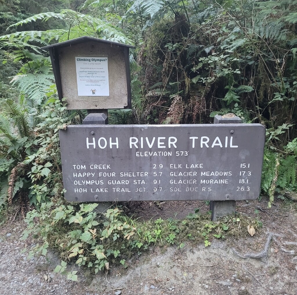
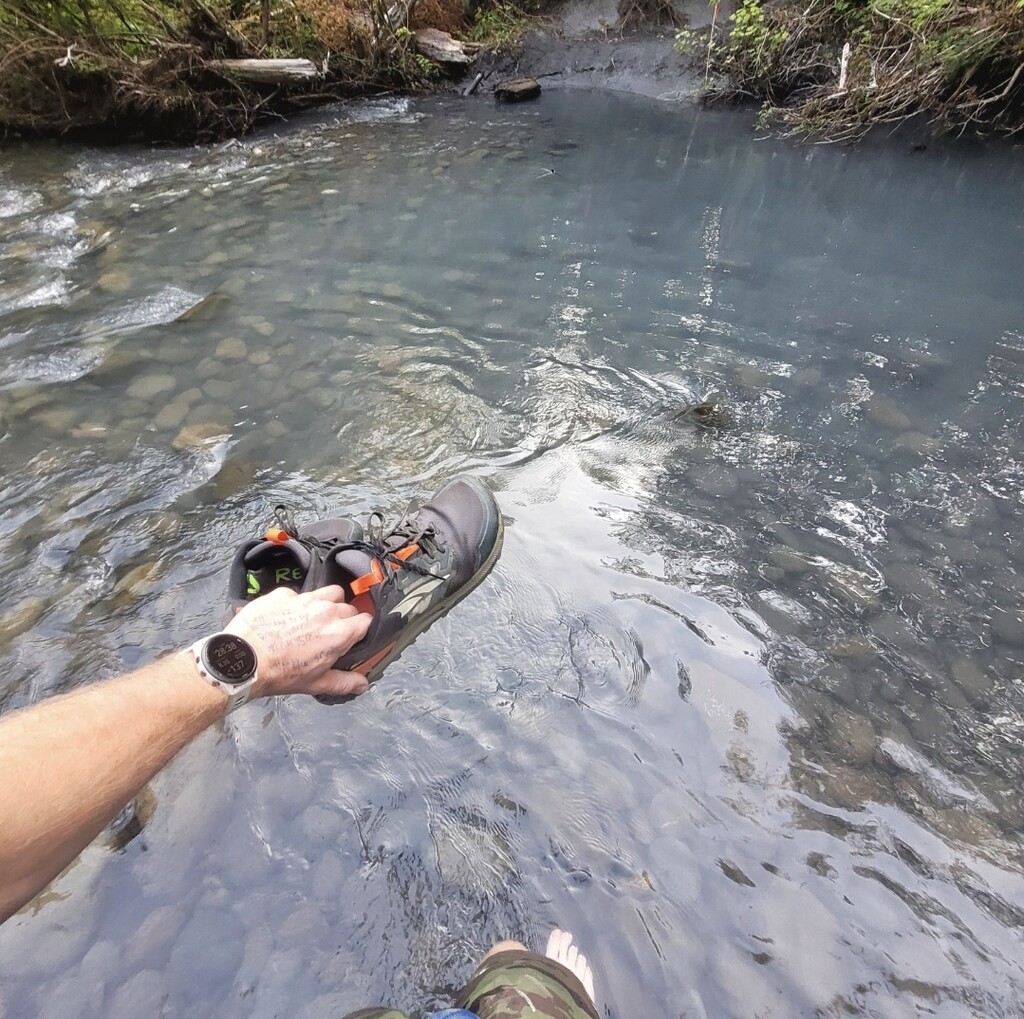
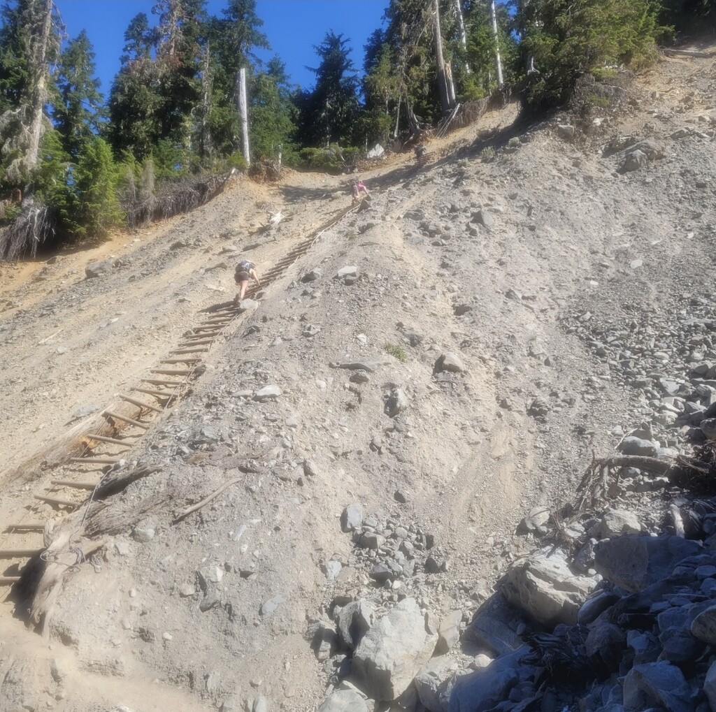
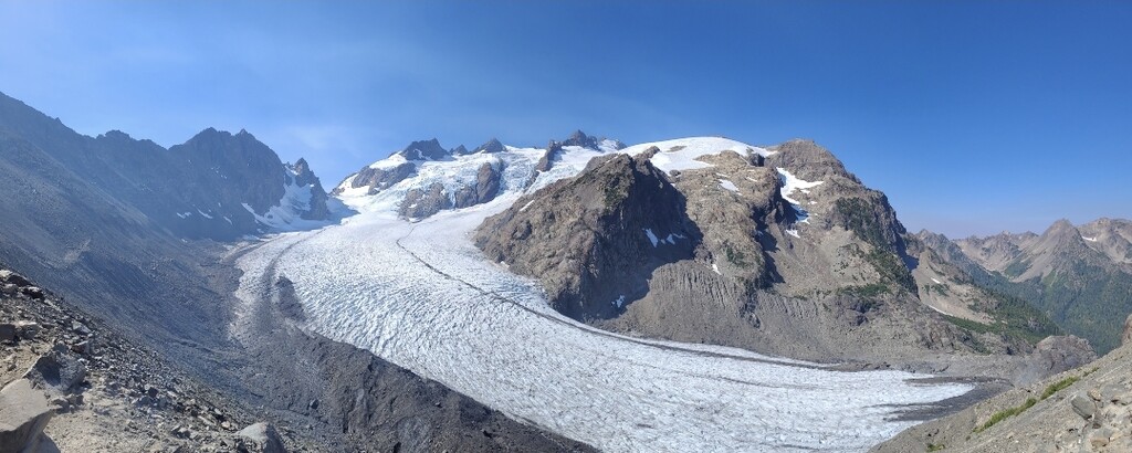
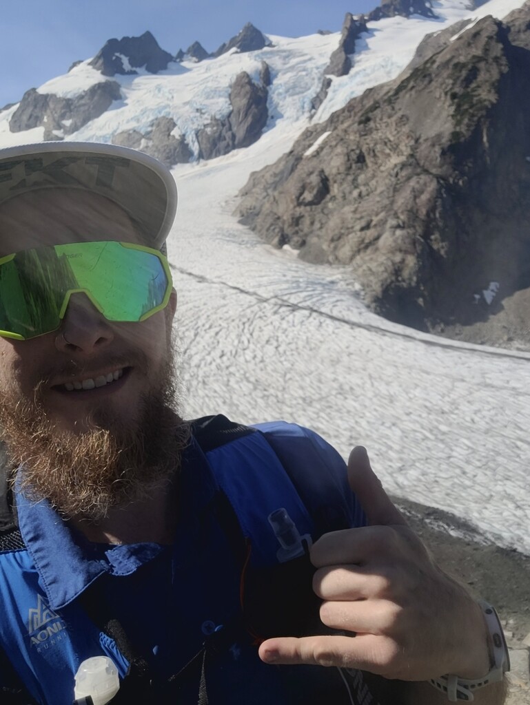
This route starts and ends at the Hoh River Trail sign as pictured. This is a classic Olympic National Park Route that absolutely deserves to be here. From the forest floor in the heart of the Hoh Rainforest, you will climb to the base of the tallest mountain in the Olympics. What makes this trail so great? You are surrounded by old growth trees, lush green everywhere you look, and the glacier fed Hoh river off to your right. There are streams to fill water bottles approximately every 4-5 miles. The route is generally pretty flat for the first 12 miles with many roots and rocks to navigate, then begins to ascend very abruptly and consistently for the next 6 miles. The final push is a demoralizing climb to the glacier viewpoint from Glacier Meadows camp. It is very rocky and steep. The turn around point is at the top of the Glacier Moraine - Post a Glacier Selfie!
It seemed that every website I looked at had differing data on the total mileage and elevation gain. I believe most only calculate the point A to point B difference, not all the ups and downs in between which added an additional 2300 ft according to my Garmin!
https://www.wta.org/go-hiking/hikes/hoh-river-blue-glacier
https://strava.app.link/5Yw1IXMlqCb