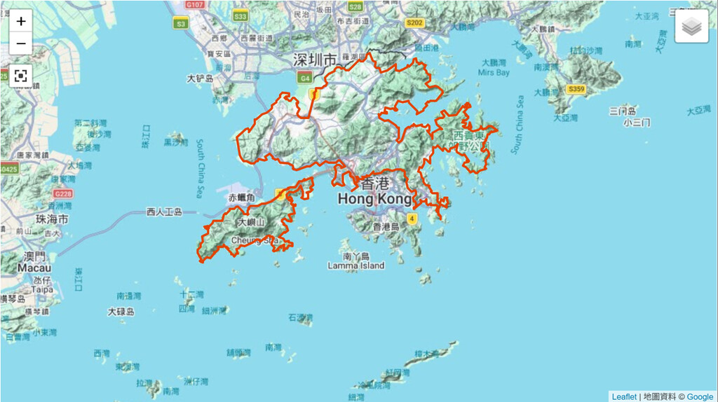
Hong Kong SAR China has a total area of 1,108 sq km (428 sq mi), of which 3.16% is water. Referring to the image above, Hong Kong is administratively divided broadly into 4 parts: New Territories East, New Territories West, Hong Kong Island and Kowloon, and Lantau Island. New Territories East and West comprise an area of 952 sq km (368 sq mi), and Lantau adds significant outer coastline.
This route laps around the outermost periphery of the New Territories mainland and then Lantau Island, creating a full major-territories circumnavigation on foot.
The route is fixed with minor deviation allowed, and runners have to follow route parameters. Since the goal is to reach from the start back to the start, minor deviation is allowed as road block and repairs varies day to day. Clockwise the whole or part, and anticlockwise the whole or part, are allowed.
No transportation is allowed throughout.
Attraction of the route:
- Time needed: likely 10–20+ days for the whole route, depending on pace (New Territories several weeks; Lantau four to five days).
- The trails are well-traveled in many sections (especially Lantau), many with park posts marking every half kilometer.
- There are park benches, maps, bathrooms, fire pits, picnic tables, and tent camping areas for the use of hikers (more common on Lantau).
- Nice scenery and beautiful views.
- Nice beaches at Pui O and Changsha on the southern side of Lantau.
- Mui Wo on the east end and Tai O on the west end of Lantau offer old village attractions .
- Hong Kong's second and third highest peaks are on Lantau.
- Run a few hours for scores of miles, carrying one bottle of nutrition drink. Take time to rest, refuel food and drinks from convenience store, then restart the exploration. For payments, convenience stores and public transport accept Stored Value cards (Octopus). Running solo is no problem as Hong Kong is one of the safest city in the world.
New Territories section bases/overview
The route runs along the outermost periphery of New Territories.
Lantau Island section bases
Bases at north-west shore: Tung Chung New Development Ferry Pier 東涌新發展碼頭, Civil Aviation Department Headquarters Office Building 民航處總部辦公大樓, Hong Kong Boundary Crossing Facilities Artificial Island of the Hong Kong-Zhuhai-Macao Bridge 港珠澳大橋香港口岸人工島 (touch the rim), Skypier at Hong Kong International Airport 渡輪碼頭海天客運碼頭, AsiaWorld-Expo 亞洲國際博覽館, .
Bases at west shore: Tai O Promenade 大澳海濱長廊, Nga Ying Kok Campsite 牙鷹角營地, Yi O Pier 二澳碼頭, ... Fan Lau Miu Wan 分流廟灣.
Bases at south shore: Fan Lau Stalagmite 分流石荀, Fan Lau Tung Wan 分流東灣, Kau Ling Chung Campsite 狗嶺涌營地, ... 61metres Hilltop 6 山頭 22°13'49.38"N 114°01'05.19"E.
Bases at east shore: Cheung Sha Wan 長沙灣, Chi Ma Wan Public Pier 芝麻灣公眾碼頭, ... Tai Chuen 大轉.
Bases at north-east shore: Tsing Chau Tsai Shipyard 青洲仔船廠, Sunny Bay Road 欣澳道, ... back to Tung Chung New Development Ferry Pier 東涌新發展碼頭.