Classic loop route! This one goes out to all the marathon baddies that have those fast turnover legs. I tracked this run on my boyfriends garmin watch as well as on my iphone. My phone shows 1584' climbing and the Garmin shows 2329'. I think the Garmin is much more accurate, there are dozens of small hills on the trail side that I think my phones tracking did not capture.
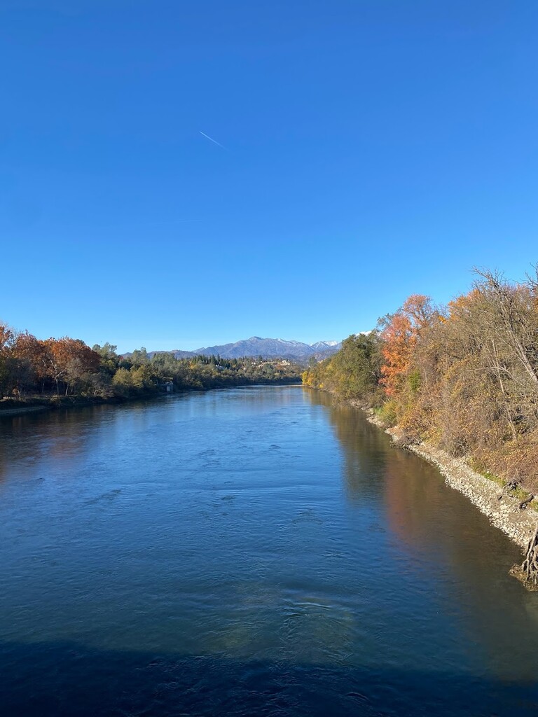
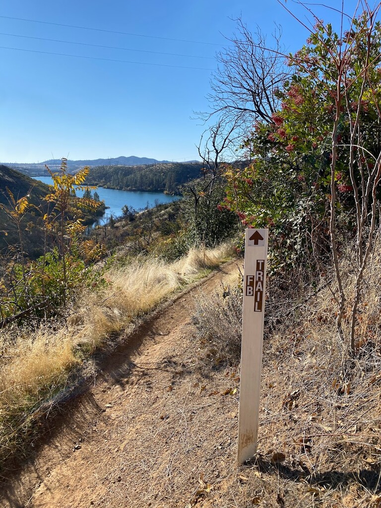
I started this loop from the Diestelhorst Bridge parking lot, running in a counterclockwise fashion across Diestelhorst bridge so I could connect to the Sacramento River trail on the north side. From there, follow the paved trail for a few miles until you come to the Keswick Dam. At this point, there is a small sign to the FB trail to the right, that goes slightly uphill. From here, for the next 20~ miles, you'll follow a primarily single track trail that bobs and weaves along connecting the FB trail to Hornbeck Trail to Upper Ditch Trail. When in doubt, choose singletrack. You'll have a dozen or so fire road crossings, 1 actual road crossing, and some off shoot trails to points of interest and other trails in the area. You'll be following a meandering path that mostly parallels the Sacramento River up to the Shasta Dam. Once you've finished the trail portion, it'll spit you out onto the road that leads to the parking lot and access to cross over the dam.
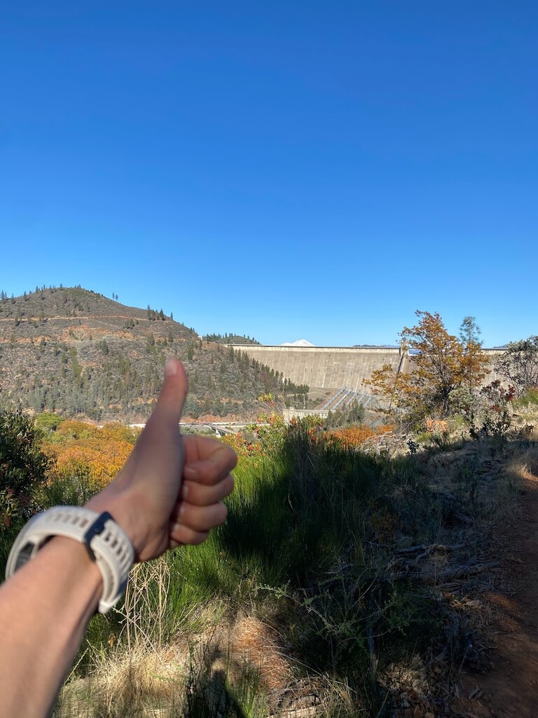
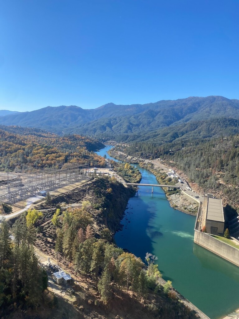
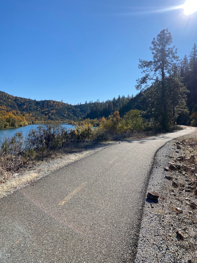
Cross over the dam. Don't try to get too sad seeing how low the water levels are. At the end of the dam , you'll turn left and have to run 1~ mile down a road with no shoulder towards the "Chappie Shasta OHV area". The road is narrow, curvy and without shoulder but also very quiet. On a gorgeous Saturday, I had 6 cars pass in total. At the bottom of the hill, you'll run along the road through the campgrounds and day use area until you see a sign for the Sacramento River Rail to Trail. Switch gears to flat road running. Follow along the paved route for 14 miles back to the Diestelhorst Bridge, cross through the bollards and cry your eyes out cause that was a hot flat fast effort. To note... I said this paved part if flat but there are a few miles of rolling climbs and downhills in the middle that just hurt badly deep into the effort.
WATER/NUTRITION: I run pretty light when it comes to water and nutrition, so take my numbers with a grain of salt: 2 liters water, 1/2 liter hammer electrolytes bottle, 3 kirkland nut bars. This was on a temp range from 45 - 62 degrees, gorgeous sunny day. I easily would have consumed 4 - 5 liters of water had I been carrying it but I began rationing almost immediately. I cried a few tears when the fountains at shasta dam didnt work and then cried a few more now happy tears when I came across the spigot in the OHV area.
NAVIGATION FYI: Just a couple point I'll lay out in no particular order:
1. On the rail-to-trail part, there are mile markers made with iron numbers where one side will say "9" and the other "2". You'll see the coundown continue "6" paired with a "5"... etc. Just know this - the mile markers countdown for the section from Keswick Dam to the start of the rail to trail. NOT the whole paved side. Don't get excited cause when you hit zero... you still have 3.25 miles to go.
2. On the trail side, the signs for FB, Hornbeck and Upper Ditch have mile marker numbers. I have run/biked this trail a dozen times and do not at all understand what the numbers mean haha! There's one sign for the "Trail" haha that someone hand wrote "5.1 mile to the dam". This is accurate.
3. If you feel like ditching the attempt while you're still on the trail side, slag off and go ahead and hit up Chamise Peak. GORGEOUS! I was thinking about adding that as an out-and-back add on to the trail but i love a perfect loop so I held off. Adds 4 miles / 1400'.
4. When in doubt, stay single track and follow in order from town towards dam - FB -> Hornbeck -> Upper Ditch.
5. Theres a left turn on the rail to trail that is important to make. There will be a sign that shows your three options - follow the left turn downhill for Keswick Dam 2.7 miles.
6. Obviously, this is a loop so start/finish where you want to. Here's why I think Diestelhorst Bridge is the logical start. There is ample parking. There is water. Town is 1 mile away so you can get food ASAP afterward. This allows you to get all the trail out of the way in the first half of the run, which also trends slightly uphill. This also means that the last 15 miles are paved and generally downhill though theres a few miles of roller 1/3 - 1/2 mile hills that will have you cursing the heavens. And it's always nice to anticipate the finish because you'll start to see so many people. You'll see Diestelhorst bridge about a mile off and there are consistent 1/4 mile markers for the last 3 miles. At least for me a long, unsupported effort, this definitely rallied my spirits for the last 10 minutes. IF you start at the dam... please for the love of god, start by running the paved side. I do not wish the road climb from the rail/trail to the dam on anyone as the last mile of this effort. It is slow, steep, miserable and on a road with no shoulder.
WATER: I've biked this route a few times spanning all the seasons and based on my past experiences, I strongly suggest carrying enough water to cover you for the effort. There are 2 reliable water sources -- one is a spigot in the parking area at Diestelhorst Bridge by the bollards. The other is a spigot in the Day Use area near the campgrounds at the base of the dam (near the Chappie-Shasta OHV area). The spigot does have a sign. There are fountains at Shasta Dam but every time I've hoped to top off there, they have been off.
SHADE/EXPOSURE: man... pre-fire damage, I imagine the trail side would have been much more shaded but as it is, expect long stretches of non stop sun. Redding is the second sunniest city in the US and gets very very very very hot. I'd say the route was 70/30 sun versus shade.
SUPPORT/ROUTE ACCESS: Because this is a loop route, you can start finish anywhere along the route. Here's an incomplete list of parking in order of the route if you follow my counterclock way:
Diestelhorst Bridge - lots of parking, water access. https://goo.gl/maps/3w5PxGBoybChD3dJ7
Harlan Trailhead - very limited parking. no water. https://goo.gl/maps/u89eudCZK1MmGr8q9
Keswick Dam Trailhead - small lot ... maybe 20 cars max. small lot. no water. https://goo.gl/maps/7QnrZWHAwBeZjhkx6
Walker Mine trailhead - same as above. https://goo.gl/maps/3qgnz9XTVH8BsRLNA
Shasta Dam - loads of parking. not sure if you have to pay. terribly frustrating water fountains that I absolutely would not rely on. https://goo.gl/maps/tcFrYK3H24aRRQJZ7
Chappie-Shasta OHV area - there's day use parking thats close to the start of the rail-to-trail part of this loop. There was a spigot + campground so you shouldnt have problem getting water here. + restrooms! https://goo.gl/maps/u1hKP54TA39vTnK78
Sacramento River Trail - Keswick Dam - If I recall this lot correctly, it is small and completely in the sun and just pit toilets. https://goo.gl/maps/JtZMFP7r7dbKLsCv6