This point-point, open-course route takes you from the easternmost point of Joshua Tree National Park to its westernmost point, along the park’s longest “axis”. It is about 80 miles long. The GPX route shown below is the one Sam Kottoor followed, but it is not required to go this route, and you are encouraged to make your own, as only the start and end points matter. A link to his trip report is found below. It is acceptable to attempt either from East to West, or from West to East. Additionally, you must stay within the boundaries of Joshua Tree National Park from start to finish.
All rules of Joshua Tree National Park must be followed. It is fair game to use natural elements found in the park (as long as authorized by the park). Use of road/trail is allowed. Any time of the year is allowed.
The Eastern Terminus is located at a national park boundary stake with a white sign found at Lat: 33.869595 Lon -115.262160 (DMS: 33° 52’ 10”, -115° 15’ 43”).
The Western Terminus is located at Lat: 34.076016 Lon: -116.457588 (DMS: 34° 04’ 33”, -116° 27’ 27”). There does not seem to be any clear marker indicating where Joshua Tree National Park ends and the BLM land of Big Morongo Canyon Preserve of the Sand to Snow National Monument begins. Therefore, it is acceptable to get within ± 0.0003 of a DD coordinate, or ± 1 second of a DMS coordinate of the Western Terminus coordinates listed above.
The route was first done in November 2022, solo and unsupported [the adventurer must carry all their food, water and all other supplies/equipment from the start and will leave "no trace" (carry out all the trash as well until the end). It is not allowed to receive support from anyone else (navigation, weather, carrying equipment, filming or photography, etc.). No pre-placed food or water caches allowed. The use of a satellite phone, distress beacon or GPS does not constitute support].
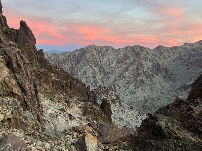
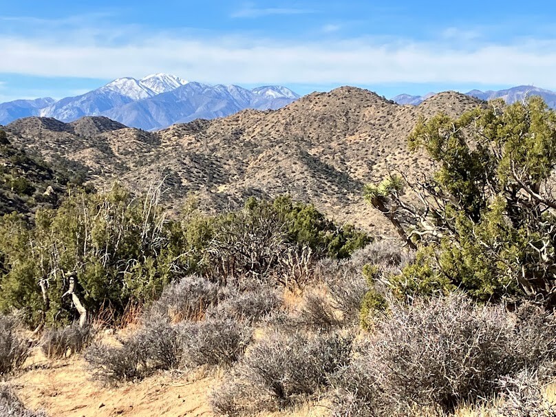
This route is significant because it requires an individual to traverse the entirety of one of America's 63 great national parks, Joshua Tree National Park, the 15th largest national park in America, as well as the 2nd largest in California. This full length crossing is done east to west as opposed to north to south, as the distance from the eastern terminus to the western terminus is greater than the distance from the northern terminus to the southern terminus, making this the most comprehensive possible crossing of the park.
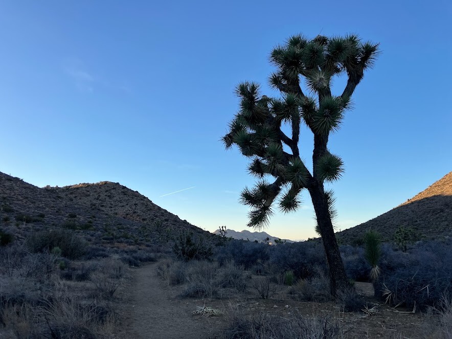
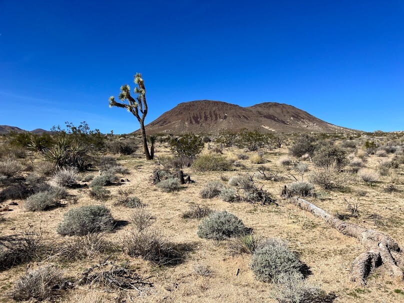
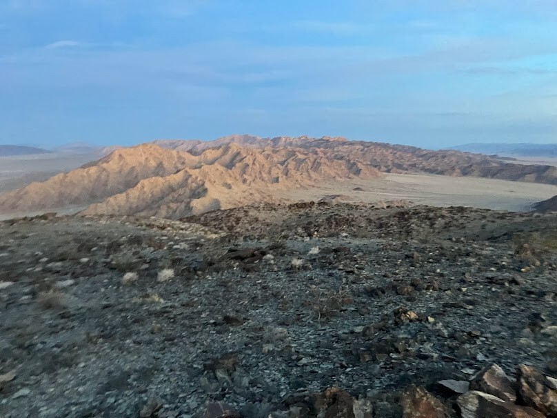
Additionally, the route fully crosses two mountain ranges (the Coxcomb mountains and the Hexie Mountains) as well as enters a third mountain range (the Little San Bernardino Mountains).The route even travels through two distinct deserts: the Colorado desert and the Mojave desert. The route includes three different ecosystems, the Colorado Desert, the Mojave Desert and the San Bernardino Mountains, all three mentioned before.
As there are little to no potable water sources available in the park, the challenge becomes interesting in the fact that the individual is tasked with carrying all their needed supplies from start to finish, if the manner chosen is "unsupported". Finally, much of the route encourages an individual to find their own way through the wilderness, while other parts of the route make more sense on trail.
Link to Sam Kottoor's trip report: https://docs.google.com/document/d/1kJXYUSRiBISiobVyNzb7Wu_QOrOod_JJLyljOZRmrPk/edit?usp=sharing
Admin note: The east to west elevation gain is approximately 9,500'. West to east would be significantly less.
Comments
Hello!
For anyone interested in attempting/discussing this route, please reach out to me, I am more than happy to discuss, and am always excited to aid in an attempt. I'm best reached at samjkottoor@gmail.com, or send me a text at 309-370-1603.
Peace,
Sam
I took a shot at this a couple of weeks ago to see if I couple pull it under 20 hours. My weekend window was limited so I started Friday night. I left my car sometime after 9pm with the temp at a chilly 30 degrees and went looking for the start point on the west end which is a random side of a steep, loose and brushy ridge with no moon out. It took a few. It’s a lot of the same terrain the first couple of miles but then I connected to one is the ohv roads within the park. I wasn’t paying attention and ended up running .25 miles outside the boundary so I backtracked where I left the park and went on.
I met up with the CRHT and only saw one tent back in them hills as I ran through the night. I was doing this self supported with only one cache at the park road past the halfway point so I had about 8lbs of water and supplies. I has been dealing with some sciatica the last few weeks so I kept my strides a little shorter and shuffled my feet a bit, kicking some rocks along the way. My back, hammy and glute started getting tight, probably a combo of the sciatica and not having run the last few weeks because of the sciatica, but I continued to push. Overall, not a bad night and I started seeing that first glow on the horizon as I approached the Ryan Mountain area.
It was nice to actually see the trees and boulders as the sun came up while crossing the trail towards Squaw Tank but at about mile 30, my knee started getting cranky about the short strides across the long sandy washes. I threw a brace on which usually takes care of it, but 5 miles later, the pain started back up. I kept pushing through it as I ran through Fried Liver Wash but I had to stop and do a quick squat stretch every half mile to loosen the knee a little. I was hoping it would work itself out but it wouldn’t. As I approached my water cache, 50 miles in, I had to reassess my situation. I had about 30-35 miles left. It wasn’t a question of whether I could finish, but if I could do it within 20 hours. Like I said, I had a small window and needed to make that work. Stopping every half mile was not computing well, plus I was about to cross Pinto Basin where there was not access expect by foot or helicopter. If I had further problems, I was on my own. I decided to be responsible and call it for the day. I ended up hitching to 29 Palms with an awesome 76 year old widower who converted to Van life and we ate and talked over Jack in the Box till my parents picked me up to take me back to my truck in Yucca Valley. Maybe I’ll take another shot again later….