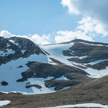
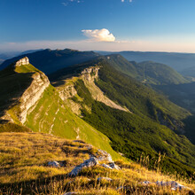
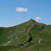
This is the highest peak in the Jura mountain range next to the Leman Lake in Geneva (Switzerland). The path starts at a refuge at 880 meter of elevation quickly reaching an unforgiven steep path to climb to the summit. First 400 meters of elevation goes through the typical Jurassian forest to then open-up to mid-mountain terrain with no trees and on an almost runnable part for about 200 meter of elevation more. Then the final push to the summit starts with some scrambling through a rocky path before reaching the summit at 1720 meters of altitude. This is the most famous peak in the Jura mountain range (extending by 360 kilometers), its prominence make it very distinguishable and popular across people living in Switzerland and France. In winter is covered with snow and also popular for ski mountaineering routes.
The downhill part: "the downhill part starts taking a path slightly on the right shoulder prior to the summit. First 200 meters is a fast track with 10% drop to quickly enter a steeper single track trail to circumvent a rocky cliff (on the left) with a big drop (in the right). This goes for about 200m of altitude, then the path turns into blocks and rocks wild track until a refuge at around 1350m of altitude, the downhill continues with a steep single track with slippery rock debris based ground for about 200m of elevation more. Afterwards we arrive to the crossing point with the uphill path and quickly enter the forest for a steady 20% drop until the end. Loop is closed and the quads destroyed :)


