The route to Harada is difficult to access by car due to the long drive. Generally hikers leave their cars at this point on catch a mountain bus which takes them a further 15 kilometers up the valley to access Kita Dake.
On the return course, the trail begins gently up to the first hut, Daimon Sawa Koya, before the ridge line there is a free water point. From this point on the course steeply climbs up to the ridge line, which is often exposed to strong winds.
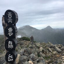
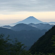
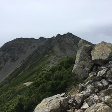
The ridge line provides exceptional views of Mt. Fuji, Aino Dake and Kita Dake. It is approximately 9 kilometers along the ridge to Kita Dake, the 2nd highest mountain in Japan (3193m). On route the course undulates various times, dropping down 200 to 350 meters , before climbing up to initially Notori and then Aino, which is the 3rd highest peak in Japan ( 3190m). Aino is a large flat summit that almost feels like a plateau instead of a peak. On route there are 3 huts that can provide food/water/ and shelter.
The course takes in the 2nd and 3rd highest mountains in Japan and is spectacular in terms of scenery


