Kitchitwaa Shkwaandem, roughly translated from its proper Anishinaabe name as Heaven's Gate, was acquired in 2021 through the incredible generosity of community donations. This project was made also possible by the Government of Canada through the Natural Heritage Conservation Program, part of Canada's Nature Fund, as well as funding from the Ontario Land Trust Alliance. The acquisition of Kitchitwaa Shkwaandem served to protect culturally and ecologically significant land from development, and bridge the gap between LaCloche Provincial Reserve and Killarney Provincial Park. The landscape of Heaven's Gate inspired members of the Group of Seven, some of whose iconic paintings were created in the area.
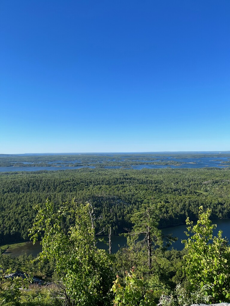
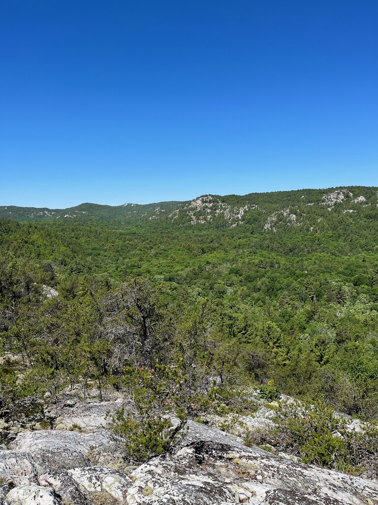
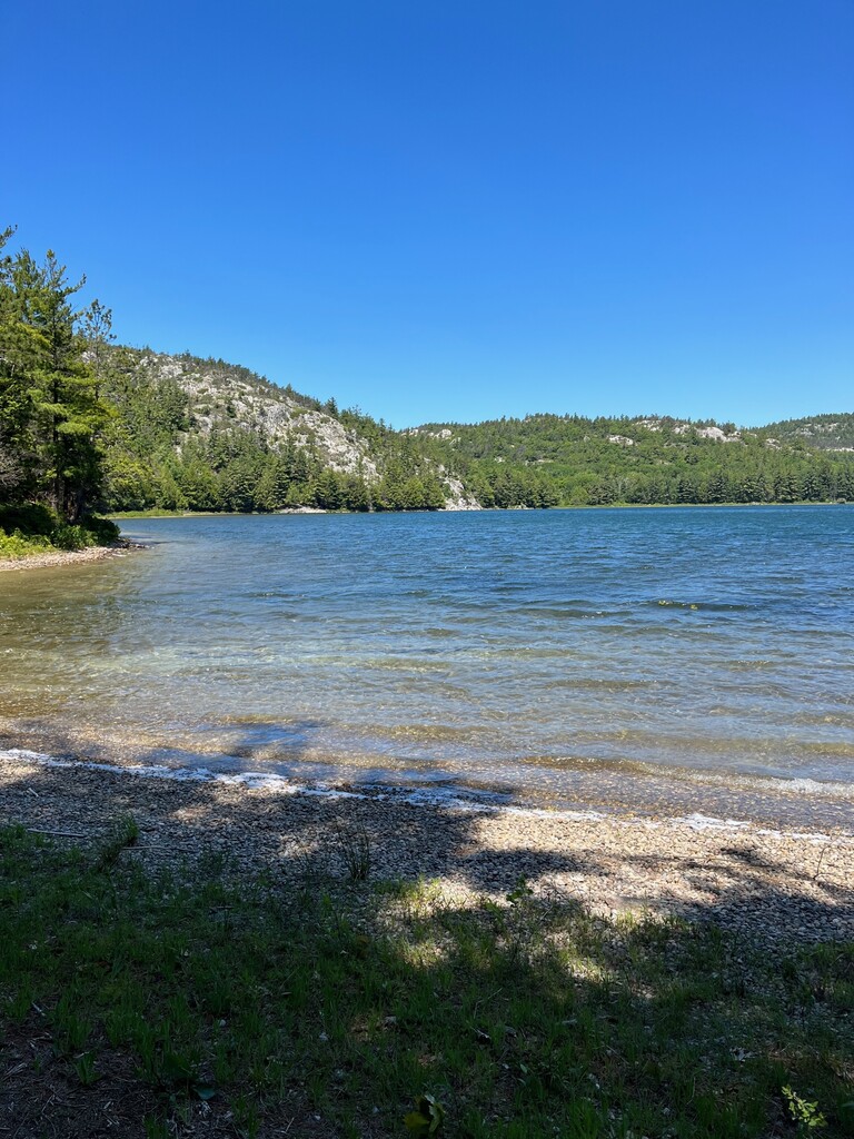
The land is extremely biodiverse, with over 12 species at risk calling it home, 3 lakes and 2 mountains within its borders along ancient Canadian Shield landscape. Hiking in this pristine environment you're likely to see some of our rarest and most beautiful flora and fauna, including Bald and Golden Eagles, River Otters, Blanding's Turtles and maybe, if you're lucky, catch a sign of majestic Algonquin Wolves. With over 1,900 acres of wild beauty to explore on our trails, Heaven's Gate is sure to be one of the most memorable hikes you'll ever have.
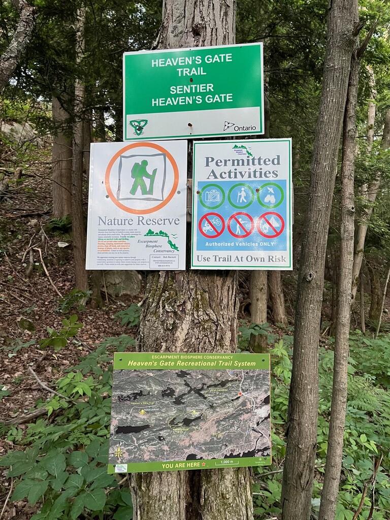
The Heaven’s Gate Trail runs along the ridge of the La Cloche Mountains, the white quartzite hills that jut out of the Canadian Shield just west of Espanola. The entire Heaven’s Gate Trail stretches from Sagamok First Nation, through La Cloche Provincial Park, to just outside Willisville, an estimated 40km with a different start and finish point. The trail weaves you through the heart of the hills—into maple groves, birch forests, and up to Group of Seven-worthy vistas.
There is a small parking lot off of Highway 6 near the east trail head. There is plenty of parking at the west trail head at Fort LaCloche.
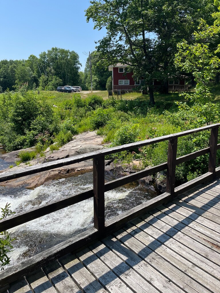
Do not let the distance fool you on this route. It's more like an adventure than a trail. It is all back country. No road crossings. No facilities. Only way out is to finish or hit the SOS button for a rescue. I wouldn't rely on cell service in this area. The trail is very hilly and rugged. Find your way using white blazes, flagging tape and rock cairns. It is very hard to stay on course at all times. It is not well traveled. Poorly marked in some areas. Having a navigation plan is necessary. Please be prepared! If it feels like you are bushwhacking, do not fret...you most likely are. There are enough good water sources that you will come across including many lakes. The east trail head is the sign just off of highway 6 and the west trail head is the bridge over the waterfall at Fort LaCloche. This is a difficult, but beautiful route. Please enjoy responsibly!
https://www.alltrails.com/trail/canada/ontario/heavens-gate-trail