Submitted by Steve Auch (with photos by Steve Auch):
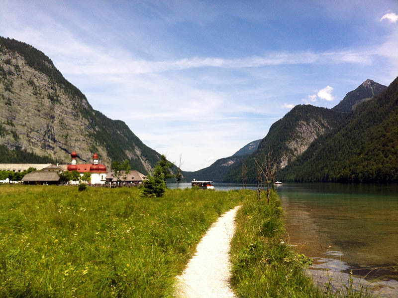
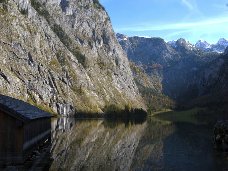
Centered in the middle of the Berchtesgaden Alps Nationalpark in Bavaria lies the famous Königssee (King’s Lake). Surrounded by mountains with a spectacular view direct in the famous east face of Mt. Watzmann. The lake has a maximum depth of 190m and a scope of around 20k. The water is pure drinking water and since 1909 only electric-powered passenger ships are allowed.
If you want to circumnavigate the lake you have to use the hiking trails which lead over mountain passes in a continuous up and down.
In 2009 the famous photographer and trail runner Stephan „Gripmaster“ Repke produced a short film together with the local running shop owner and top performing trail runner Stephan Tassani and his wife Barbara.
http://laufsport-tassani.de/wb/pages/home/ergebnisse-und-berichte/berichte-und-fotos-2009/koenigssee-umrundung.php
This is the time where the famous circumnavigation of the King’s Lake was born and since then everybody knows, that it is possible, to do the impossible and run around the lake in very less than one day. Normally it is at least a two day hiking trip.
Over the years this route became one of the most famous trail running routes in Germany. In May 2013 Runner’s World printed an article about this route over 7 pages. It was the longest article ever printed in this magazine.
There are some variations of this route. A shorter version, where you run on the lower trails, which weren’t marked or maintained. A longer version where you stay longer in the mountains and come down to the lake only once. And even a lot of personal variations depending on the preferences of each runner.
But for sure, everything began with this original route and everybody should run this route before thinking about variations.
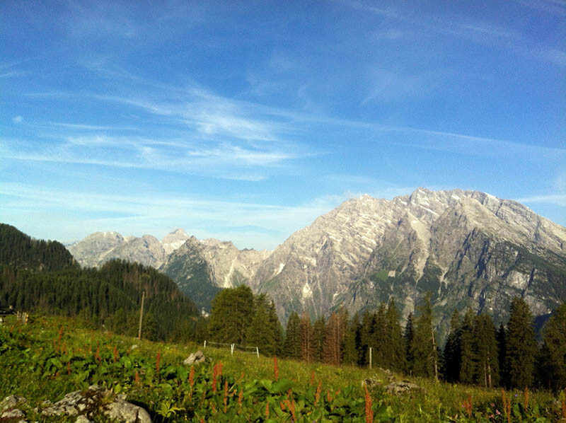
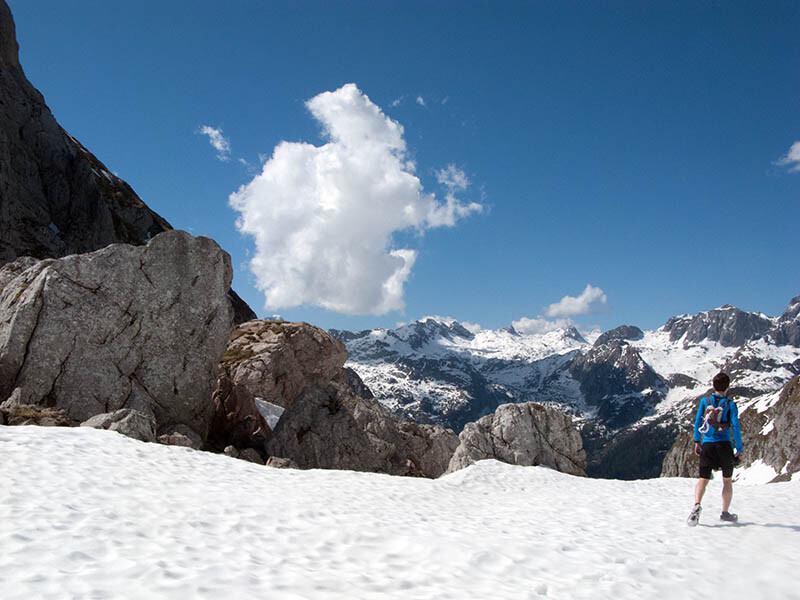
This original route used a mix of the official known and well marked trails, combined with a short part running on old paths which were used today only by hunters and locals. The route is around 35k long and covers a total climb of 2700m.
Starting at the crowded parking lot (605m) next to the lake you have to follow an easy and steep hiking trail up to Königsbachalm and Priesbergalm.
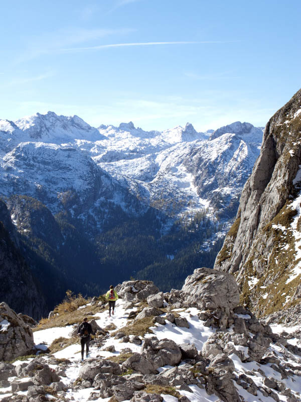
Direct after the Priesbergalm, with a great view to Mt. Watzman, the single trail starts and leads you through the famous Stiergraben directly to the highest point of the route; Hochgschirr 1959m. After this climb you have to descend via the Landtal und Röthsteig to Obersee and to the very far end of King’s Lake. This downhill with more than 1300m of descend is one of the most beautiful downhills in the whole area. Starting a bit rocky, turning relatively easy with smooth trails and ending on a steep trail with ladders and ropes.
After reaching Obersee and a bit later the end of King’s Lake you were directly thrown back into the overcrowded civilization.
Now speed up and get on the old hunter path which is not so easy to find. Watch for logical lines and little piles of stones.
This old path will directly lead you to another famous and well known hiking trail which you have to follow down to the lake again and directly into the next overcrowding spot; the famous pilgrimage church of St. Bartholomä.
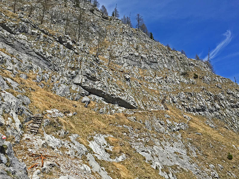
Again, speed up and get to the last climb which is a really tough one. The Rinnkendlsteig is steep as hell and normally the sun is burning during the whole climb where you can rest in the shadows only at the beginning of the climb and at the end. You need a lot of liquids because during the next 800m of vertical climbing there is no water at all. The Rinnkendlsteig is the most difficult part of the route with small trails and breathtaking deep views down to the lake. Be careful if it’s wet or the weather is turning bad. You can get in serious trouble if you underestimate this part.
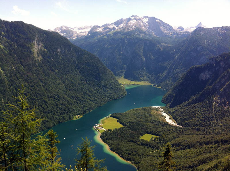
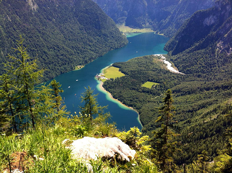
At the end of the climb you should visit the awesome viewpoint of Archenkanzel with an amazing view down to the lake.
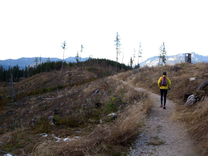
Follow the trail to Kühroint and then it’s only a 800m downhill via a steep and very easy service road with a last stretch back to the parking lot.