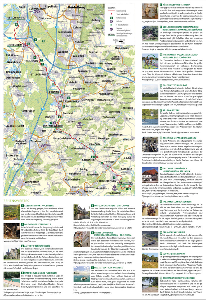
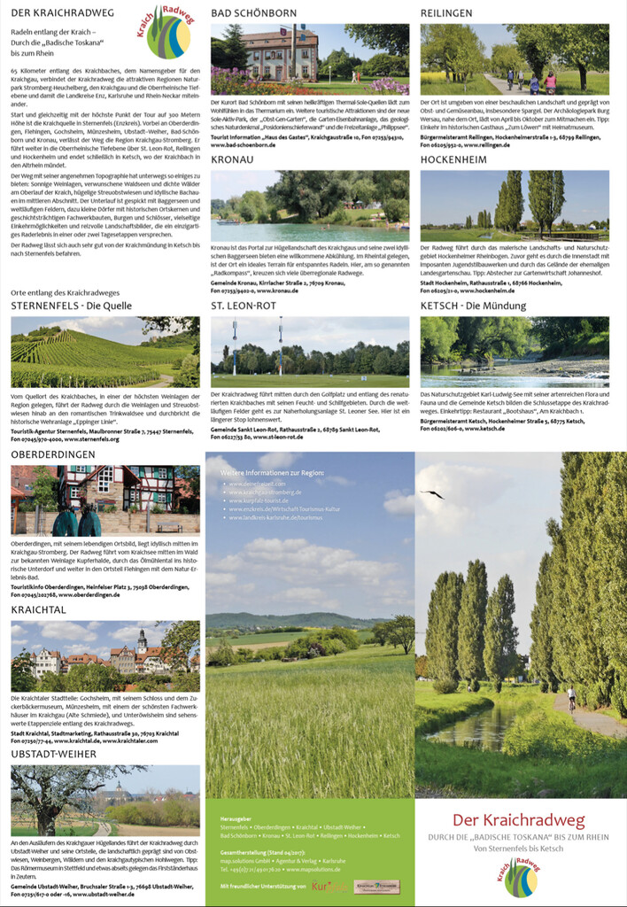
Route: Kraichradweg (Germany)

Submitted by danielgoeck on Mon, 04/19/2021 - 07:08am
Location
Germany
Distance
63.3 km
Vertical Gain
101 m
Description

Along the Kraichbach, which gives the Kraichgau its name the Kraichradweg connects the attractive region Stromberg-Heuchelberg Nature Park, the Kraichgau and Rhine-Neckar. 
 

Start and at the same time the highest point is the Kraichsource in Sternenfels. Passing many Villages along the creek. It continues into the Upper Rhine Plain via Hockenheim and finally ends in Ketsch, where the Kraichbach flows into the Old Rhine. 
 

The Path has a lot of sunny wineyards, idyllic brook meadows, and small Villages with historic town centers. 

GPS Track
Images