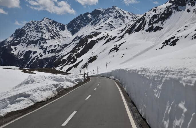
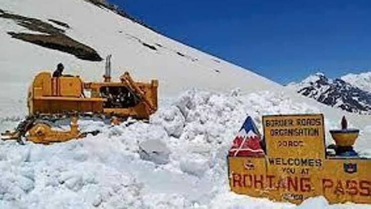
Rohtang Pass (or Rohtam Pass) is a high mountain pass at an elevation of 3.979m (13,054ft) above the sea level, located on the eastern Pir Panjal Range of the Himalayas. The pass is traversed by the Leh-Manali Highway. Every new season, the road crew has to struggle with their GPS to dig out the road buried under the layers of snow. However, massive and deadly landslides continue, giving the pass its name, which translates to ground of corpses.
Situated about 53 km from Manali, the pass connects Kullu valley with Lahaul and Spiti which in turn provide access to Leh. It’s only open from May to November for motor vehicles and it’s so dangerous the Government of India has built an 8.8km tunnel as an alternative.
The FKT starts at the round-about in Manali and ends at the pass.
A race has taken place on this route: https://www.thehellrace.com/rohtang-epic/ It is not clear if this will be an on-going (annual) event.
What is Rohtang Pass famous for?
Known for its scenic beauty, Rohtang Pass holds strategic importance for India. It's the gateway to Keylong in the landlocked Lahaul Valley from Manali in the state's Kullu district. The surface of the road is asphalted. This road has humbled many egos. It’s not for the sissies and should not be attempted by novice drivers. This pass is an ancient trade route between the people on either side of Pir Panjal. The move to control traffic was also necessary as the area beyond Rohtang Pass (Lahul and Spiti valley) gets connected by road for only three months (July to September) in a year given the rough weather conditions. This is the time when people from Lahul valley transport their cash crop, potatoes and peas to the markets across the Rohtang Pass to Kullu and earn money for the land locked period of 9 months rest of the year.