Submitted by Ethan Kennedy:
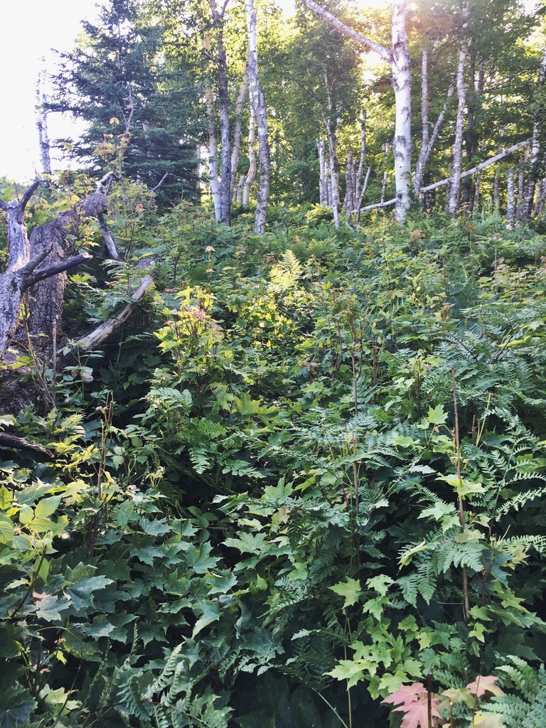
The Minong Ridge Trail is widely considered the toughest trail on Isle Royale National Park. At just under 28 miles, the trail follows the Minong Ridge on the north side of the island from Windigo to McCargoe Cove. The trail is also the least traveled trail on the island, so vegetation engulfs it. The later in the season, the more vegetation you will encounter. I would suggest attempting this trail in May or early June when the vegetation isn't up to your head.
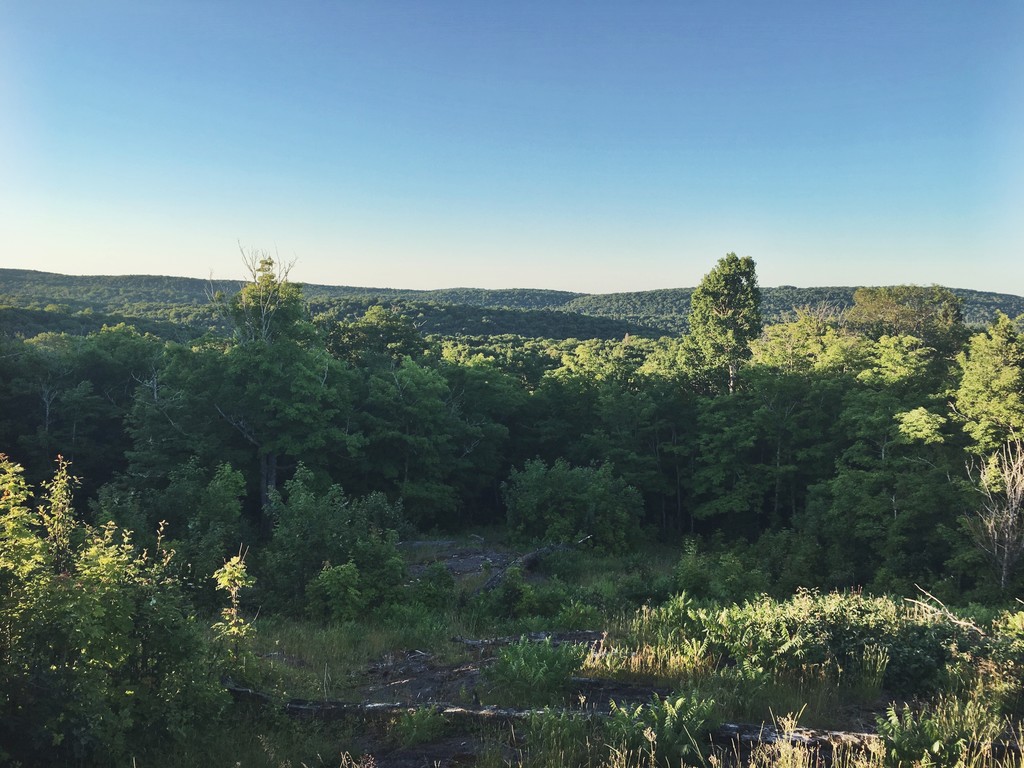
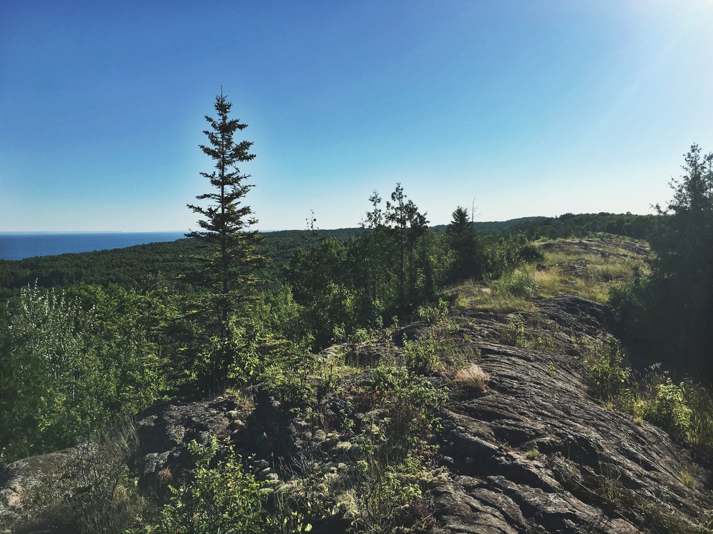
The first 3 miles of trail is well maintained, easy to follow, and contains a series of gradual climbs and small descents that bring you onto the Minong Ridge. The next 12 miles or so is spent on or near the ridge. This requires incredible focus as you will be bushwhacking through thick vegetation and running over jagged rock. On most of the ridge there is no definitive path. Rather look for the cairns every 100 feet or so. Sometimes they are hardly noticeable. I lost the trail at least a dozen times on the bare ridge and had to back track a couple hundred feet to get back on the trail.
The trail follows a sawtooth pattern. You will climb sharply for a couple hundred feet, traverse the rocky ridge, descend sharply into a valley, and then start climbing again. When you descend into the valleys, you will encounter swamps, wet areas, and the dreaded beaver ponds. In total there are 4 beaver ponds that you will have to traverse. Be prepared to have wet and muddy feet.
The views from the Ridge are beautiful. On a clear day, you can see the Minnesota and Canadian shoreline 15-20 miles away. Look for the rock formations of Sleeping Giant Provincial Park and Pie Island.
Once you get to the Little Todd Harbor trail junction, the trail mellows out, widens, and becomes more runable. Vegetation thankfully does not engulf this section. The trail descends gradually into Todd Harbor and has much more flow to it. The contrast of spruce/fir and birch/aspen forests makes for a lovely run on this section. After about 7 miles of fast and rhythmic singletrack, the trail climbs sharply back up to the ridge. The rock is once again unforgiving, with lots of jagged footholds and hidden roots.
About 1.5 miles from the finish, there is a side trail that goes to the Minong Mine. If you still have some energy, run down this path to explore the mine. The Minong Mine was in operation from 1874 to 1885 and produced 249 tons of copper. You can explore the old mine shafts and tailings piles. It is a popular destination among backpackers.
The final 1.5 miles is a fun descent to the McCargoe Cove Campground where the Minong Ridge Trail ends. There is a dock at McCargoe Cove which is a perfect spot to jump into refreshing Lake Superior and cool down. McCargoe Cove is a popular campground, so there will likely be plenty of people around who will stare at you funny for running the Minong. I enjoyed relaxing on the dock and telling some hikers about my run.
The Greenstone Ridge Trail is the most run trail on the Island. It is 40 miles long and traverses the length of the Island. It is the longer option, but also the easier option. The trail is very popular and thus is well maintained. On the other hand, the Minong Ridge Trail is shorter, but more grueling. If you are looking for a challenge, enjoy power-hiking and bushwhacking, then I would recommend running the Minong Ridge Trail.
Figuring out how to run the Minong Ridge Trail can be a logistical nightmare. I would suggest taking the Voyageur II, the intra-island ferry, from Rock Harbor to Windigo on a Sunday or Tuesday. The Ferry will arrive in Windigo around 2 pm ET. You can get a campsite at Washington Creek Campground and relax for the rest of the evening. In the morning, on a Monday or a Wednesday, wake up early, run the Minong, and then wait at McCargoe Cove until the Voyageur comes around 1:30 pm ET to pick people up and drop people off. From there its a 2.5 hour ferry ride back to Rock Harbor.