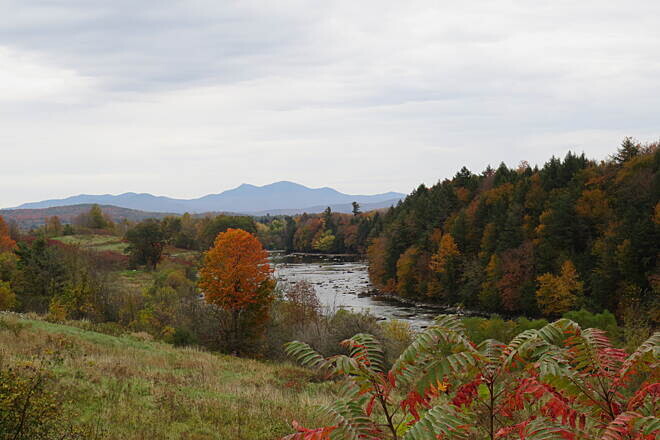
The Missisquoi Valley Rail Trail (MVRT) is a recreational trail on a former rail road and the FKT route is an out-and-back from St. Albans to Richford and back to St. Albans, of ca 53 miles total. The MVRT follows the Missisquoi River from about Sheldon Springs to Richford. The FKT route starts and ends at the official Trail Head by Seymore Rd. but the trail extends 0.2 miles further toward Swanton Rd were you find ample parking opportunities. You can add this section if you like. The turning point in Richford is by Troy St.
From the MVRT website:
Welcome to the Missisquoi Valley Rail Trail!
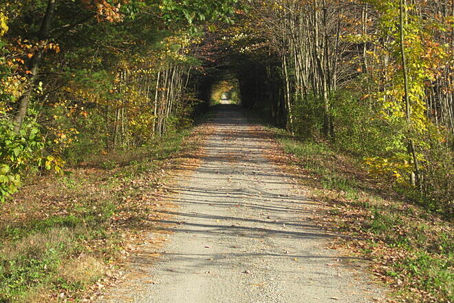
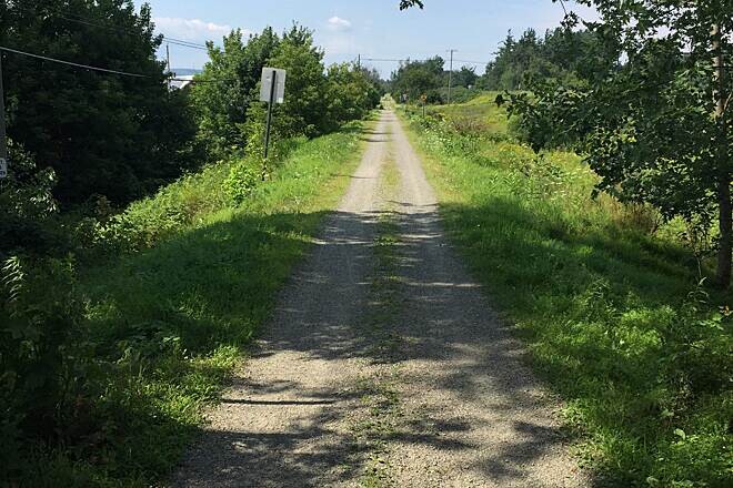
With its bucolic setting, quiet river nooks, booming mountain views, and quintessential New England villages, the Missisquoi Valley is one of Vermont’s true treasures. The New England Central Rail Line has been connecting the communities of the Missisquoi Valley since 1886— first by train and now by multi-use trail corridor. The 26.4-mile trail wanders through the villages, farms, forests, fields, and wetlands of Franklin County at a railroad’s pace: slow, steady grades with sweeping bends.
For the full length of the Trail, you’ll see the postcard images of Vermont you’ve grown to love. Interspersed between our historic village centers, you’ll also find the families and working landscapes that created and continue to support this spectacular scenery. Come visit us and explore the MVRT!
MVRT Vital Trail Facts
Overall Length: 26.4 Miles
Allowed Uses: All non-motorized uses are allowed. In the winter snowmobiles also use the trail (and it is groomed by the local snowmobile clubs). Signs posted at trail entrances summarize the allowed uses and expectations. ATVs and other motorized recreation are not allowed on the trail. E-bikes allowed. Horses are permitted on the Trail but must travel near the shoulder whenever possible. Horse and pet owners should remove animal waste from the trail surface. Pet owners must have control of their animals at all times.
Grade: 3% maximum grade. Town road crossings may be greater. Steep side slopes (stay on trail).
Trail Width: 10 foot trail surface
Surface Type: Crushed stone with stone dust for the majority of the trail. 1/3 mile asphalt pavement in Enosburg Falls. Asphalt pavement at most agricultural crossings.
Speed Limit: 35 mph in rural areas. 15 mph in village areas.
End Points: St. Albans & Richford