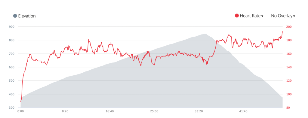
Route: Mount Orford (QC, Canada)

Submitted by Nick Martire on Sun, 04/25/2021 - 12:46pm
Location
Quebec, CA
Distance
6.88 km
Vertical Gain
472 m
Description

Mount Orford (FrenchMont Orford) is a mountain and ski resort located in the Mont-Orford National Park in the Eastern Townships region of QuebecCanada. It is 10 km (6 mi) northwest of the centre of the city of Magog.

This route leads to the summit of the 4th highest ski resort in Quebec at 850m (2788 ft).  The route starts and ends right at the bottom centre of the mountain, at the trailhead for the "4km" ski run, and goes straight up to the antenna at the summit, and directly back down.  The route is mostly loose gravel / rocks, and is fairly steep on the climb with a gain of 472m (1548 ft) in 3.44km (2.15 miles)


GPS Track