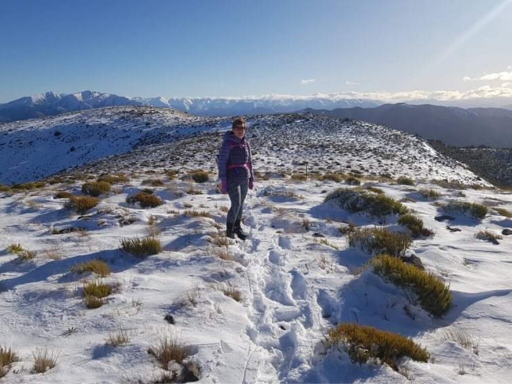
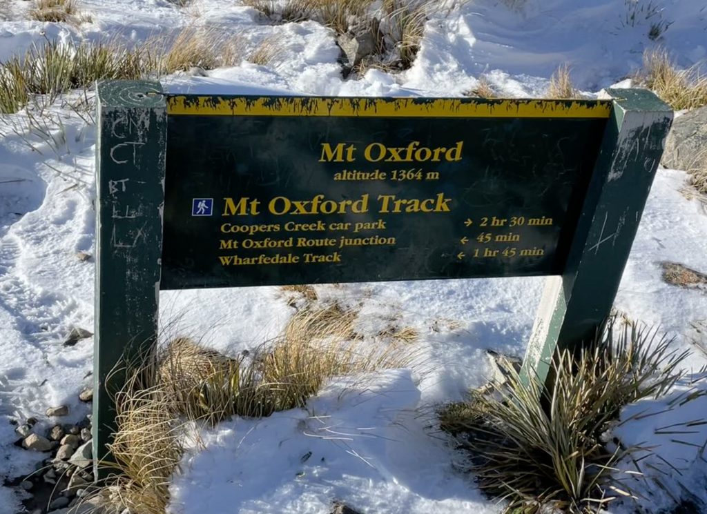
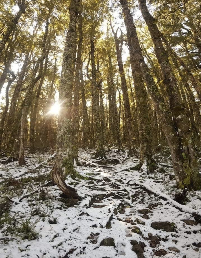
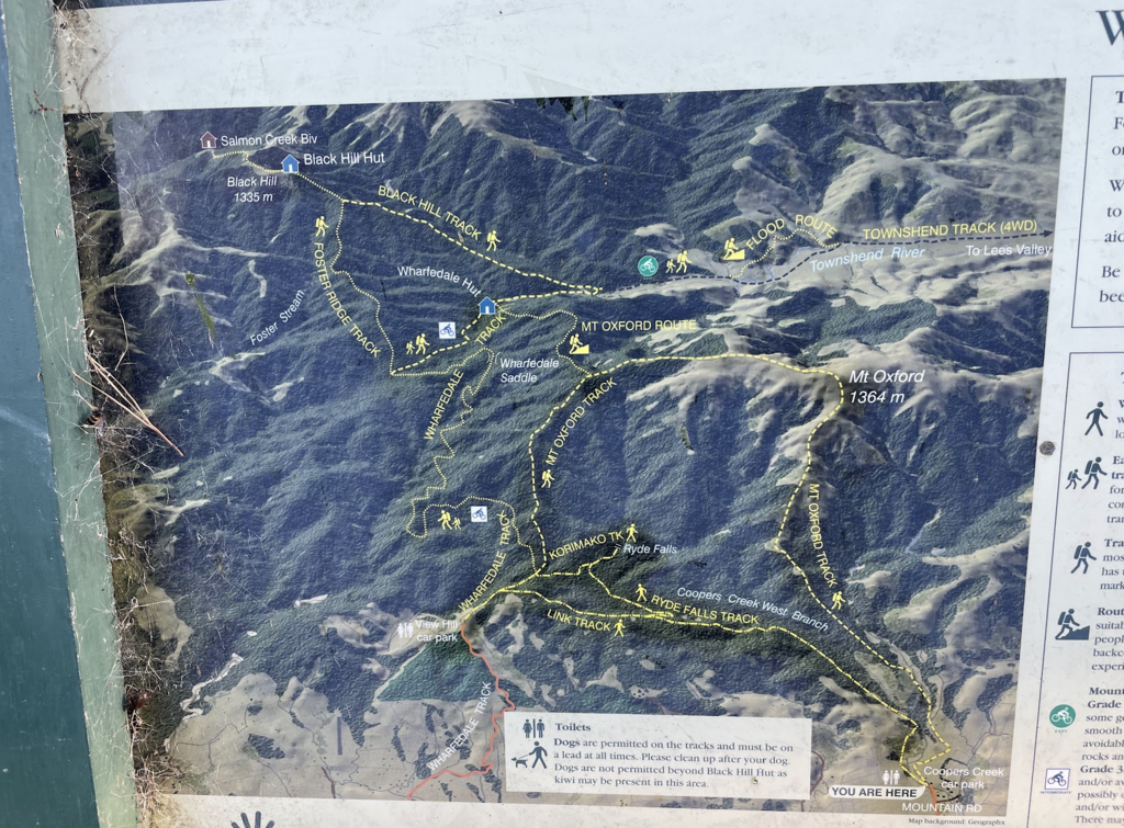
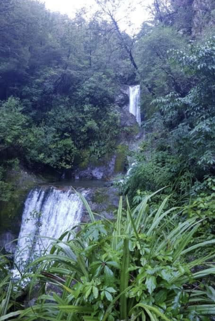
This route starts near Oxford, Canterbury, about 1h drive from Christchurch (nearest city). The route starts in Coopers Creek car park which has a toilet and some information about the various routes in the area. Mt Oxford Track can be done clockwise or counterclockwise and during all season (pictures are from May 2022). I did the loop clockwise staying on the left side of the stream with a little detour to Ryde Falls. The route was Coopers Creek car park - Ryde Falls Track - View Hill to Mt Oxford Track and then Mt Oxford Track back to the car park. The first part of the route was through beautiful beech forest to Ryde Falls. This offers views of a five-tiered waterfall and there is a flat area that could be used for camping just before the falls. There are also some information panels explaining the history of this area mainly used for milling the beech trees. You go back the same track until hitting the Ryde Falls junction and ascending through the forest above the tree line. Then the path leads through tussock all the way up Mt Oxford. This offers stunning views across the Canterbury plains with the ocean in the far distance. The descend is quite steep and it can get muddy. The last bit of the route goes through farmland and then over a bridge across the stream back to the car park.
The route is marked with orange triangles on trees and posts above the tree line (although they were not visible in the snow and also got blown over).
There is no mobile coverage for most of the route, there are no toilets except in the car park and no water fountains.
Link to the route description by the Department of Conservation NZ: https://www.doc.govt.nz/parks-and-recreation/places-to-go/canterbury/places/oxford-forest-conservation-area/things-to-do/tracks/mt-oxford-tracks/