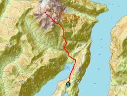
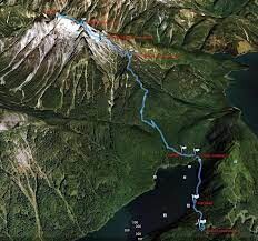
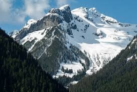
Route: Mt. Robie Reid

Submitted by TobinBerntsen on Sat, 07/30/2022 - 06:56pm
Location
British Columbia, CA
Distance
20 km
Vertical Gain
2,320 m
Description

https://www.alltrails.com/trail/canada/british-columbia/mount-robie-reid-trail

You can see this iconic peak from all over the Fraser Valley. You park between Alouette Lake and Florence Lake and hike down a logging road to Alouette lake, then jump on the trail that goes around the northern tip of Alouette Lake and then the trail goes straight up a ridge to the subalpine. Then you follow some ridges to gain the Alpine and then its a nice scramble all the way to the top following the ridge and over a couple false summits. 


GPS Track
Images