The "Shasta Picnic" is a swim-bike-mountaineer-bike-swim triathlon!
It is modeled after the the infamous "Teton Picnic" with the exception of the swim coming first-last instead of in the middle. I talked with local guiding services ahead of time to find any history of people doing this effort before, it just seems to logical and aesthetic to not have been done before. Lead Guides at Shasta Mountain Guides got back to me that, "I don't think I've heard of anyone doing it in any consistent way, or fast" and then followed with, "but it seems like an incredible effort, you should go for it!"
Note: you do want to be proficient in snow travel/self-arrest to take on Mt. Shasta. One should always check mountain conditions before ascending.
The play-by-play:
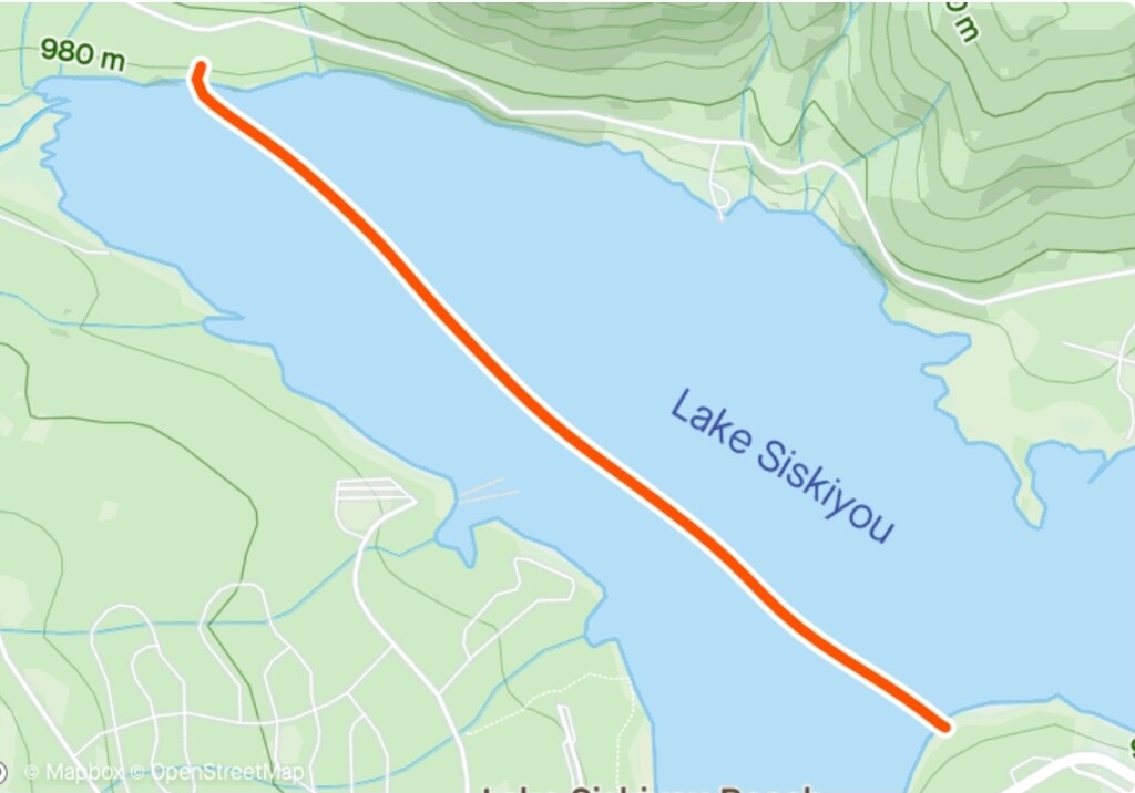
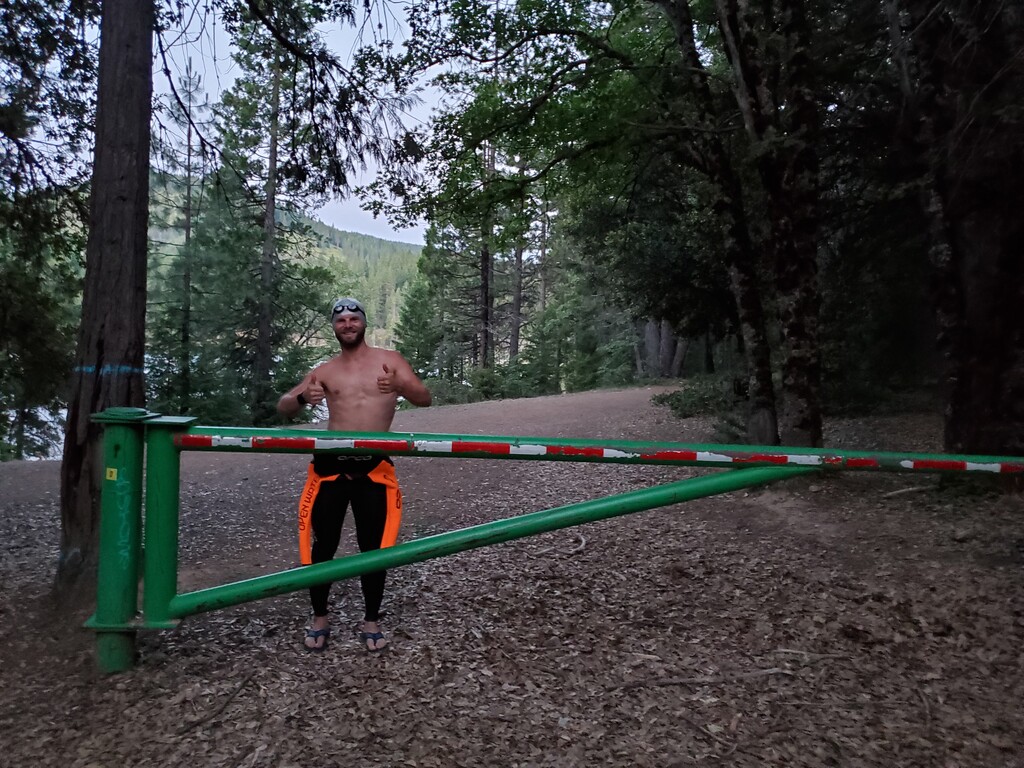
- In a seeming classic style, you start at the pictured green gate at what is on google "Parking Area Siskyou Lake Beach", here https://goo.gl/maps/bgig9nenSpQzjCm18
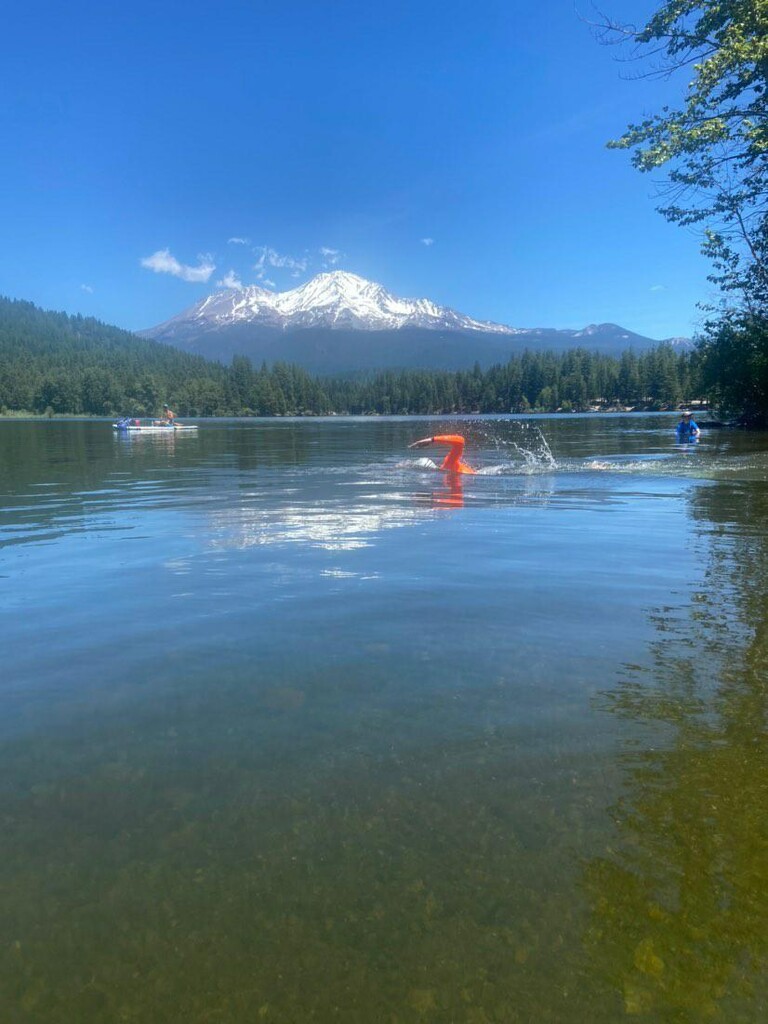
- Run down the diagonally sloping trail to the water and swim 1.2 miles from "Parking Area Siskyou Lake Beach" to "Cable Beach Parking"
- Run from the waters edge (41.278455, -122.334408) up to the "Cable Beach Parking" for your transition to the bike
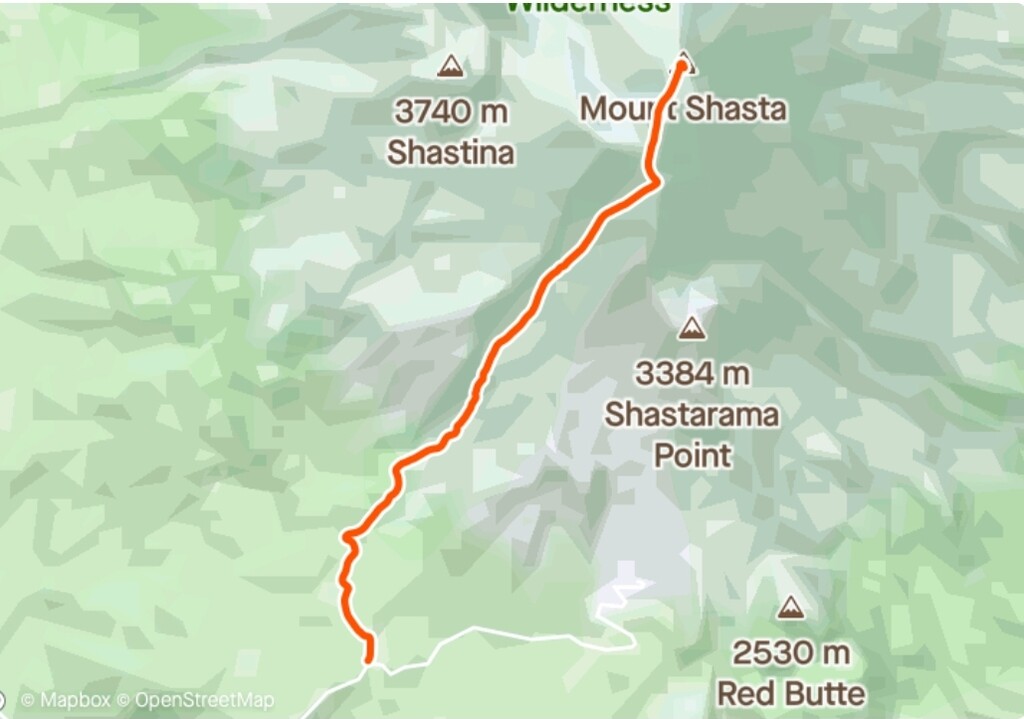
- Bike 15 miles from Cable Beach Parking (elevation 3185'), through the heart of Mt. Shasta City, up to Bunny Flat Trailhead (elevation 6950')
- Transition bike to "run"
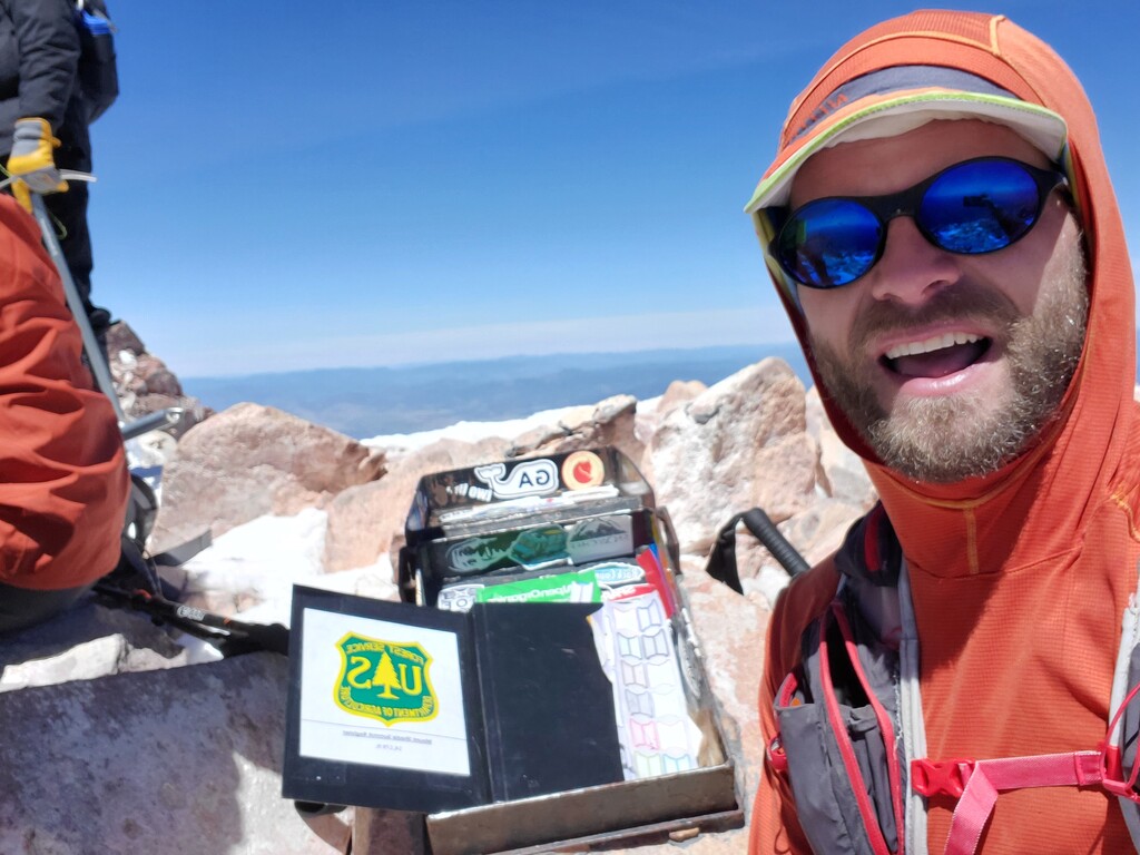
- Trail run/mountaineer the 5.3 mi up to the Mt. Shasta summit at 14,180' (7,200' gain)
- blast safely 5.3 mi back down to Bunny Flat on foot, transition back to the bike
- on the bike again, descend 15 mi down from Bunny Flat, again safely through Mt. Shasta City, back to "Cable Beach Parking"
- transition back to the swim, run down to the waters edge
- swim back across Siskyou Lake, exit the water, run up and tag the green gate at "Parking Area Siskyou Lake Beach" to stop your time.
Basic stats:
2.4 miles of swiming
30 miles of Biking (with ~3795' of gain)
10.6 miles run/mountaineer (with ~7200' gain)
If you are looking to rent mountain gear or a bike support this local business: https://thefifthseason.com/
Check weather: https://www.mountain-forecast.com/peaks/Mount-Shasta/forecasts/4317
Avalanche Center: https://www.shastaavalanche.org/
If you attempt this self-supported with all your gear cached along the way, It would be reasonable to have someone accompany during the swim, for safety, so long as they stay behind the swimmer, providing no help with sighting visually or verbally. Probably the supported form makes the most sense for this one.
One could conceivably do an unsupported time by starting from Bunny Flat biking down, swimming across the lake tagging the gate, swimming back across the lake, biking back up, and then doing the round trip on the mountain.

Comments
If you are interested in the “Casual Shasta Picnic" perhaps play by these rules:
with stoke,
Jason
Here is a video of the Shasta Picnic Triathlon effort: https://youtu.be/T_B-oL3i020