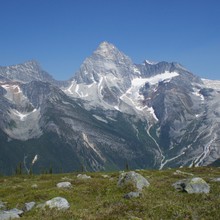
Mount Sir Donald (10,816') is a beautiful peak above Rogers Pass in the Selkirk range of British Columbia. Donald, a huge pyramid of Matterhorn shape, offers many splendid routes on good quality rock varying from 5.0 to 5.8, with no particularly easy way off. Sir Donald is the highest mountain along the Trans-Canada highway, located south of where it winds through Rogers Pass. It sits right in the middle of Glacier National Park of Canada, and is surrounded by dozens of other rugged peaks, all with imposing walls and glaciers that would inspire anyone. From the parking area one must ascend over 2,000 meters to reach the summit. Sir Donald is also highly identifiable from almost everywhere in the surrounding area. It can be seen from the Columbia Icefields, the Northern Selkirks and the Purcells. It stands noticeably above the surrounding peaks. Its Northwest Ridge (YDS 5.4) is a classic moderate climb on good rock. The Northwest Ridge of Mount Sir Donald is listed as one of the “Fifty Classic Climbs of North America” in Steck and Roper’s book first published in 1979. The route can be climbed in a single push from the road, but does entail 7800’+/- accumulated gain, thus is almost always climbed in two days minimum.
Note that Shep Steiner, "Big Dan", and "PA" (Just PA) reported doing the climb from the col to the summit and back in 2h10m on 8/9/1985. "Started climbing in shorts and fires at the base of the ridge at 6pm , back down at 8:10 ... we didn’t take a rope but we did have a chalk bag and downclimbed using the W face bypass which we knew . We were not try to beat any records , just the setting sun ."

