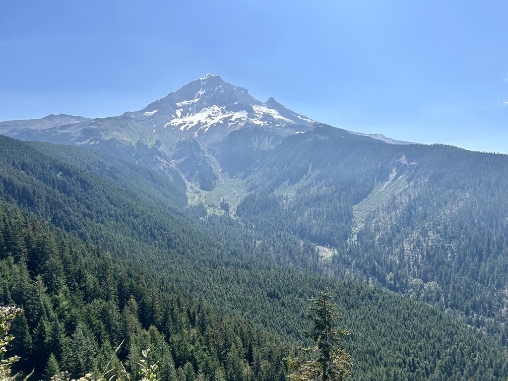
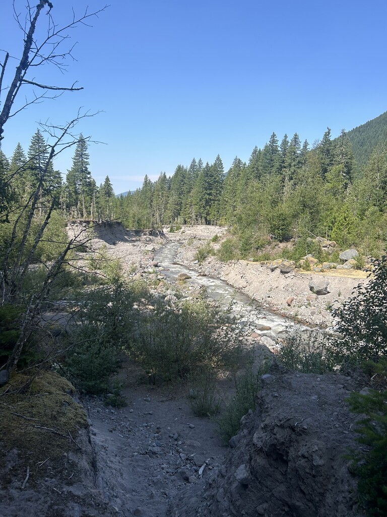
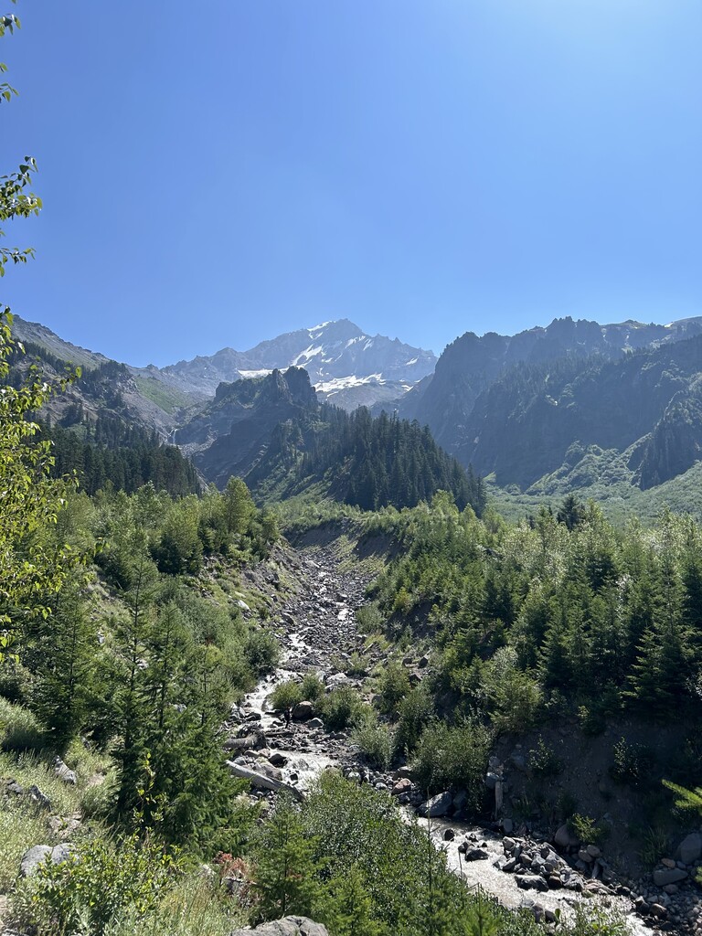
This hike begins at one of the more crowded trailheads Ramona Falls, but quickly moves to some of the loneliest terrain on the mountain. Along the way, the scenery is dominated by evidence of the forces of nature at work that provide a terrific living laboratory for children and adults: the Muddy Fork canyon is literally coming apart at the seams, with several recent mudflows dramatically changing the landscape before you. The gleaming pyramid of Mount Hood towers above the entire route.
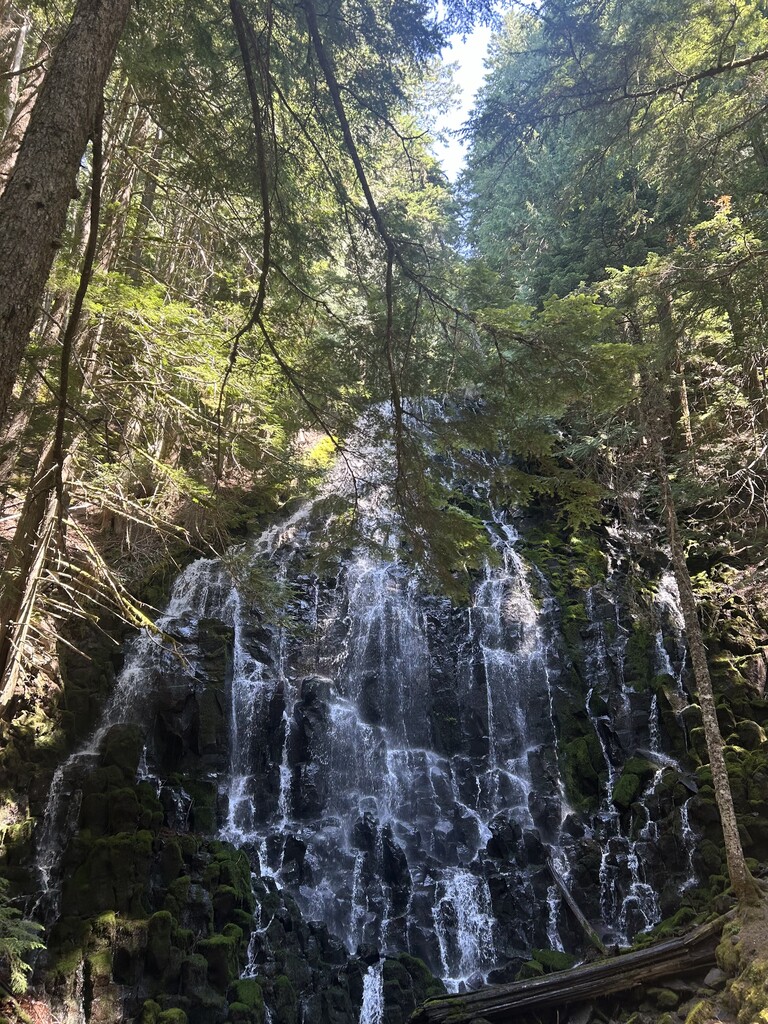
This lower-level loop using the Pacific Crest and Timberline Trails can be done early in the season before alpine trails have melted out. The route takes in some of the more interesting features of Mount Hood's west side, including Ramona Falls as well as short side trips to the stunning view from Bald Mountain overlook. In recent years, the volatile main channel of the Sandy River and its Muddy Fork have destroyed permanent bridges, so crossing those streams can be an adventure and ideally should be attempted only after a period of dry weather. Also note that this section of the Timberline Trail has several slide areas that could be tricky to cross before repair crews reach them in the late spring. The steep meadows and lush springs of the Bald Mountain and Yocum Ridges make this a prime wildflower hike in late spring/early summer.
Start at the Ramona Falls Trailhead and quickly check in at the mandatory check station about 1/4 mile in following the Sandy River Trail #770. From there follow the trail to the most optimal river crossing, usually across a combination of stones and logs. From there quickly head towards the junction with the Pacific Crest Trail #2000 which will rise steeply until meeting with the Timberline Trail #600. From here take the Timberline Trail #600 counterclockwise towards Bald Mountain overlook. Passing the overlook head down to the Muddy Fork River drainage. Once at the Muddy Fork look for the best path across and head up trail #600, climbing back out of the valley towards the junction with Yocum Ridge. Once at the junction continue on trail #600 down to Ramona Falls. Passing Ramona Falls stay on trail #600 until it runs into Pacific Crest Tail #2000. Use this and follow the river until an optimal crossing site where the trail leads you to a combination of logs and rocks to cross, around the junction with the Sandy River Trail #770. Once across the river, follow trail #770 until you are back at the parking lot.
Please see Oregon Hikers guides for more information:
https://www.oregonhikers.org/field_guide/Muddy_Fork_Loop_Hike
https://www.oregonhikers.org/field_guide/Muddy_Fork_Hike