The route is located in the Tatvan district of Bitlis, Türkiye. The starting point is accessed by driving up the mountain road that leads directly into the Nemrut Caldera. The route begins at the caldera rim and follows the continuous ridgeline for a full 360-degree loop around the crater lakes.
Conditions & Challenges
This is a technical skyrunning route rather than a standard trail.
- Terrain: There is no groomed path. The ridge is entirely covered with loose scree, boulders, and rocks of various sizes. It requires constant concentration and cautious stepping.
- Altitude & Elevation: The route sits at an average altitude of about 2,670 meters and peaks over 2,900 meters. The thin air, combined with the continuous, steep ups and downs (accumulating around 1,450m to 1,600m of vertical gain), makes pacing difficult.
- Exposure: There are no water sources on the rim, and there is full exposure to the sun and mountain winds. Runners must be completely self-sufficient.
Highlights
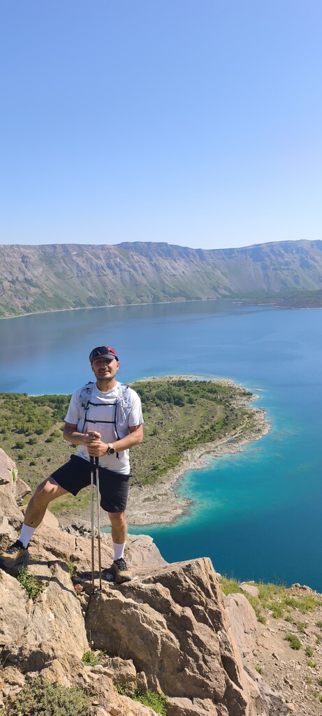
The route offers a truly spectacular and unique experience. Throughout the loop, you run with breathtaking panoramic views: on one side, you look down into one of the world's largest intact calderas and its massive crater lakes, and on the other side, you have sweeping views of the vast Lake Van (Türkiye's largest lake).
History
Mount Nemrut is a dormant stratovolcano in Eastern Anatolia. The massive caldera was formed by the collapse of the volcano's cone following major eruptions. Today, the caldera houses a unique microclimate, rare vegetation, and both hot and cold crater lakes, making it a significant geological and natural site in the region.
Further Information