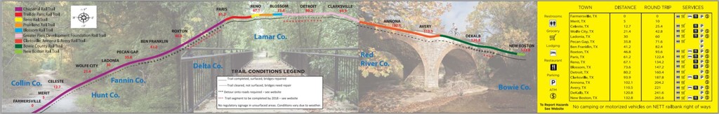
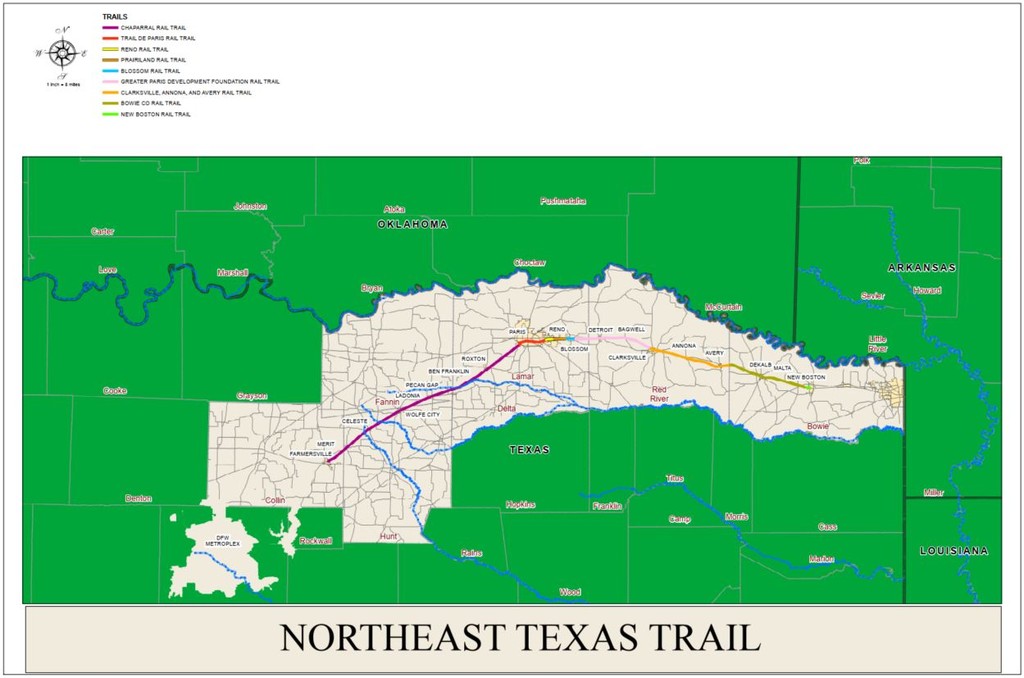
A rails to trails route that is about 130 mi point-to-point. When fully completed the Northeast Texas Trail (NETT) will be the longest Hike/Bike and Equestrian Trail in Texas and one of the longest in the U.S.A.
NETT History (source: https://netexastrail.org)
The infrastructure for the NETT was made possible by the creation of the 1983 Federal Law called the National Trail Acts and the Rail Banking process. Rail banking is when a railroad company voluntarily sells, donates, or leases unprofitable or unwanted rail lines and tracks to a qualified public or private entity (the Rail bank entity). Via this Law, land for construction of the NETT project is provided at no cost.
In the late 1990’s, 2 railroads, the Union Pacific and the Chaparral decided to cease active service and publicized their railroad corridors availability for rail banking through the Surface Transportation Board of the United States Department of Transportation (STB). 3-private agencies Rails to Trails Conservancy (RTC) 1997, Greater Paris Development Foundation (GPDF) 1996, and Chaparral Rails to Trails Inc. (CRT) 1995 realizing that this will be an investment with a great rate of return that will richly enhance the quality of life in Texas applied for and became rail bank entities: RTC from New Boston to Clarksville, GPDF from Clarksville to Paris, Chaparral from Paris to Farmersville.

Comments
I will be attempting this solo tonight and tomorrow and will be tracking on my Coros Apex/Strava. The plan is to be self-supported, but if for some reason someone helps me along the way, I will submit it as a supported run. I was going to do the Alamo to Austin FKT tonight, but would rather not drive 9 hours to do so. This one is close to home. The goal is to finish in 30-something hours.
I will be attempting supported FKT on this trail beginning tonight at 7PM. Tracking will be on my Garmin watch and live tracking link will be posted on Twitter @jenkirk72
I plan to have a go at the supported FKT on December 12/13, starting from the Farmersville trailhead early Saturday morning. I will be tracking with my Garmin InReach, link below...
https://share.garmin.com/chadrunsfar
Thanks to Chris and Jen for paving the way on this one. I have learned a lot by reading your reports / strava data. I look forward to getting out there on the trail and will update you on my attempt after I have finished.
UPDATE: I made it from Farmersville to Bagwell (approx. 85 miles) and decided to call it a day. Wasn't my day, but I will be back to run the whole trail at some point!
Someone should update the description of this FKT. It says it's 298 miles but the website says 130 and all the current FKTs come in around 130. No one is doing 300 miles in 29 hours.