Route: Osterfeuerkopf / Osterfeuerspitze

Submitted by Florian Potschka on Mon, 08/28/2023 - 03:35pm
Location
Germany
Distance
7.14 km
Vertical Gain
625 m
Description

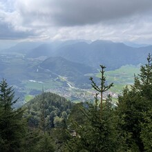
Only 1368 meters high, the Osterfeuerkopf (or Osterfeuerspitze as it is also sometimes called) is one of the smaller mountains of the Bavarian Pre-Alps. The path to the summit is relatively short, winding through the mountain forest on partially steep and rooted switchbacks and already offers great views of the Estergebirge and the Zugspitze on the ascent. Once at the summit, you are rewarded with a really amazingly beautiful panorama for such a small mountain, with views of the surrounding peaks and all the way to the Murnauer Moos.

The start and finish of the route is at the hikers' parking lot at Eschelainetal, just behind Eschenlohe. The route leads to the summit and back to the valley, the exact route can be chosen freely.

- Submitted by Florian Potschka

GPS Track
Images

Comments

Unsupported run on August 26, 2023 from the parking lot to the summit (1:20:20h, 7.14km, 625m vertical gain). On the uphill, I deviated from the standard hiking route and took the very steep shortcut to get some workload into my legs. :) Because of the roots, the trail is not very runnable in large parts, so in the end it's a lot of power hiking.