Route: The Parklands of Floyds Fork (KY)

Submitted by tgrunfit on Sat, 02/27/2021 - 11:34am
Location
Kentucky, US
Distance
19.5 mi
Vertical Gain
761 ft
Description

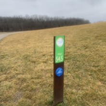
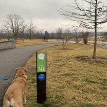
The Parklands of Floyds Fork is a string of green spaces in eastern Jefferson County developed from 2012-2016 and running north/south along the Floyd's Fork waterway. The FKT route is on the existing Louisville Loop and uses the Loop's permanent mile makers to determine the start/stop points, at mile markers 54.5 and 74. This encompasses the entire park from Shelbyville Road silos in the north (mile 74) and Broad Run in the south (mile 54.5). The route is run on the Louisville Loop and runners should follow that directional signage to stay on the pedestrian Loop and not divert onto the roadways or unpaved trails. All intersections are clearly marked. 

The path is entirely paved, a combination of blacktop and concrete. This route includes a few street crossings but all are marked for pedestrians and should not under most circumstances cause any stoppage. Bathrooms and water fountains are located along the route and can be identified using The Parklands website interactive map, and there are numerous parking lots for those doing supported attempts.

GPS Track
Images

Comments

Ran this as an Out & Back November 27, 2021 but added the extra distance to go Gate to Gate to Gate starting at Bardstown Rd gate. Awesome run and beautiful route with minimal traffic. Effort totaled 40.03 miles in 7:02:30 hours at 2,079 ft of elevation gain.