The Pennine Bridleway is one of the UK's 16 National Trails. National Trails are long distance routes through some of the very best landscapes the UK has to offer. They are special – they have been designated by the Government and are managed to a set of Quality Standards that set them above other routes. You will find the trails well waymarked with the distinctive acorn symbol. Each trail is looked after by a dedicated officer often with teams of volunteers. Funding for National Trails is provided by national government through Natural England and Natural Resources Wales and also by local highway authorities and other funding partners.
The Pennine Bridleway is a 205 mile (330 km) long National Trail running through the Pennine hills from Derbyshire to Cumbria. It is a fantastic trail for horse riders, mountain bikers, runners and walkers. The route was opened in stages with the final section and full length officially opened in June 2012 by the President of the British Horse Society, Martin Clunes.
The Trail is a linear route but it also includes 2 large loop sections, which are not included in this FKT route.
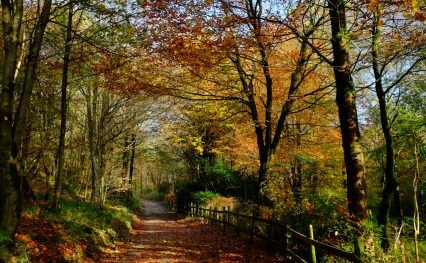
The Trail provides an amazing long distance, largely off-road ride/walk through the Pennines following old drove roads, packhorse routes and new sections of bridleway. The route passes through varied and beautiful countryside following a succession of different types of tracks and surfaces. It is by no means easy but well worth the challenge and completing any or all of the route will provide a real sense of achievement.
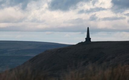
There are many highlights along the Trail. The southernmost section of the Pennine Bridleway follows the line of the former Cromford and High Peak Railway along the High Peak Trail and there is an alternative starting point (recommended for horse riders) which uses part of the Tissington Trail on the former Ashborn-Buxton line. Towards the south you’ll also find the flora and fauna in the vibrant, clean and green Chee Dale Nature Reserve; stunning views over the Kinder plateau either side of the exhilarating yet peaceful Roych Clough (one of Britain’s classic mountain bike rides); panoramic views of the Pennines and valleys in Calderdale, Rochdale and Lancashire; the 6 compartmented water trough at Mankinholes where packhorse ponies stopped for refreshment; and the Rochdale Canal.
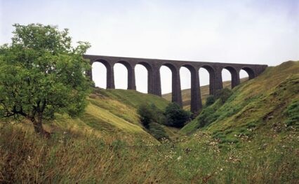
New trails link with old to zig zag up, down and across the Lancashire moors en route to the village of Wycoller with its ancient packhorse bridge. The north Lancashire stretch offers a more pastoral scene and a bit of a breather before reaching the Dales. The Yorkshire Dales section features classic limestone landscapes, including great views of the nationally important Malham Tarn and the peaks of Ingleborough, Whernside and Pen-y-ghent. The route travels from Dales villages to remote open uplands via enclosed grassy tracks and wide drove roads with glimpses of limestone pavements, impressive viaducts on the Settle to Carlisle railway, and a prizewinning new bridge. Once up on Lady Anne’s Highway there are stunning views along the Mallerstang valley before a final push from High Dolphinsty to the Cumbrian village of Ravenstonedale.