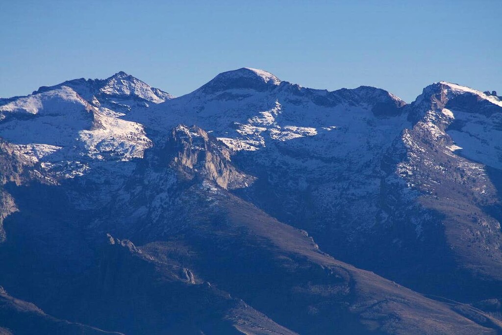
Location
Nevada,
US
Distance
4.7 mi
Vertical Gain
4,865 ft
Description
GPS Track
Ruby_Dome_FKT_1_28_49_0.gpx1.47 MB
FKTs
Male
Female
| Cole Campbell | 1h 28m 49s |
| Tezla Hayduk | 3h 0m 31s |
Images
Comments
John and I are planning to climb Ruby Dome tomorrow; will report back on snow conditions
Unsuccessful attempt today due to snow. Someone with steep snow skills likely would not find it challenging, as the snow was in great condition. We would have needed more gear for me to be comfortable up there.
Longer story...
I purchased a day pass at this site ahead of time (didn't end up needing it, as the electronic gate was open):
https://springcreekassociation.activityreg.com/daypass_t2.wcs
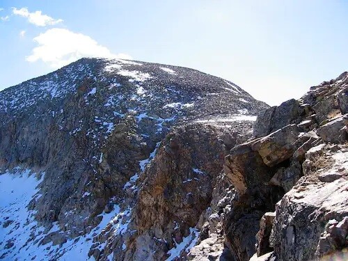
No issues up to the lake, just some occasional trail and cairn finding. Spent extra time climbing up from the lake, stayed too far left and finally managed to traverse over to the trail. Nice route over to the basin. Lots of snow, easy slope for kicking steps. Fun scramble up the spur.
When we reached the traverse, we found a steep snowfield. We were carrying microspikes and one ice axe, but I wasn't ready to commit to it without a short rope and an axe for John (and some practice with steep snow travel instead of stepping off the rocks onto the top of the slope).
Hard to tell what's higher up, potentially a cornice at the upper saddle (not sure). We saw a guy top out, maybe from the back side? Never saw his footprints going up.
Heading back we found the actual trail down to the lake, except there was a bunch of snow across it. Spent time working across/around/down that. So there's no easy route above the lake at the moment.
Hope that helps someone else, and perhaps we'll be back eventually. It's a beautiful place and we were happy to get to see it.