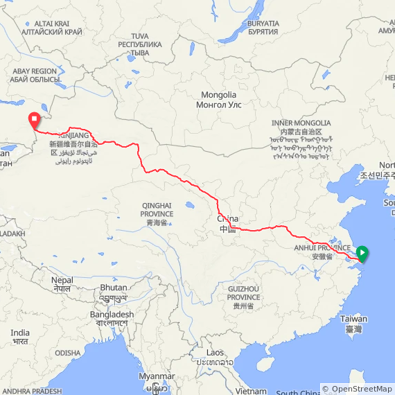
This route establishes a repeatable coast to border crossing of China, beginning at Nanhuizui Guanhai Park on the East China Sea and finishing at Khorgos Port of Entry on China’s western border with Kazakhstan.
The goal is a continuous westward crossing on foot, linking the East China Sea to the country’s western edge through a corridor that is both historically grounded and practically navigable.
The route connects the Yangtze River Delta, the Central Plains, and the Silk Road through the Hexi Corridor and into Xinjiang. It passes through Shanghai, Zhejiang, Jiangsu, Henan, Shaanxi, Gansu, and Xinjiang, moving from dense coastal cities to interior agricultural regions and then into desert basins and remote western valleys.
From Xi’an westward, the route follows the historic Silk Road through Lanzhou, Zhangye, Jiayuguan, and Dunhuang, before continuing across Xinjiang via Hami, Turpan, and Ürümqi toward the Ili Valley and Khorgos.
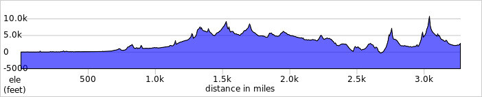
Terrain changes continuously. The eastern portion is flat and highly developed. The interior becomes more rural and agricultural. The western sections transition into long, exposed stretches of desert and arid basin culminating near the Tian Shan mountain range on the western border. The route follows a mix of urban streets, secondary roads, and rural corridors.
Due to restrictions on pedestrian travel along certain expressways and in sensitive regions, particularly in Xinjiang, the route uses parallel roads and accessible alternatives while maintaining continuous forward progress.
More information and documentation:
https://www.davidgreen.run
Admin note: The gpx file shown here is just one possible route. It would seem that any legal route connecting the Ocean to Kazakhstan/Kyrgyzstan/Tajikistan in acceptable.