The Run Around Australia is one of the ultimate endurance challenges in the world. It is a continuous foot journey around the Australian continent, connecting the nation's major cities, remote landscapes, coastlines, and regional communities under human power alone.
The challenge is to complete a full circumnavigation of mainland Australia on foot, following an established route defined by mandatory waypoints that recognise previous successful attempts while providing a clear and repeatable standard for future athletes.
How the FKT is Set
The FKT is the fastest elapsed time to complete the loop. To set a new FKT, an athlete must:
- Pass through every mandatory waypoint listed below, in the order given for their chosen direction
- Travel the entire distance on foot, under human power only
- Return to their own starting point, closing the loop
- Complete it in a faster elapsed time than the current record holder
Elapsed time runs continuously from the athlete's first step to the moment they close the loop. It includes sleeping, resting, eating, weather delays and everything else — the clock does not stop. Total distance covered and elevation gained are not assessed. Everything below is detail on how the waypoints work and how the route accommodates change.
Start and Finish Point
As this is a looped Route, athletes may commence and finish at any point they choose. The MCG appears in the mandatory waypoint sequence as the Melbourne landmark, but it is not a required start/finish point — previous record holders have started and finished at different points on the route (for example, Sean Bell (2024) started and finished at the MCG in Melbourne, VIC, while Dave Alley (2015) started and finished at Lismore Oval, in Lismore, NSW).
If an athlete chooses a start and finish point that is not on the recognised mandatory route, their elapsed FKT time begins from their first step, not from when they reach the first mandatory waypoint — since starting away from the recognised route is their own choice. Similarly, their elapsed time finishes when they return to their official starting point, not from when they last leave the recognised route.
Direction of Travel
Athletes may complete the challenge in either direction — clockwise or anti-clockwise — provided all mandatory waypoints are completed in the required order for the direction chosen.
Route Definition
The Run Around Australia is defined by mandatory waypoints rather than a single prescribed road route.
Exact roads between mandatory waypoints are not prescribed. Any foot-legal route between the mandatory locations is acceptable, provided all required waypoints are completed in the prescribed order.
The mandatory waypoint system has been developed to maintain consistency with recognised previous attempts while allowing reasonable flexibility for changing road conditions, safety requirements, infrastructure changes, and legal access requirements.
The mandatory route as specified is approximately 13,900 km and 58,000 metres of elevation gain.
These figures are indicative rather than a standard to be met. Road realignments, roadworks, temporary detours and differences between GPS devices mean that no two attempts will measure the same distance. The FKT is assessed on elapsed time to complete the loop and return to the starting point, not on total distance covered.
Mandatory Waypoints
A successful attempt must include passage through the recognised mandatory locations and landmarks below, in the sequence listed.
Mandatory waypoints are spaced approximately 10–20km apart through metropolitan areas, city centres, and any section where a shorter alternative route exists. On remote single-corridor sections where no alternative foot-legal route exists, waypoints are spaced at the available towns and roadhouses, which may be 100km or more apart. The purpose of the spacing is to prevent an attempt from covering materially less ground than the established route, not to prescribe a turn-by-turn course.
An example of this in practice, following Sean Bell's 2024 Run Around Australia:
1. Melbourne (start / finish)
- MCG (key landmark for Melbourne, start)
2. Melbourne → Gippsland → East Gippsland
- Caulfield North
- Dandenong
- Officer
- Nar Nar Goon
- Tynong
- Drouin
- Warragul
- Yarragon
- Trafalgar
- Moe
- Morwell
- Traralgon
- Rosedale
- Sale
- Stratford
- Bairnsdale
- Johnsonville
- Lakes Entrance
- Nowa Nowa
- Orbost
- Cann River
- Genoa
- Eden
- Pambula
- Bega
- Quaama
- Cobargo
- Tilba Tilba
- Narooma
- Bodalla
- Moruya
- Mogo
- Batemans Bay
- Ulladulla
- Nowra
- Berry
- Gerringong
- Kiama
- Shellharbour
- Wollongong
- Austinmer
- Stanwell Tops (Sea Cliff Bridge)
- Waterfall
- Engadine
- Kogarah
- The Rocks, via Sydney Harbour Bridge (key landmark for Sydney)
3. Sydney → Hunter Region
- North Sydney
- Hornsby
- Berowra
- Kangaroo Point
- Mount White (Hawkesbury River crossing)
- Kariong
- Ourimbah
- Tuggerah
- Wyong
- Doyalson
- Dora Creek
- Hexham
4. Hexham → Coffs Harbour (Pacific Motorway)
- Nerong
- Bulahdelah
- Coolongolook
- Nabiac
- Moorland
- Kew Interchange
- Oxley Interchange
- Kempsey Bypass
- Eungai Creek Interchange
- Macksville Interchange
- Urunga Interchange
- Coffs Harbour
5. Coffs Harbour → Brisbane
- Grafton
- Casino
- Lismore
- Alstonville
- Ballina
- Lennox Head
- Byron Bay
- Mullumbimby
- Brunswick Heads
- Pottsville
- Cabarita Beach
- Chinderah
- Coolangatta (NSW/QLD border)
- Palm Beach
- Broadbeach
- Southport
- Helensvale
- Pimpama
- Yatala
- Loganholme
- Sunnybank
- Woolloongabba, via Southbank (key landmark for Brisbane)
6. Brisbane → Sunshine Coast
- Newmarket
- Brendale
- Narangba
- Caboolture
- Elimbah
- Glass House Mountains
- Beerwah
- Landsborough
- Caloundra
- Currimundi
- Mooloolaba
- Maroochydore
- Coolum
- Peregian Beach
- Noosa Heads
- Tewantin
- Cooroy
- Pomona
- Cooran
- Gympie
7. Gympie → Mackay Region (Bruce Hwy)
- Curra
- Gunalda
- Tiaro
- Howard
- Childers
- Gin Gin
- Miriam Vale
- Mount Larcom
- Raglan
- Bajool
- Rockhampton
- The Caves
- Yaamba
- Marlborough
- St Lawrence turnoff
- Clairview
- Carmila
- Ilbilbie
- Koumala
- Sarina
Maryborough CBD passage not required. Mackay CBD passage not required.
8. Mackay Region → Townsville → Inland
- Calen
- Proserpine
- The Big Mango (key landmark for Bowen region). Bowen CBD passage not required.
- Home Hill
- Ayr
- Mingela (Flinders Hwy)
Townsville CBD passage not required.
9. Inland to the Territory
- Charters Towers
- Torrens Creek
- Hughenden
- Richmond
- Julia Creek
- Cloncurry
- Mount Isa
- Camooweal
- Avon Downs (Barkly Hwy)
- Barkly Homestead (Barkly Hwy — sole facility on this section)
- Threeways (Barkly Hwy / Stuart Hwy intersection)
10. Threeways → Darwin (turnaround)
- Renner Springs (Stuart Hwy)
- Elliott
- Dunmarra (Stuart Hwy)
- Daly Waters Hi-Way Inn (Stuart Hwy / Carpentaria Hwy junction — Daly Waters township passage not required)
- Larrimah
- Mataranka
- Katherine
- Pine Creek
- Adelaide River
- Darwin Waterfront Precinct (key landmark for Darwin — turnaround point)
11. Darwin → Katherine (run back south, on foot — not uplifted) → Kununurra
- Adelaide River (second pass, on foot)
- Pine Creek (second pass, on foot)
- Katherine (second pass, on foot)
- Victoria River Roadhouse (Victoria Hwy)
- Timber Creek
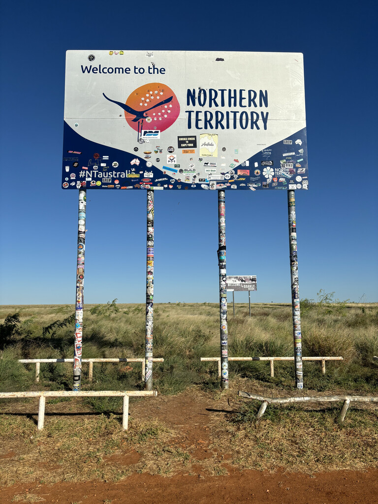
- NT/WA border (the 129th meridian, longitude 129°E)
- Kununurra
12. Kununurra → Broome (turnaround) → Port Hedland
- Doon Doon Roadhouse (Great Northern Hwy)
- Warmun
- Halls Creek
- Mary Pool rest area (Great Northern Hwy)
- Ngumpan Cliff rest area (Great Northern Hwy)
- Fitzroy Crossing
- Ellendale rest area (Great Northern Hwy — sole facility on this section)
- Willare
- Roebuck Roadhouse (Great Northern Hwy / Broome Hwy junction)
- Broome, via Simpson Beach (key landmark for Broome — turnaround point)
- Roebuck Roadhouse (second pass, on foot)
- Sandfire Roadhouse
- Pardoo Roadhouse
Derby passage not required. Port Hedland CBD passage not required — bypass via surrounding highway.
13. Port Hedland → Perth Region
- Whim Creek (North West Coastal Hwy)
- Roebourne
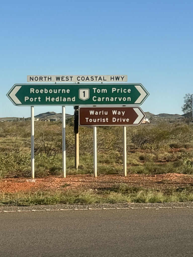
- Fortescue River Roadhouse (North West Coastal Hwy)
- Nanutarra Roadhouse (North West Coastal Hwy)
- Barradale (North West Coastal Hwy — sole facility on this section)
- Minilya Bridge Roadhouse (North West Coastal Hwy)
- “Welcome to Carnarvon” sign (Carnarvon CBD passage not required)
- Wooramel Roadhouse (North West Coastal Hwy)
- Overlander Roadhouse (North West Coastal Hwy — Shark Bay turnoff)
- Billabong Roadhouse (North West Coastal Hwy)
- Galena Bridge (North West Coastal Hwy — Murchison River crossing)
- Northampton
- Geraldton
- Greenough
- Dongara
- Eneabba
- Badgingarra
- Cataby
- Regans Ford
- Gingin
- Muchea
- Bullsbrook
- Upper Swan
- Midland (Perth region — Perth CBD passage not required)
Karratha CBD passage not required — bypass via surrounding highway.
14. Perth Region → Nullarbor (Great Eastern Hwy / Eyre Hwy)
- Mundaring
- Sawyers Valley
- Bakers Hill
- Clackline
- Meckering
- Cunderdin
- Tammin
- Kellerberrin
- Doodlakine
- Hines Hill
- Merredin
- Burracoppin
- Carrabin
- Bodallin
- Moorine Rock
- Southern Cross
- Yellowdine (Great Eastern Hwy)
- Coolgardie
- Higginsville
- Norseman
- Fraser Range
- Balladonia
- Caiguna
- Cocklebiddy
- Madura
- Eucla
15. South Australia
- Border Village
- Nullarbor
- Yalata
- Nundroo
- Penong
- Ceduna
- Wirrulla
- Poochera
- Minnipa
- Wudinna
- Kyancutta
- Kimba
- Iron Knob
- Port Augusta
- Warnertown
- Merriton
- Redhill
- Snowtown
- Lochiel
- Port Wakefield
- Dublin
- Lower Light
- Two Wells
- Waterloo Corner
- Gilles Plains
- Windsor Gardens (near Adelaide — Adelaide CBD passage not required)
16. Adelaide → Mount Gambier
- Norton Summit
- Uraidla
- Summertown
- Littlehampton
- Murray Bridge
- Tailem Bend
- Meningie
- Salt Creek
- Kingston SE
- Millicent
- Tantanoola
- Mount Gambier
17. South Australia → Victoria → Melbourne (finish)
- Dartmoor
- Heywood
- Tyrendarra
- Yambuk
- Port Fairy
- Warrnambool
- Allansford
- Garvoc
- Terang
- Camperdown
- Colac
- Winchelsea
- Moriac
- Geelong
- Lara
- Little River
- Werribee
- Laverton North
- Footscray
- Melbourne CBD
- MCG (key landmark for Melbourne, finish)
Passing a Waypoint
Passing a named waypoint on the highway that serves it satisfies the requirement. An athlete is not required to leave the highway, enter a town centre, or visit a facility, unless the waypoint is separately identified as a city centre or a named landmark. This is recorded so that a future attempt is not held to a stricter standard than the route it is being measured against.
Some waypoints are named for a town that the highway runs past rather than through, highways having been progressively realigned to bypass town centres. These remain mandatory as route markers:
- Gingin, WA — the Brand Highway routes around the town centre.
- Yalata, SA — the community sits back from the Eyre Highway; the roadhouse that stood on the highway was demolished in 2018.
- Iron Knob, SA — the route passes the Iron Knob turnoff and rest area on the Eyre Highway, 1.5 km from the town centre.
- Moriac, VIC — the Princes Highway passes 2–3 km north of the township.
- St Lawrence and Ogmore, QLD — both townships sit east of the Bruce Highway; the highway passes through both localities, and the St Lawrence turnoff is the mandatory point.
On remote sections, a number of waypoints are roadhouses, rest areas, highway junctions or border crossings rather than towns. They are named because on those corridors they are the only fixed, mapped, findable points that exist. There is no requirement to stop, to leave the road, or to enter the property.
Where a facility named as a waypoint has since closed or been removed, the waypoint stands as the location on the highway. Remote roadhouses close — the one at Yellowdine is no longer trading — and the route must not depend on a business remaining open.
Foot-Legal Route and Continuity
Foot-legal means roads, paths, trails, or other publicly accessible routes where pedestrian travel is permitted. Travel between mandatory waypoints must be completed under human power only.
Each day's running must resume from the exact point where the previous day's running finished, with no forward progress between running sessions by any means other than foot.
Route Integrity and Variations
The purpose of the route specification is to create a fair and consistent benchmark for future attempts while recognising that Australia's roads and access conditions will continue to change.
Reasonable route variations are permitted where required due to:
- Road closures
- Safety considerations
- Accommodation requirements
- Pedestrian access restrictions
- Changes to road authority requirements
Where a significant deviation from the established route is required due to legal restrictions or government authority requirements, supporting documentation (e.g. written confirmation from the relevant road authority) should be provided as part of the FKT verification process.
Spirit of the Challenge
Prior to this route specification, a successful Run Around Australia was recognised within the community on the standard set by Ron Grant's original 1983 run: a continuous journey, with no rest days, and a minimum of 20km covered on foot each day. While Pat Farmer (1999), Dave Alley (2015), and Sean Bell (2024) each continued running until they closed their own loop back to their own starting point, the record itself was recognised as broken at 13,383km — the total distance Ron Grant covered in that inaugural, first known run around Australia — as the fairest available benchmark, given that road network and road law changes over time make it almost impossible to replicate the exact closed-loop distance from one attempt to the next.
This route specification records those conditions as guidance, in recognition of the standard Ron Grant set and every athlete since has honoured. While not technically required, future athletes are encouraged, as a mark of respect for that history, to honour the following:
- No rest days, with a minimum of 20km covered on foot each day.
- Total distance covered over the course of the attempt meets or exceeds 13,383km — Ron Grant's total distance in the inaugural, first known run around Australia, and the distance at which the record has been recognised as broken ever since. In practice, this means that if an athlete's tracked distance falls short of 13,383km, they are encouraged to continue running until that distance is reached, in recognition of that history.
- The route follows the previous record holder's course as closely as possible — for example, by following their published Strava track or GPX files in full — with deviation only where directed by the relevant road authority (e.g. VicRoads, Queensland Transport & Main Roads etc.) for safety, legal, or access reasons.
These points reflect the spirit in which the challenge has been run since Ron's original attempt, and are offered as guidance, and as homage to Ron, Pat, Dave, and Sean, rather than as formal criteria of the FKT route. An attempt that completes the full mandatory waypoint sequence remains eligible for the record regardless of the number of kilometres per day, rest days, or minor route variation beyond this guidance.
FKTs
| Sean Bell | 165d 13h 26m 48s |