https://www.hikingproject.com/trail/7030837/sage-creek-wilderness-area-loop
A internet search will provide you with much beta on the route. It is a great back country back packing trip as well, but if you want to do it in a day, it's possible. It will be a long day and you will need to start early and will end late. Some of the miles will not come easy on this one.
This route is located with in Badlands National Park in South Dakota. It is an approximately 22-24 mile loop route. The distance will depend on the route that is chosen through the Sage Creek Area. This is a route more than a trail. You will want to make sure you are good on navigation and have the route on your phone. There is no water on the route that is potable. You will have to carry all you need from start. Recommend 3-4 liters and more if it's hot!
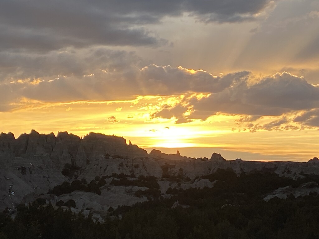
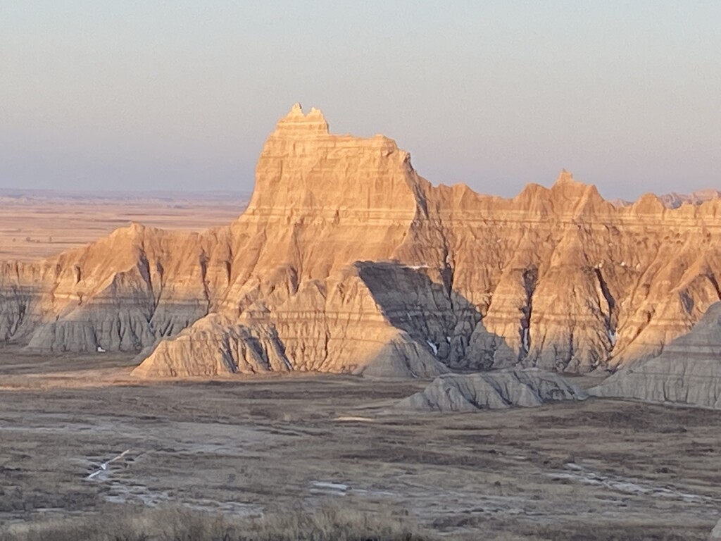
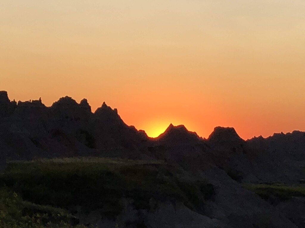
This route will surprise most who try it. The Badlands can be a harsh but they can also be very beautiful in their own special way. I suggest doing the route in spring or fall. The route should be done when weather window is good and it has not rained recently. The ground turns to gumbo when wet and you will come out much taller and heavier, if you go when it's wet. The Route will take you through the Sage Creek Wilderness Area and up and through the Sage Creek. This is a very winding creek that you will go up/over/through/around many times as you make your way. Sometimes the best route is in the creek bottom. You will also go up and over an area called Deer Haven. This area is a heavy stand of Juniper trees that are up in the formations. It is a great spot to view the area from above.
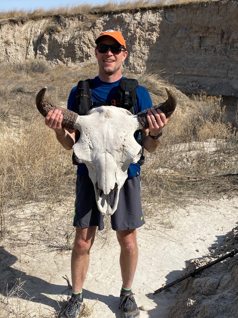
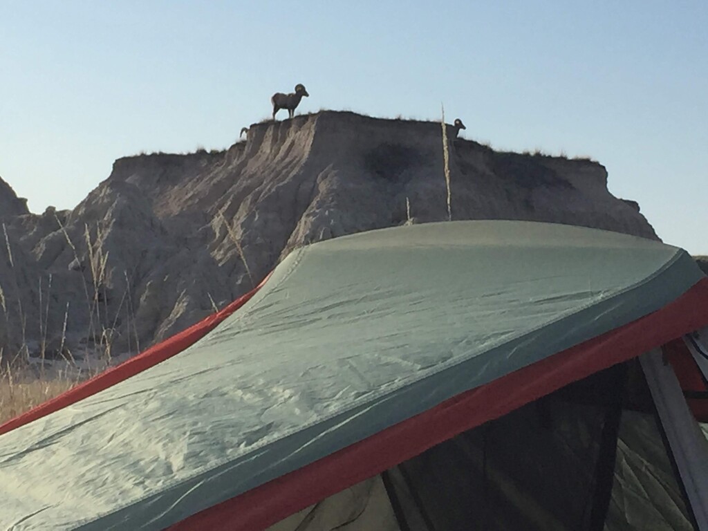
There is an abundance of wildlife in this area. A herd of buffalo/bison can be seen. You will need to make sure to stay clear of them and sometimes you can be surprised by what's over the hill if your not careful. Big Horn Sheep will be seen as well as Mule and Whitetail deer. Prairie Dogs are out there as well as frogs, rattle snakes, and coyotes. Wouldn't be surprised if there are mountain lions as well. You will also possibly observe many animals that didn't make it as I have seen many Buffalo and Sheep skulls/bones.
This route is on National Park Service land. Land managers remind us not to take rocks, fossils, plant specimens, or anything else out of the park. Fossils can be reported to the visitor center with a picture and location and a paleontologist will investigate the report.
In the spring, you will see many types of flowers that pop up through the soils. The grass also is very green and the place comes alive! It is not a barren wasteland but a very diverse landscape. When you get off the road and out in the park, you will see much more than expected. Most people never really experience the Badlands. If you choose to leave the car and immerse yourself in it, you will leave a changed person. Don't forget to look up at the star while you are there. This area is a great place to star gaze as it is very remote and away from man made light. The sunrise/sunsets are fantastic as they come up over the formations.
Give it a try, you won't be disappointed! I promise.
Here is a downloadable GPX track with relevant waypoints created by route submitter Lance Smith.


Comments
This route looks awesome. Going to make an attempt tomorrow (11/21/20). Hoping to start around 8:00am local time.
Let me know how it went out there. I met u this summer while u were selling fireworks. Karen has my contact information. Lance Smith. She knows your wife(teach together). Let’s get together for a run sometime.
John Haak and I are going to give this a go tomorrow (10/10). Sometime near sunrise.
John Haak and I are going to give this a go tomorrow (10/10). Sometime around sunrise.
Too wet yesterday. Emily Wanless and I are heading back now to see if it’s dry enough for another attempt.
I attempted and completed this route on June 13, although not a successful FKT. I've completed several off-trail wilderness FKTs so I wasn't expecting much trail. To improve this time, someone would likely need a practice run and to follow Lance's most recent gpx route. I was trying to find a good balance between the public route on maps and the gpx route of the title page. Both are wrong in the sense they just illustrate the general direction and not to be followed. It is true that it is now a purely wilderness route with zero "human" trails after the split in the loop. Bison trails can be followed occasionally.
The principal difficulty I had was not having a better gpx source to use and doing it in NOT-winter. All of the areas Lance shows in the videos have low grass and easily runable prairie or dirt. I felt like it had been a dry week when I started but the washes still had mud and water and I wasted a lot of time climbing and crossing the wash ravines. Spring and summer grass/brush is waist high and very thick. I also had to stop a dozen times to extract cacti needles from my feet and shoes. After inefficient navigation, dense terrain and 3 detours around Bison herds, I gave up on time and just walked it in. I ended up with 21.2 miles in 4:57 elapsed, 4:40 moving. A better gpx route and dry winter terrain can be 19 miles and fast. Won't be me. It was a very cool and comfortable day at 75*F. Zero chance I come here in 30-40* =D
I can add that if there's a lot of water in the puddle under the trailhead sign with the snake, then it will be too wet.