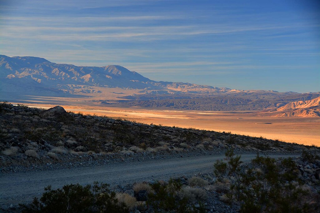
Saline Valley is located in the northwest of Death Valley and it lies in the rain shadow of the Sierra Nevada Range and the Inyo Mountains bordering the valley on the west. Access to the valley is only by dirt roads with the two main routes being the North Pass (Big Pine) and the South Pass (Panamint).
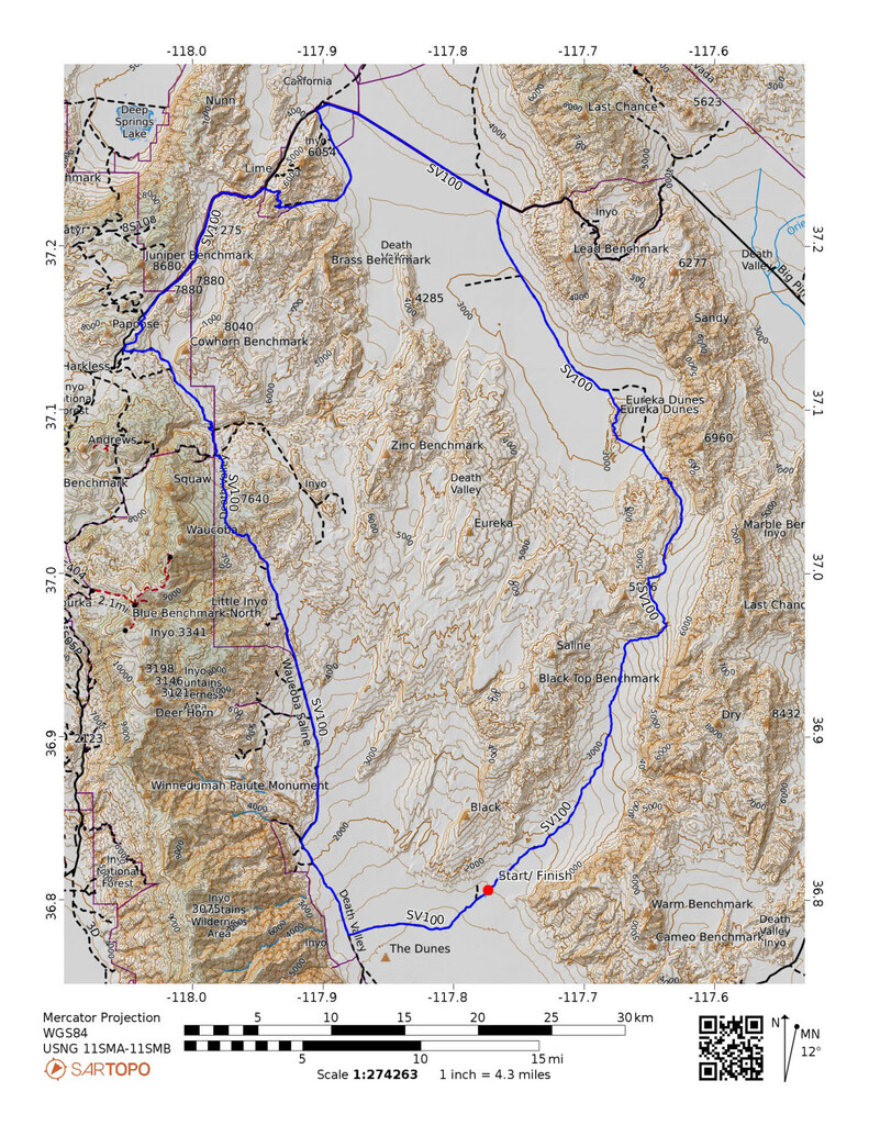
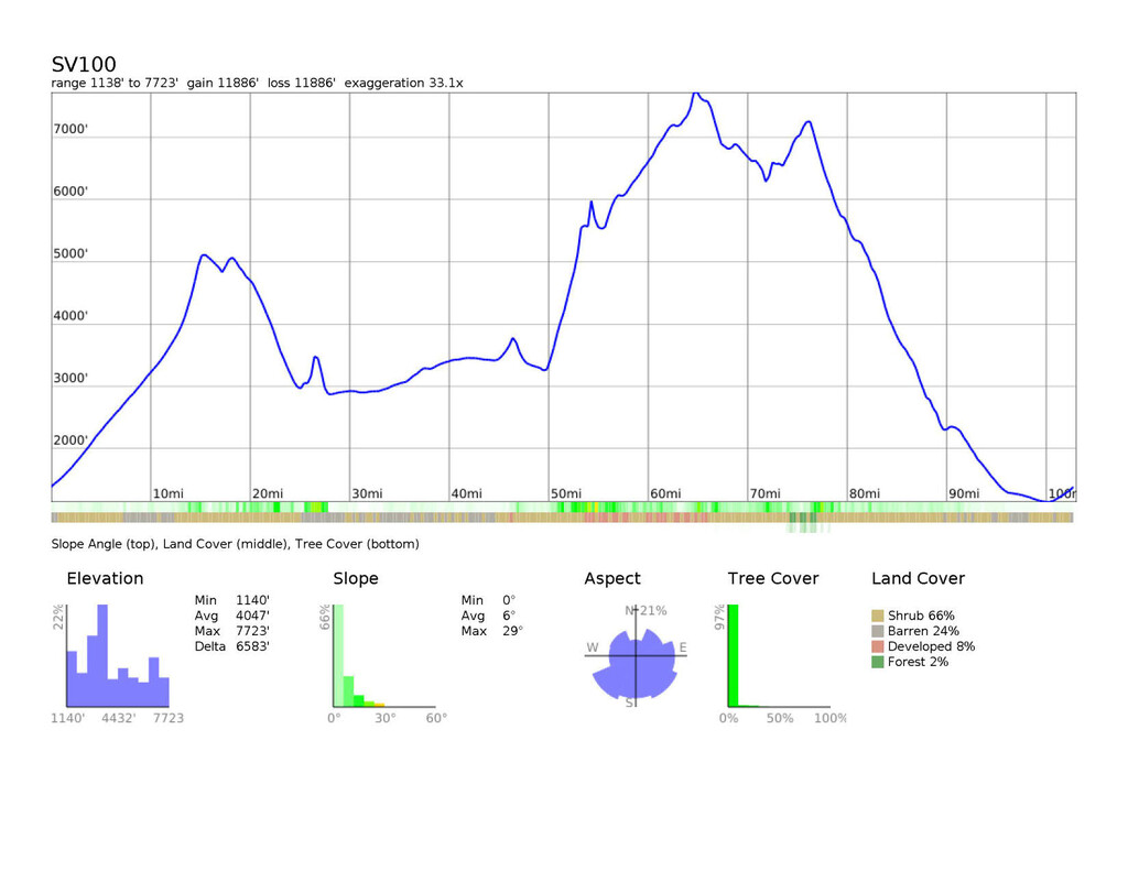
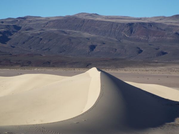
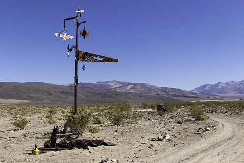
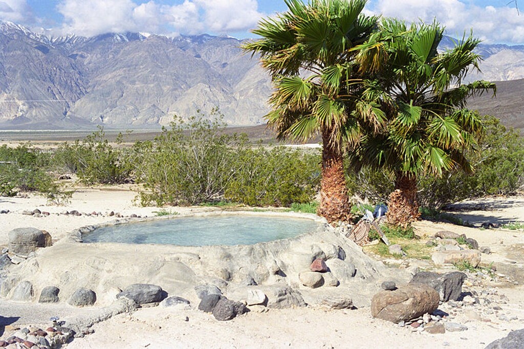
The starting point of this 103 mile loop is the remote campground Saline Valley Warm Springs. The route slowly climbs northeast to the top of Steel Pass. From there, you will continue across a high plateau, then descend into Dedeckera Canyon and emerge at the Eureka Sand Dunes. The dunes rise approximately 680 feet above the surrounding valley floor, making them one of the highest dune fields in North America. It is recommended to traverse the dunes to get the full experience. You will traverse the dunes along the ridge and then travel north on the washboard S. Eureka road and northwest on Death Valley road. You will continue on Death Valley road as well as jeep roads to the North Pass access point of the valley. Here, you will travel on Waucoba Saline road descending to the valley floor. Go east on Warm Spring road to the bat pole at around mile 100 and continue for a couple miles to return the springs. Finish off your adventure with a soak in one of the hot tubs.
The first 40 miles is all sand and rock. More of a jeep trail that requires a vehicle with high clearance 4x4. The entire area from steel pass to the dunes is also all deep sand. Overall the entire route consists of approximately 50 miles of rock and sand, 40 miles of washboard gravel and less than 10 miles of pavement. Along this route, there are great natural features such as the dunes, canyons and stunning desert landscape, as well as unique man-made landmarks such as the bat pole, the springs, marble bath, abandoned mining camps all in very unique and remote area.
WARNING:
This is a very remote area of Death Valley and you are on your own with no services for close to 100 miles. There is virtually no cell signal in the entire valley. You must plan ahead with plenty of water, nutrition and proper clothes. Temperatures can range from below freezing to well over 100F. Road conditions can vary and are subject to snow, flash floods and closure at any time. When traveling by car to the campground, sharp rocks can damage your tires. It is not uncommon to end up with one or more flat tires.
Comments
I am starting a solo female unsupported attempt at the Saline Valley Loop this morning. 103 miles. I'm starting at Death Valley Rd and Waucoba Saline Rd and traveling counter clockwise. I have 8 liters of water. It's cold here. You can follow me at
https://share.garmin.com/FreeRange