ya like salt?
this routes got plenty of it, traversing the Bonneville Salt Flats from the NV border to the eastern edge near the booming metropolis of Knolls, UT.
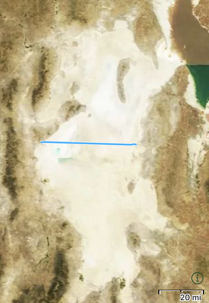
- The sallt flats: The Bonneville Salt Flats are the largest salt flats in the US. It's all public land and open to the public. It's also home to land speed events as one of a few locations where land speed records are broken.
https://en.m.wikipedia.org/wiki/Bonneville_Salt_Flats
- The route: Obviously there are a lot of routes one could plot across a vast open salt flat. I wanted the route follow I-80 across the salt flats for convenience, safety and because I find that route the most interesting, if not the most beautiful. The majority of the route is on an I-80 frontage road (with almost no traffic). I felt this provided a convenient, safe and well defined route across the flats. The Eastern and Western end points of this route were chosen to reflect when the environment transitions from desert hills into salt flats. You can see that reflected in the satellite view of the route. Note the western end point of this environmental distinction happens to also be the NV/UT border.
- Why it's interesting: These flats are famous for their land speed records of 600+ mph, and I would guess that the vast majority of people who have experienced these flats have done so through the window of a vehicle traveling 85+ mph, crossing this distance effortlessly in less than a half an hour. Personally, I find attempting to cross these flats on foot in the fastest time possible an interesting juxtaposition of the meaning of speed and hopefully brings a greater appreciation for how fast we travel.
Make sure you calibrate your speedometer part way through.