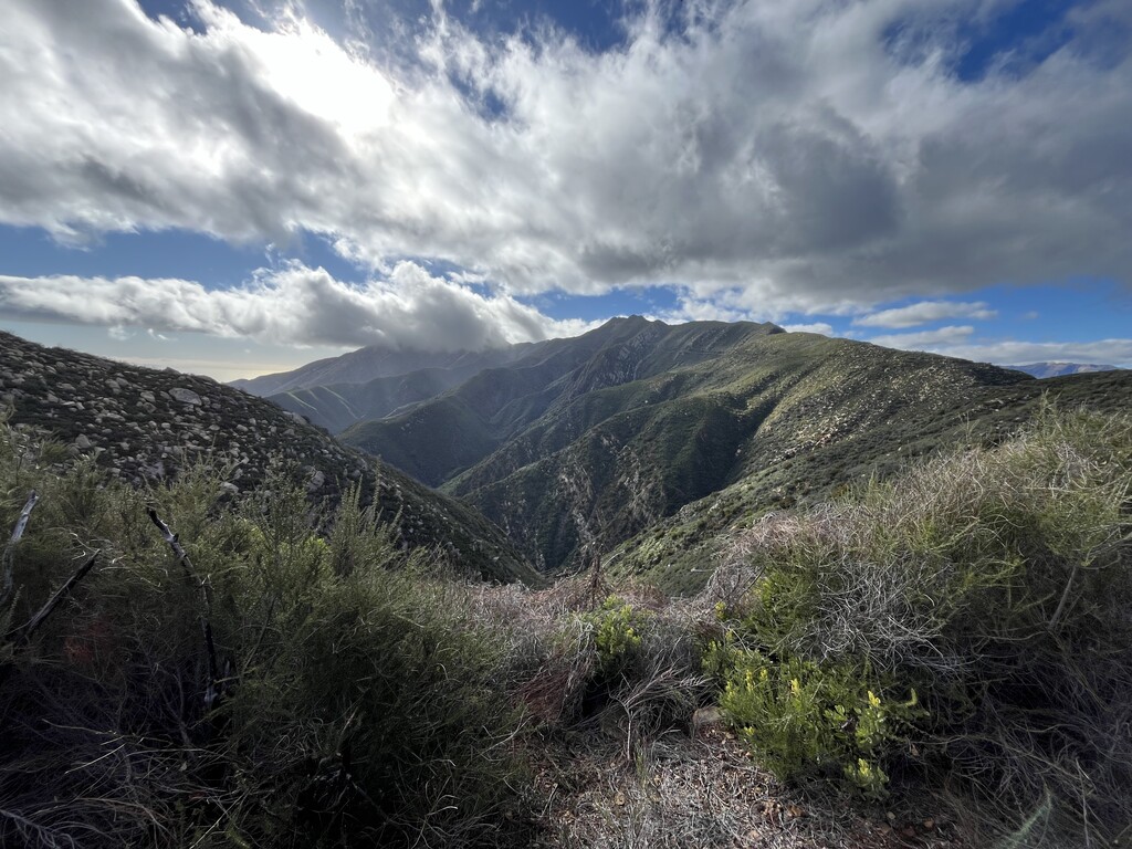
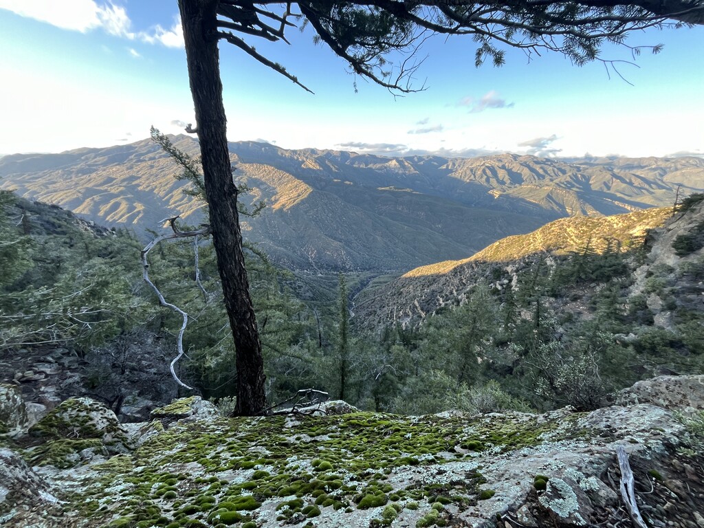
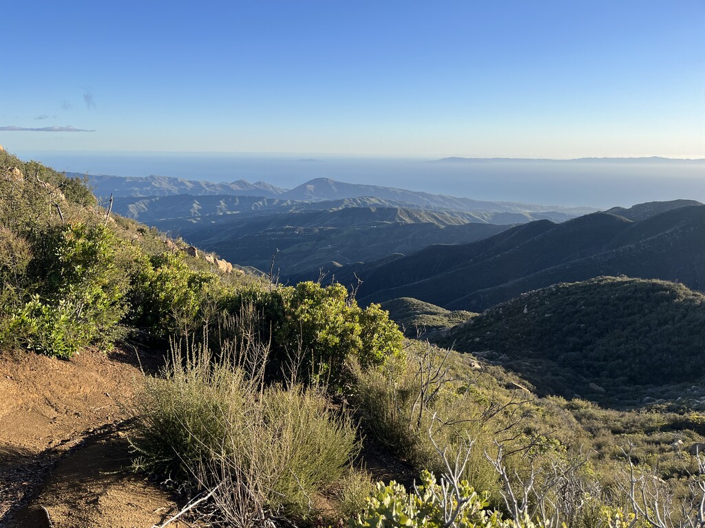
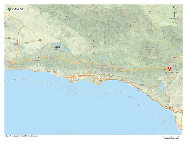
The Santa Ynez Traverse covers the entire range of the Santa Ynez Mountains and offers beautiful views of the Pacific Ocean, Channel Islands, Lake Cachuma, Gibralter Dam and Matillija Dam, Lake Casitas and the San Rafael mountains. The route skirts along several well known peaks including Gaviota Peak, Broadcast Peak, Brush Peak, La Cumbre Peak, Montecito peak, Cathedral Peak, Badger Peak, Divide peak, and more. To break down the sections:
Gaviota Peak Trailhead to Fr 5n19: This is a well traveled section, many hikers take the Gaviota Peak trail and hike around the surrounding areas. Gaviota hot spring is directly on the route in addition to several seasonal streams. When it connects to the fr 5n19, this fire road is exposed and often marks the end of trails leading up from the coast. Trails that end along this road include the Campbell trail, Nojoqui falls, Arroyo Hondo/arroyo quemada trails.
Fr 5n19 to Refugio Rd: This is about a 5 mile section of unmaintained county road with a few seasonal streams. Please be aware of crossing through private property and reach out to Gaia Farm or Regan Ranch if you would like assistance navigating.
Refugio Rd to West Camino Cielo to Hwy 154: Refugio Road has several seasonal streams and is well known for its birding. From the intersection with West Camino Cielo, asphalt continues till Santa Ynez peak where it switches over to a well maintained dirt road. The route passes along the Tequepis trail and skirts a Santa Barbara favorite, Lizards Mouth known as a popular recreation and climbing area. Very little water here
Hwy154 to East Camino Cielo: This perhaps the most well traveled portion of the route and is primarily on asphalt. The majority of the front country trails in Santa Barbara end along this road, too many to name here. It passes next to Santa Barbara County high point La Cumbre Peak, and off shoots from the road are well traveled by mountain bikers and dirt bikers. The asphalt ends near the cold spring saddle and transitions to well maintained OHV Roads. Very limited water here
Romero Camuesa to Ocean View trail: Here the trail travels along OHV trails until reaching the beautiful, community maintained, Ocean View Trail. There are a few vernal pools along the route, a couple seasonal streams, and spectacular views.
There is very limited water and support is highly recommended.