This is the shortest route for hike/trail run from Sea level to the highest mountain in Norway. The route consists of paved road/gravel road for the first 20 kms, then trail marked by "Turistforeningen" /DNT with red painted T's. The route passes the DNT mountain lodges Leirvassbu and Spiterstulen, before the final ascent to Galdhøpiggen. The last ascent is mainly rocky, with some short passages on snow/glacier.
Pictures:
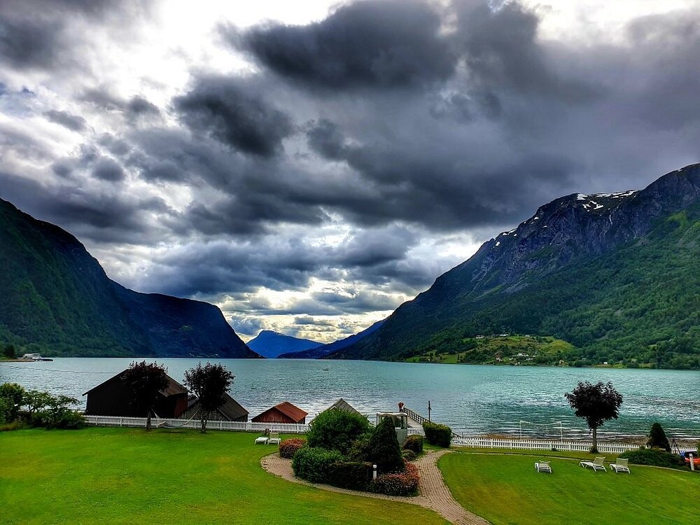
1: Starting point at Sognefjorden.
2: Turtagrø hotel, starting point to other famous mountains (Store Skagastølstind i.e).
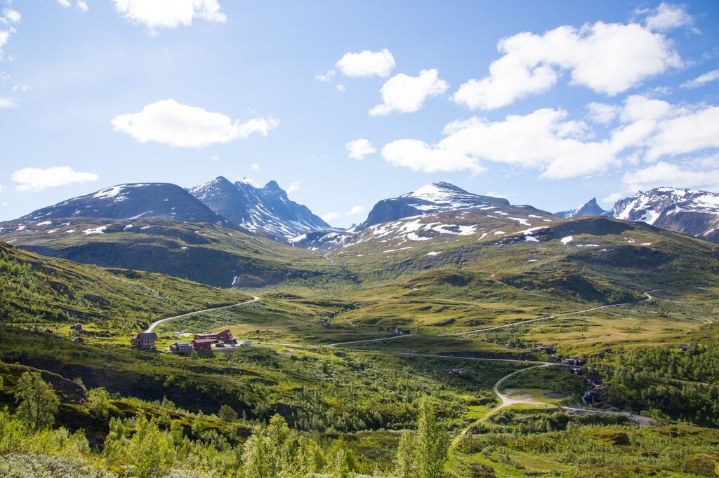
3: Leirvassbu in the middle of Jotunheimen.
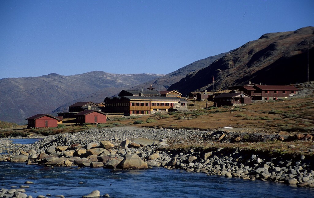
4: Spiterstulen - before entering the last 6 steep kilometres.
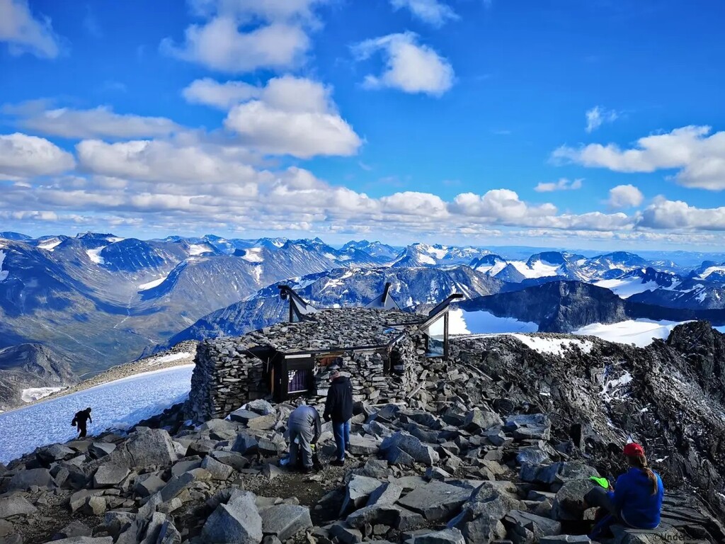
5: Galdhøpiggen summit, 2469 m asl.

Comments
Wow!
I was just thinking about taking this route!
Looks simply amazing hike! I was planning to pass the lake Illvatnet via the southern trail. Was there a reason you took the ”harder” north path?
Any idea is there still snow in mid June?
Laaate answer; I just wanted to add Fanaråken just for the extra vert and views - tried late august 2022 but dnf'ed due to hallucinating (2 hrs sleep the last two days before starting, not optimal). June is too early, I would recommend waiting until july due to snow.
The route has now been edited to present the most logical route from Skjolden to Galhøpiggen, the fastest way from Sea to Summit without adding an additional mountain summit.
Finn Isaksen - Regional Editor Scandinavia