This route is a mix of a mountain bike race called Judgement Day that has you ride 10 DFW trails/ 70+ miles in one day and Loop the Lake which is a 50 miler around Lake Grapevine that connects five different trails. We needed a new summer adventure so we played with the idea of how close some of our favorite trails are. This route starts at Cedar Hill State Park then you run to Cedar Ridge Preserve, then to Big Cedar Wilderness then to Boulder and end at Oak Cliff Nature Preserve. I suggest mapping at least the last two road sections on google and saving links to those walking directions to help with navigation.
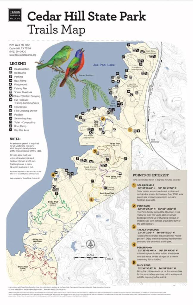
Trail #1: CHSP- 7.5ish miles
(We got dropped off and planted a car half way on the route since we would not be back to the start. The park opens at 6 am and is gated.)
You start at the DORBA trail head and run the 8 mile route that is actually short.
Road Leg #1: 3.7ish miles
(We attempted to get water outside the bathrooms in the park, but every faucet was turned off so do not access to water but the bathrooms were open.)
Exit the trail and run past the circle lot, turn right on S. Spine Rd, right on W. Belt Line Rd, and left on S. Spine Rd all the way out of the park. Be mindful of traffic coming in. Take a left outside of the park and stay on the left side of FM 1382 because there is a sidewalk on this side. Be sure to drop a pin of when you will need to cross the road to squeeze through the back gate to enter CRP.
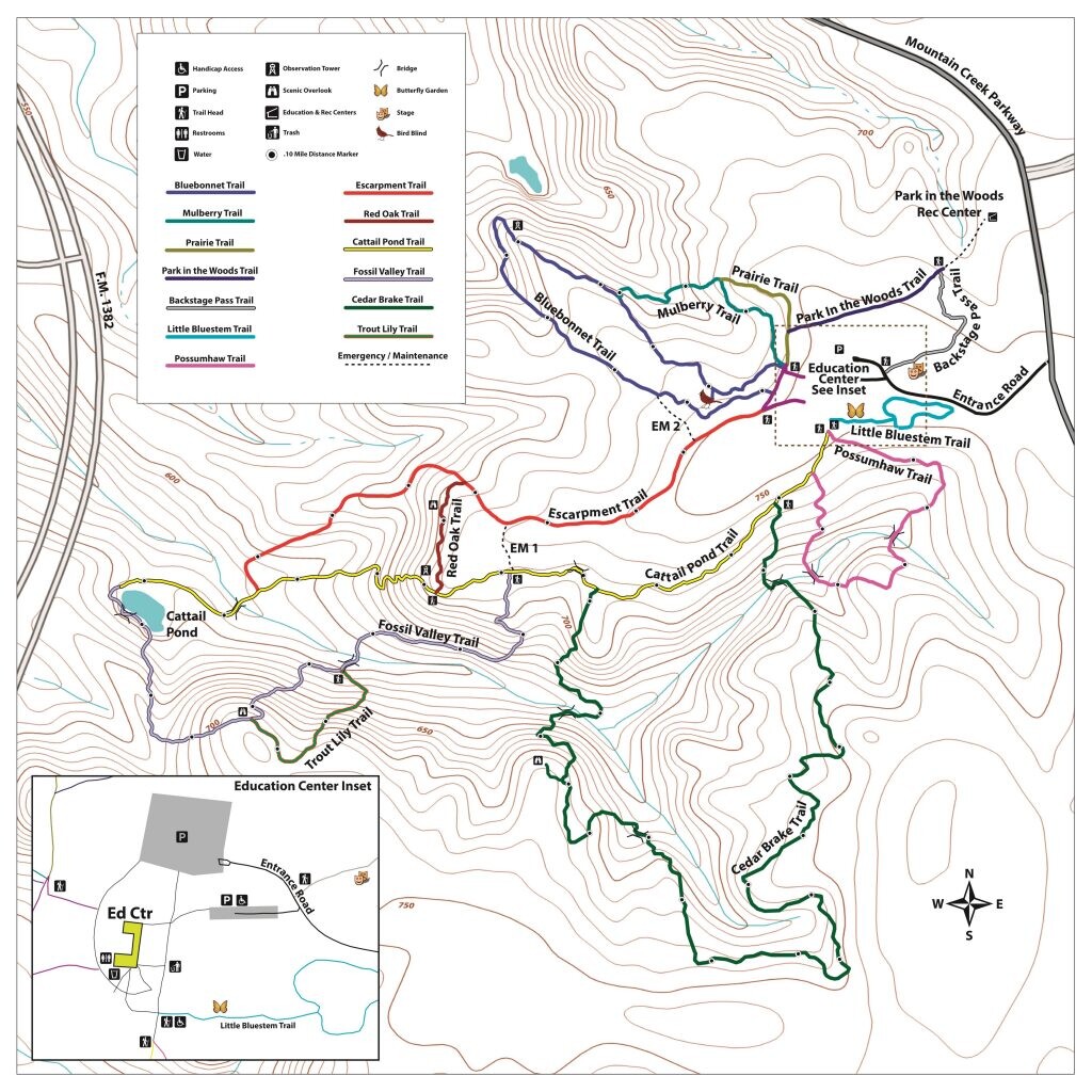
Trail #2: CRP- 6.5ish miles
(You will have access to water and bathrooms here.)
This will shoot you out at the bottom of Escarpment Trail so run up that and you can stop for water or to use the bathroom at the top if you need to before going on Bluebonnet Trail. Then you will cross the bathrooms again to enter on Possumhaw Trail. When that trail meets Cattail Pond Trail, take a left then another left onto Cedar Brake Trail. When that one meets back up with Cattail Pond Trail, take a left and then another left onto Fossil Valley Trail. This will spit you back out at the bottom of Escarpment Trail. Run up that trail past the bathrooms and follow the road out of the preserve.
Road Leg #2: 1.1ish miles
Exit CRP and take a left onto Mountain Creek Parkway and a right onto W Wheatland Rd, left on Christie Ln, right on Isom Ln and you will be at the entrance of Big Cedar.
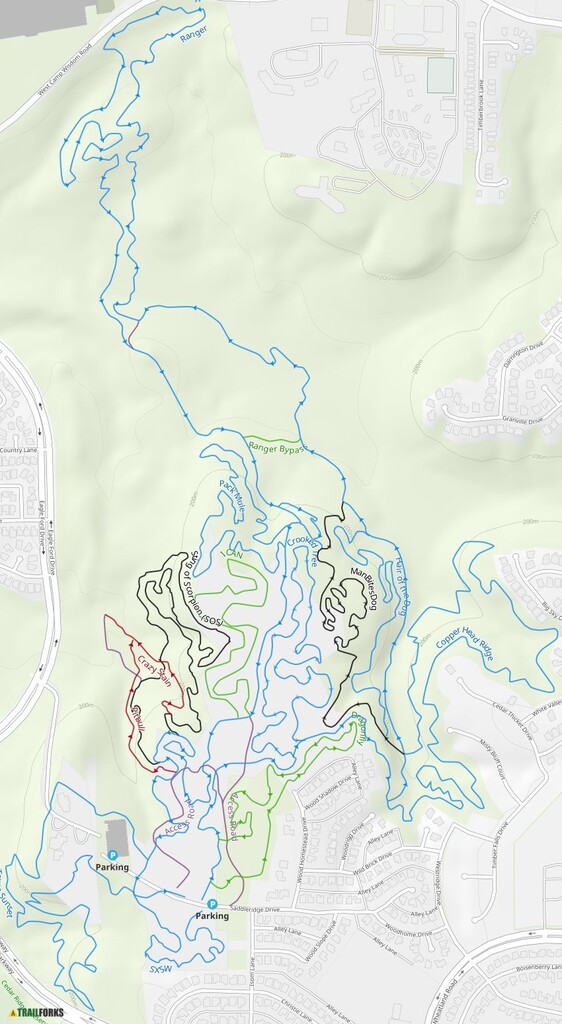
Trail #3: Big Cedar- 7ish miles
(They have public bathrooms but I do not think their water faucet was turned on outside to drink. Big Cedar has specific hours they are open so be sure to check which day you go. Sundays they don’t open till 1pm.)
Enter on Ranger and take an immediate right onto Dragonfly. This will spit you back onto Ranger and take that till almost the end of it and you will see I Can trail on your right. When you meet back up with Ranger, take a right and exit Big Cedar.
Road Leg #3: 6ish miles
(We parked a car at Walmart on the corner of W. Wheatland and Clark Rd- mile 26.5 with supplies to refuel and hydrate.)
When you exit Big Cedar, take Saddleridge Dr, then right on Woodhome Dr, right on Westridge Dr, then left on W. Wheatland Rd. Take this for a while then take a left on S Santa Fe Trl, right on E Center St, and left on S Cockrell Hill Rd. We turned right too soon and ended up fenced in and had to climb a fence. Go up to Gannon Ln and take a right so you can safely get to S Westmoreland where you take a left. Then take a right on W Camp Wisdom Rd and left on Pastor Bailey Dr. I think Pastor Bailey Dr was the only street section that had no sidewalk. Boulder Park will be on your right.
Trail #4: Boulder Park- 5.5ish miles
(No water access but they had a dirty porta potty.)
Take loops A & B but only follow the blue lines and not the red.
Road Leg #4: 7ish miles
Exit Boulder Park the way you came out Pastor Bailey Dr and take a left on W Camp Wisdom Rd, then left on S Hampton Rd, then right into the parking lot after W Red Bird Ln. We designed this so you will have side walk. Turn left at the back of the parking lot on the driveway/road, then right on Reynoldston Ln, left on Lake Placid Dr, and left on Brook Valley Ln that turns into Swansee St. Turn right onto Mark Trail Way that turns into Rugged Dr. This runs next to Kiest Park so we stayed on the wide sidewalk of the park and ran across the grass to take Kiest Park Cir then continued next to Perryton Dr. Take a right on S Hampton Rd, left on Glenfield Ave, left on Pierce St. You will see the parking lot to OCNP.
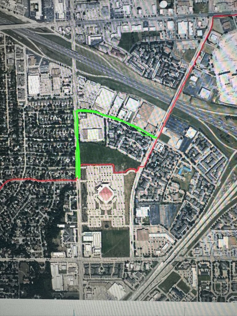
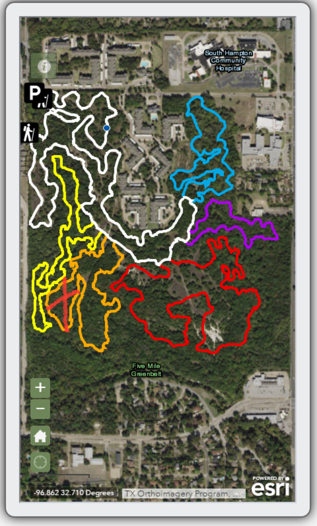
Trail #5: OCNP- 5.8ish miles
(There are no bathrooms or water access).
We took all rights and ran the white, yellow, orange and red loops. We took the white loop back to the start. Basically just skip the last two sections that are blue and purple. We also bypassed one section on the orange loop (see picture). It is at mile 2.2 ish (47ish total), you have the option to go down some rocks and across a creek or go left. We went left which is the more obvious line and what most bikers take to skip this section, but it cuts about .4 off the trail. When you are back at the parking lot then you are done! Congrats!