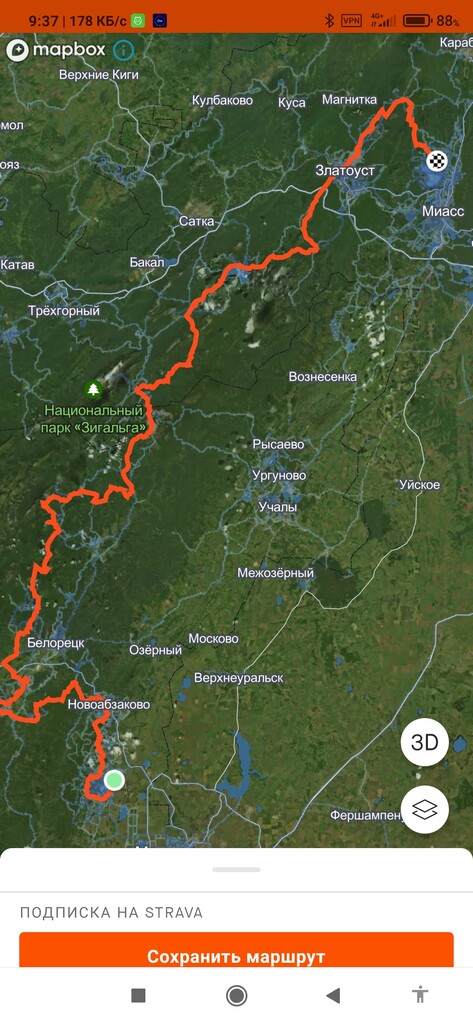
Route: South Ural Trail

Submitted by Vadim runner on Thu, 08/31/2023 - 11:48am
Location
Bashkortostan Republits, RU
Distance
491 km
Vertical Gain
11,878 m
Description

It is longest full marked trail in Russia. The South Urals trail is a marked tourist trail 500 kilometers long and consisting of several sections:

 First part of the trail

 - From Bannoye (the beginning of the South Ural trail) through Abzakovo, Blue Rocks, Uraltau, Arvyakryaz, Rysykaevo, Utkalevo, Bolshaya Kraka, Arsky stone and further to Kuzgun-Akhmerovo, to Raspberry, where it connects with the second part.


 Second part of the trail

 - Beloretsk - First and Second Crimson - descent to Otnurok - Yalangas, descent to Zhurboloto (this part has never been on the routes before) - along Tirlyanka to the Misel tract - Inzerskiye Zubchatki - Miselinskaya glade - Verkhnearshinsky village - along the old narrow gauge railway to Rudnik, then to Nikolaevka (via Bashtur) and further to Iremel along the classical path of the natural park.


 The third part of the trail runs in the Chelyabinsk region. It descends from Mount Iremel to Tyulyuk, then along the Zyuratkul National Park to the cordon of the Three Peaks, Lake Zyuratkul, Veselovka, the Urenga Ridge, Zlatoust, the Taganay National Park, Lake Turgoyak.

https://t.me/suraltrail https://vk.com/suraltrail

GPS Track
Images