Tanjung Piai National Park
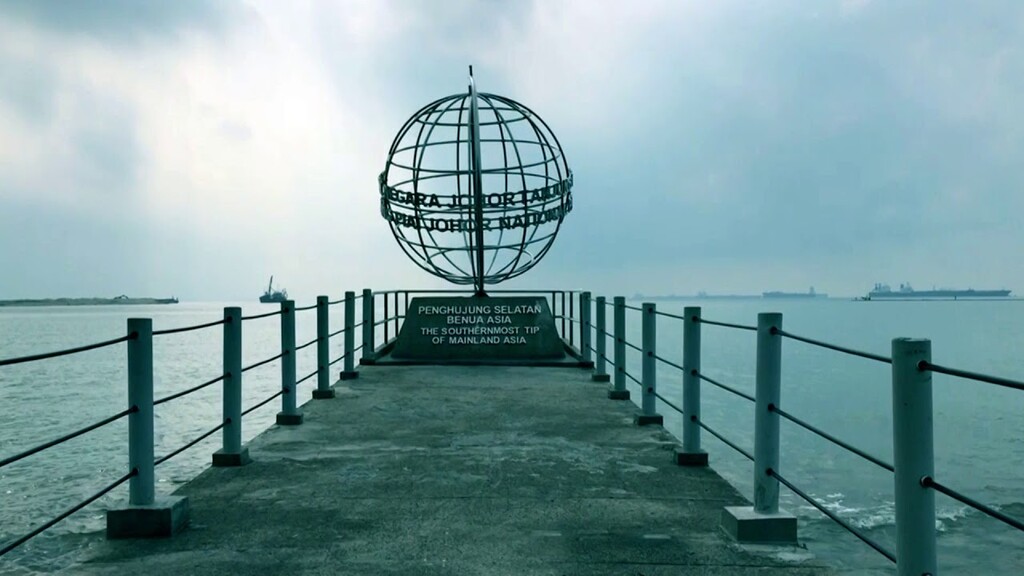
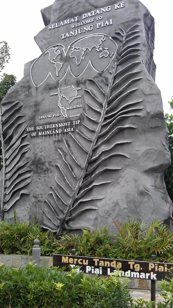
This park is also popularly known as “The Southernmost Tip of Mainland Asia”. It just means that if you want to know where the southernmost part of Asia is, it is located here. There is a structure built near the coast for you to take a photo as a momento that you have been here.
There are benches for you to sit and rest. It can be windy during certain time of the day. Do not expect this place to be as nice as other beaches as the water is muddy and dead trees are floating on certain stretch of the sea.
This route is mainly on roads around the tourist area.
Opening Hours
The opening hours is:
Tuesday to Friday - 9:00am to 5:00pm
Saturday, Sunday and public holidays - 9:00am to 5:30pm
Closed on Monday
Entrance Fees:
Malaysians: RM5/adult and RM3/child. Senior citizen: RM3
Foreigners: RM10/adult and RM5/child. Senior citizen: RM5
Getting To Tanjung Piai
If you are coming from Kuala Lumpur, use the North South Expressway and exit at Simpang Renggam toll plaza. After that, go towards the direction of Pontian. There are signboards that will take you to Tanjung Piai.
If you are coming from Johor Bahru, take the Jalan Skudai Highway and go towards the direction of Pointian. You will reach Pekan Nenas. At Pekan Nenas, turn left at Sri Bunjan after which into Jalan Tenggayun. Follow the signages to the park.