This is one of South Africa's designated caminos or long-distance hiking routes through the country's distinctive landscapes.
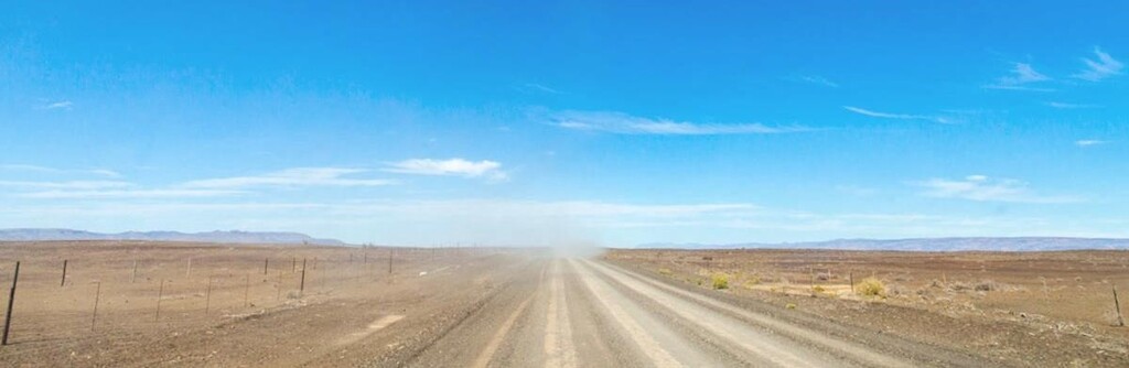
https://insideguide.co.za/cape-town/caminos/ "Both a test of physical endurance and inner strength, this camino is one of the toughest, passing through a Karoo desert landscape that is beautiful but harsh. Time and distance stretch out to infinity, sparking an inner journey. You’ll be walking along the longest gravel road in South Africa (an old trekpad), across the border between two provinces, and traverse a sliver of the Tankwa Karoo National Park, covering an average of 27km a day. It starts in Calvinia and ends at Op-die-Berg near Ceres, via the spectacular Katbakkies Pass through the Koue Bokkeveld mountains."
This route can be done in either direction. If you start in Calvinia, you follow the R355 which is a single gravel road for 211km before taking a right turn onto the R46 towards Ceres. The R46 takes you over the highest point of the course, the Theronsberg Pass which stands at 1.080m. The route takes you through the desolate Tankwa region and from the Northern Cape into the Western Cape province. There are no gas stations and only 2 farm stores with limited opening times.