The easiest of the three Tararua S-K routes starts at Putara Road end goes via Roaring Stag Hut - Raumahunga River - Cow Saddle - Mitre Flats Hut - Atiwhakatu Hut -up the River Ridge - Totara Flats Hut - Cone Saddle - Cone Hut - Smiths Creek - Puffer Track and finishes at Kaitoke (Kiwi Ranch Road).
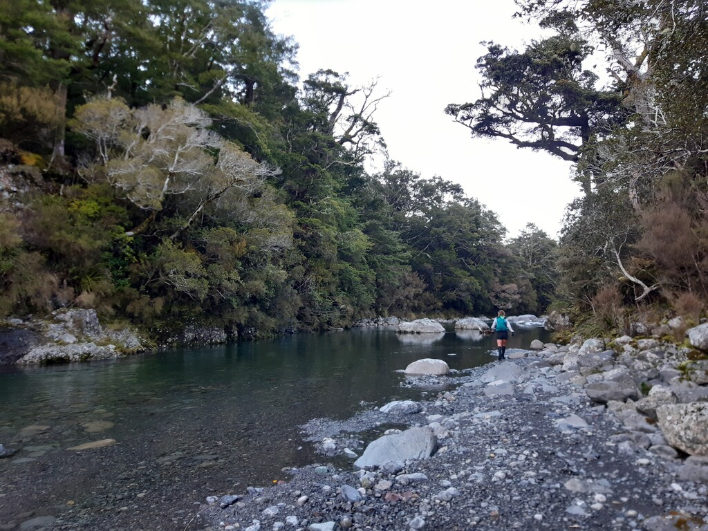
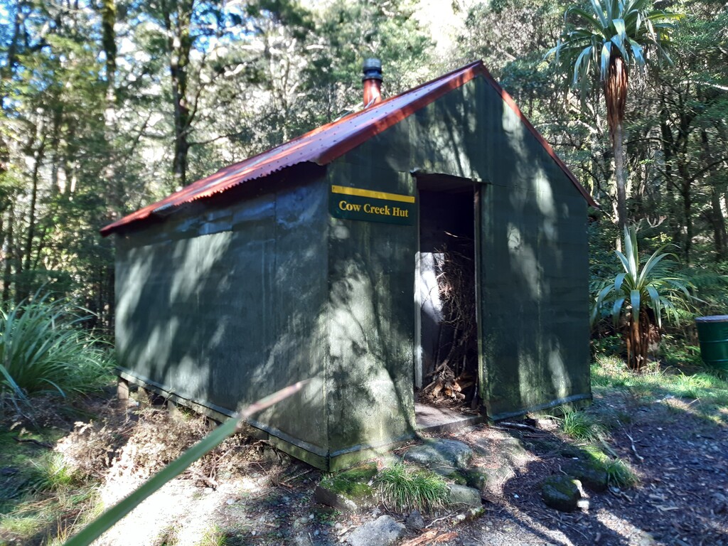
Easy track travel climbs up to the Herepai/Roaring Stag Junction, head right down to Roaring Stag Hut. Cross the swing bridge and make your way down onto the riverbank (do not climb up the hill to Cattle Ridge Hut). Follow the Raumahunga River downstream to the confluence with Cleft Creek. Climb up the bank to obtain the track that leads to Cow Saddle. In low flows it is possible to directly cross the Waingawa to Cow Creek Hut, otherwise head down stream a further 10 minutes to the swing bridge. From Cow Creek Hut, stay on the TR bank following the track to Mitre Flats Hut, this then becomes the Barton Track to Atiwhakatu Hut. Continue along this track towards Holdsworth Road end, turning right and climbing up the River Ridge Track to Pig Flat. At this point the route becomes the same as the Tarn SK. At the junction turn left and run about 800m to the Totara Creek Track - a little rooty underfoot in places, but mostly runnable. Cross the super long swingbridge to the Hut. Follow the track past to toilets onto the Flats. The route is unmarked, but well worn into the grass. Look careful for the markers on the true right bank which lead up and over the cliff. Further along, sidle in the riverbed under a large old slip, once again carefully looking for markers on the TR indicating the exit point. Crossing a small footbridge and climbing straight up a bank to the junction. Cone Saddle is a relatively easy climb, but care must be taken to stay on the right path as it overgrown in places and can be hard to follow (especially if you are doing this section in the dark). The descent down to Cone Hut is steep, but once on the Tauherenikau Track is easy running. Weaving in and out of the bush and across river flats, be sure to pick up the track on the other side of the grassy areas. Once you reach the swingbridge, there is one stream crossing (Marchant) before Smith Creek shelter - which you do not directly pass. Continue on the Dobson Loop track before the final climb over Puffer Saddle. This is claybased and the descent will be slippery after rain. Pass the sign for Marchant Ridge and continue downhill until the signposted track to Kiwi Ranch Road. Drop down the stairs, through the bush and out along the farm fence to the sign at the carpark.
There is a long established history of the S-K routes, which started with the Main Range SK. Initially the idea was to complete the north to south traverse in a weekend (under-48 hours) by fast-packing. In 1995 Colin Rolfe completed the Main Range SK in 22:59, and a sub-24 hour club was created, along with two additional routes (Tarn SK and Valleys SK). All three routes start and finish in the same location, but take different ridges or valleys to get there. Parts of all routes are exposed to the elements or require low river levels. While the Valleys route can be completed during most of the year, the Ruamahunga River level will dictate whether you need to sidle on the TR bank (involving some clambering), or have the freedom to cross the river several times. This route should not be attempted after heavy or steady rainfall due to the numerous river and stream crossing enroute.
All SK routes begin at the Putara Road end, west of Eketahuna. The area was originally called Schorman's (hence the S in SK). At the road end there is ample parking, which may become full on busy weekends. There is no camping, toilet or water facilities in the carpark. Water may be obtained from the river not far into the route. Accommodation can be booked at the Putara Basecamp (old schoolhouse), some 10min drive from the start. The route finishes near Kaitoke in the Department of Conservation car park close to the YMCA Camp on Kiwi Ranch Road, north of Upper Hutt. There are no facilities available here either. It is typical for people to arrange to be dropped off at the start of the route and picked up at the end.
As this route follows river valleys and passes a number of huts, there is no shortage of water supply. Marchant Stream will be your last opportunity for water before the Kaitoke roadend.
Best bail out options for this route include: return to start from Roaring Stag if the river is too high, Kiriwhakapapa Road end from Cow Creek, Holdsworth Road end from Atiwhakatu or before turn off down to Totara Flats, Waiohine Gorge Road end from before Cone Saddle.

Comments
In addition to Eleanor and Katie’s awesome fastest women’s team time, other FKT category times, top 10 men and women (solo or teams) can be found at
https://tararuafkt.wordpress.com/routes/s-k-valleys/s-k-valleys-24-hour-stats/
Overall FKT Marty McCrudden 13hr 10min (2020) Solo Unsupported
More details and trip reports can be found from Tararua FKT website above.