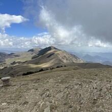
Route: Torreneules (Spain)

Submitted by martiesquerda on Sat, 08/12/2023 - 11:15am
Location
Girona, ES
Distance
8.25 km
Vertical Gain
600 m
Description

This route starts from the hostel Pic de l'Àliga and goes to the summit of Torreneules through the shortest path, the way down it's the same for going up.

First there is a little of uphill and then a some downhill quite fast to get to the main uphill. It's very constant and you do most of the vertical gain. Then you get to another part where there is a little bit of downhill and you get to the last ramp, which will be on your right. To reach the summit, the path is full of stones, so there is no actual path, but it's just the last 100 vertical. Finally it's all the same but the way down.

It's all single track. It's not a difficult route, but the last part is more technical so you have to be a little more cautious.

GPS Track

FKTs

Images