The Belo Horizonte to Acurui challenge is a 55 km (34 mile) route in the state of minas gerais that connects the capital Belo Horizonte to the colonial village of Acurui connecting old mining roads and part of the historic royal road that connects Minas Gerais to the Rio de Janeiro.
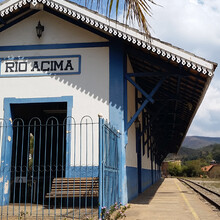
The crossing begins at the gas station of Retiro das Pedras in the Serra da Calçada region, a 15-minute drive from Belo Horizonte and travels along a dirt road for MBR mining areas for 25km to Rio Acima.
Passing the Rio das Velhas in Rio Acima we start the stretch of the road of sabarabucu (estrada real) until km 48 when we pass inside the creek. Then the climbs start to become frequent and steep until reaching Acurui, a historic village where the first hydroelectric plant in Brazil is located.
It has 563 meters of positive difference, and net elevation loss of about 300 meters.
During the crossing it is possible to find just a few establishments for the purchase of groceries in Rio Acima and Acuruí.

