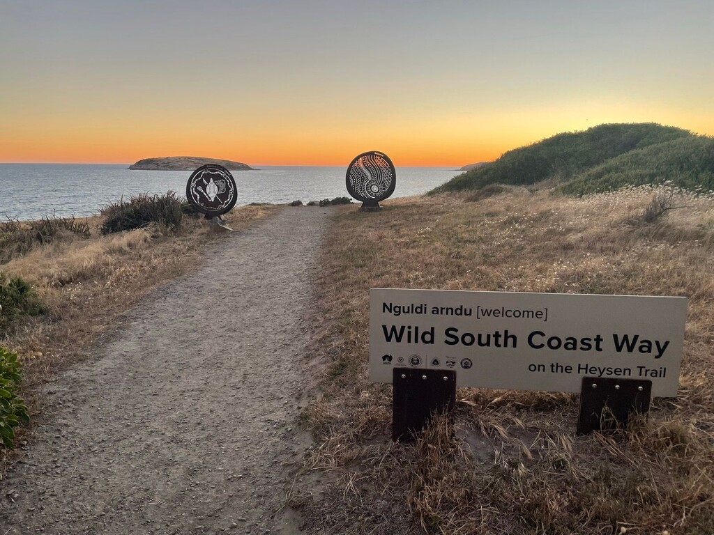
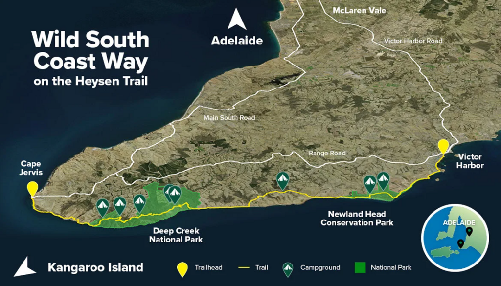
The 74km Wild South Coast Way extends from Cape Jervis at the southernmost tip of the Heysen Trail to Kent Reserve in Victor Harbour. There are references to The Bluff Trailhead (and this trailhead is better designed), however all of the maps clearly show the trail starting / finishing at Kent Reserve in Victor Harbour where there is still a trailhead located similar in style to the one located at Cape Jervis.
The Wild South Coast Way traverses Ramindjeri Ruwi (land), with connections to Kaurna Country at Cape Jervis. Ramindjeri are one of eighteen Lankinyerar (tribes) of the Ngarrindjeri Nation, whose Country spans the lower River Murray, Coorong and western Fleurieu Peninsula. The trail retraces the final footsteps of an ancient ancestor named Ngurunderi, who is said to have shaped the landscapes, spiritual identities and cultural traditions of the Ngarrindjeri palak (people). In Ngurunderi’s footsteps, the Ramindjeri palak followed – caring for Country according to the laws and customary rights and obligations he gave to them.
The route can be completed in either direction, but FKT attempts should be the full length from Cape Jervis to Kent Reserve.
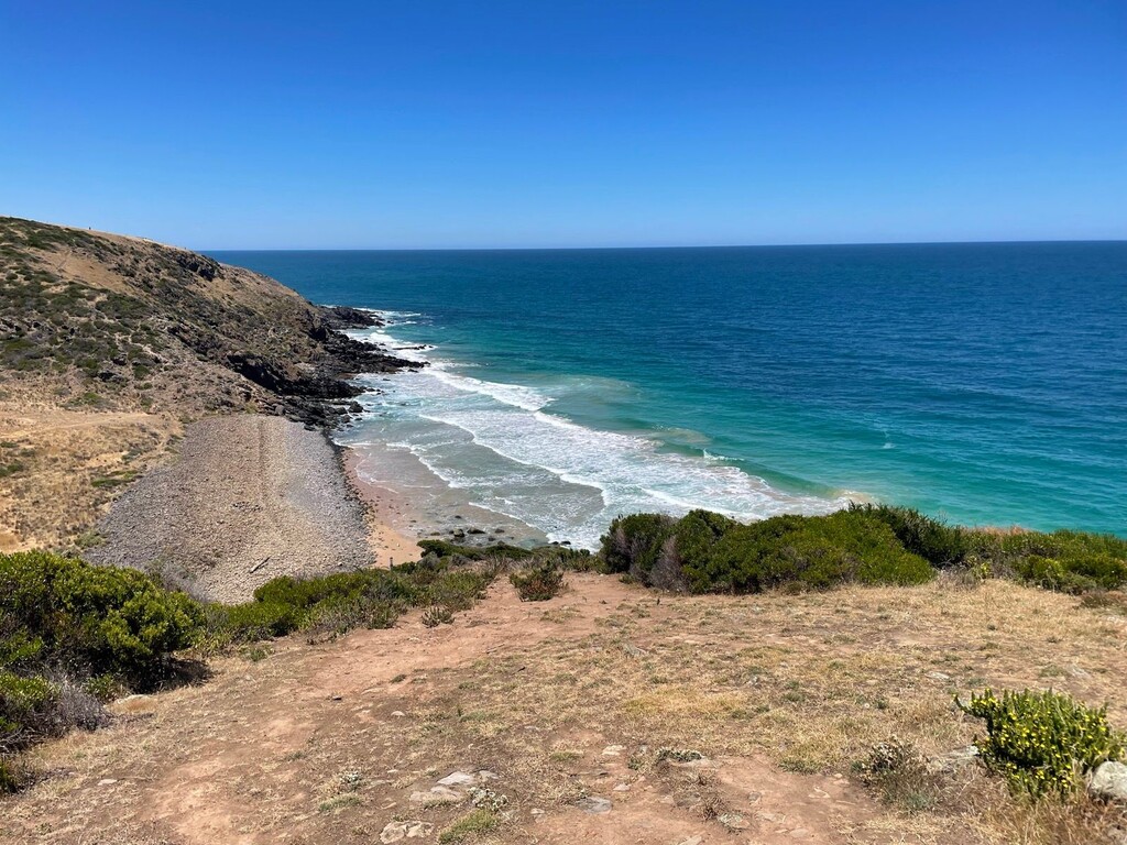
The Wild South Coast Way follows the Heysen Trail through Deep Creek National Park and Newland Head Conservation Reserve, but rather than turn north at Kings Beach carpark the trail continues towards The Bluff and along the Encounter Bay Esplanade Bike Path until reaching Kent Reserve.
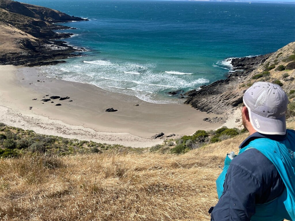
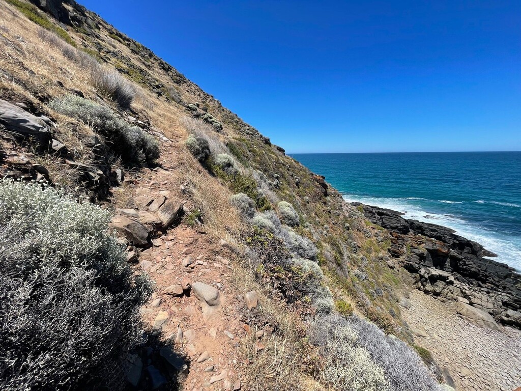
For most of the time you will have spectacular views out to the Southern Ocean with running on singletrack trail, dirt roads, pristine beaches and about 4km of bitumen near Encounter Bay/Victor Harbour.
For a route where you can see water all the time, one has to actually plan water quite well as there are very limited tank water supplies. Taking a means of purifying water (life-straw or tablets) increases your opportunity for water points by around 3-4 locations. Notably, there is no publicly accessible water between Balquhidder campsite and the Victor Harbour trailhead.
Enjoy!

Comments
On Monday 5th January I went for a run on the Wild South Coast Way while I was down that way or holidays. Did it as a training run for a bigger adventure planned later in January so had a fair bit of extra weight in the pack that you normally wouldn't take. Beautiful day, very beatable supported FKT time to get the ball rolling. A bit more information here if you're interested...Wild South Coast Way | Run | Strava